Old Maps of Russell County, Kentucky for Metal Detecting
Plan your next treasure hunt with 98 historic maps of Russell County. Find old homesites, ghost towns, trails, and gathering spots that may be lost to time — perfect for identifying promising metal detecting locations.
- Locate forgotten sites: Uncover places like long-lost settlements, abandoned rail lines, or gathering spots.
- Plan better hunts: Use map overlays combined with LiDAR or satellite views to narrow in on historically rich areas.
- Made for detectorists: Thousands of hobbyists use these maps to discover relics, coins, and hidden history.
Use these historic maps to boost your research and find new opportunities beneath the surface of Russell County.
Russell County, KY maps
(98)- 1911 Map of Monticello, 1952 Print
 1911 Monticello1952 Print · USGSWayne County and the southern loops of the Cumberland River are captured here in the early twentieth century before modern reservoirs changed the valley. Genealogists can locate dozens of country schools and churches, from Old Glory School to Union Church, alongside river landings like Rankin Landing.2 unique versions available
 - 1914 Map of Monticello
 1914 Monticello1914 Print · USGSWayne County life in the early twentieth century centered on the Cumberland River and the crossroads at Monticello. Genealogists and historians can trace numerous rural institutions like Old Glory School, Union Church, and the Ramsey Branch Stop PO.4 unique versions available
 - 1953 Map of Phil, 1954 Print
 1953 Phil1954 Print · USGSCasey County in the early fifties is captured here as a landscape of interconnected ridges and hollows. Researchers can trace rural life through numerous country schools and churches like Tate Sch, Antioch Ch, and the historic Rubert Ford river crossing.2 unique versions available
 - 1953 Map of Amandaville, 1954 Print
 1953 Amandaville1954 Print · USGSAdair and Cumberland counties appear here in the early fifties, showing a rural landscape of ridges and creek-bottom settlements. Genealogists can trace family footprints across McGinnis Cem, Inroad, and schools like Walnut Grove Sch or Elliott Sch.4 unique versions available
 - 1953 Map of Montpelier, 1955 Print
 1953 Montpelier1955 Print · USGSAdair and Russell Counties in the early fifties show a landscape of small agricultural hubs connected by winding creek-side roads. Researchers can trace family roots at Gentrys Mill, find numerous rural schools like Rainfall Sch, and locate family burial sites such as Watkins Cem.2 unique versions available
 - 1953 Map of Wolf Creek Dam, 1955 Print
 1953 Wolf Creek Dam1955 Print · USGSThe creation of Lake Cumberland in the early fifties fundamentally altered this portion of Clinton and Russell Counties. Researchers can trace submerged shorelines and landforms like Winfreys Rocks or locate vanished landmarks like Seventy Six Falls and Willow Grove Sch.2 unique versions available
 - 1953 Map of Creelsboro, 1955 Print
 1953 Creelsboro1955 Print · USGSSouthern Kentucky's river valleys and high ridges are captured here in the early fifties, centering on the winding Cumberland River. Researchers can locate vanished rural landmarks like Old Olga, the Highway Mission, and the Cherry Grove Sch.3 unique versions available
 - 1953 Map of Mill Springs, 1955 Print
 1953 Mill Springs1955 Print · USGSThe mid-century landscape of Wayne and Pulaski counties comes alive here, showing the region just as the rising waters of Lake Cumberland redefined the terrain. Genealogists and historians can trace family roots at Morrow Chapel, Simpson Spr, and the Mill Springs Battlefield.2 unique versions available
 - 1953 Map of Jamestown, 1955 Print
 1953 Jamestown1955 Print · USGSThe Russell County uplands meet the newly formed reservoir in the early fifties, showing a landscape reshaped by the water. Trace family roots in Freedom, Sewellton, and Rowena, or locate remote landmarks like Worldridge Sch and Belle Chapel.2 unique versions available
 - 1953 Map of Dunnville, 1955 Print
 1953 Dunnville1955 Print · USGSThe Green River valley and the rural ridges of Adair and Casey Counties are frozen in time here during the early fifties. Genealogists can trace family landmarks across the landscape, from Millerfield to country schools like Poplar Grove Sch and Tarter Sch.2 unique versions available
 - 1954 Map of Jabez, 1955 Print
 1954 Jabez1955 Print · USGSThe Russell and Wayne county borderland is captured here in the early fifties as the rising waters of Lake Cumberland reshaped the valley. Genealogists can trace family landmarks like Norfleet Cem, Jabez, and the Union Sch district.2 unique versions available
 - 1954 Map of Cumberland City, 1955 Print
 1954 Cumberland City1955 Print · USGSIn the mid-fifties, the newly formed shores of Lake Cumberland redefined these Clinton and Wayne County valleys. Genealogists and historians can trace the foundations of rural life through Cumberland City, Watauga Post Office, and many family burial grounds like McWhorter Cemetery.2 unique versions available
 - 1954 Map of Russell Springs, 1955 Print
 1954 Russell Springs1955 Print · USGSThe Russell Springs area in the mid-fifties shows a rural landscape adapting to the new shoreline of Lake Cumberland. Local researchers can trace family roots through numerous landmarks like Webbs Cross Roads, Central High Sch, and Beckham Ridge Ch.2 unique versions available
 - 1954 Map of Eli, 1956 Print
 1954 Eli1956 Print · USGSThe Russell County ridge country is captured here in the mid-fifties as the waters of Lake Cumberland filled the deep hollows. Researchers can trace rural life through numerous landmarks like Irvins Store, the Cedar Springs Ch, and Sunshine Sch.2 unique versions available
 - 1954 Map of Faubush, 1956 Print
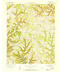 1954 Faubush1956 Print · USGSPulaski County's ridge-and-hollow landscape is captured here in the mid-1950s, just as the newly formed Lake Cumberland reshaped the southern valleys. Researchers can trace family roots through numerous remote sites like Gaines Cem, Norfleet Sch, and the community of Faubush.
 - 1956 Map of Corbin, 1966 Print
 1956 Corbin1966 Print · USGSThe Kentucky and Tennessee borderlands are captured here in the mid-fifties, showing the region's shift toward modern interstate travel and reservoir development. Genealogists and historians can trace old community lines near Albany and Monticello or locate early rail junctions along the Southern and Tennessee Central lines.3 unique versions available
 - 1957 Map of Winchester, 1968 Print
 1957 Winchester1968 Print · USGSCentral Kentucky's landscape in the mid-twentieth century features the sprawling Fort Knox and the early parkway system. Genealogists and historians can trace rail lines like the Southern Railway and find landmarks from Bernheim Forest to Pilot Knob.3 unique versions available
 - 1958 Map of Corbin
 1958 Corbin1958 Print · USGSThe Upper Cumberland borderlands appear in the late 1950s as massive reservoirs and early atomic-era growth reshape the region. Trace family roots and vanished landmarks near Lake Cumberland, Oak Ridge, and the Cumberland National Forest.
 - 1960 Map of Winchester
 1960 Winchester1960 Print · USGSCentral Kentucky's diverse landscape is shown here at mid-century, from the bluegrass plains to the rugged Pottsville Escarpment. Genealogists and historians can trace the rail-and-river network connecting towns like Bardstown and Stanford alongside landmarks like Lake Cumberland.
 - 1970 Map of Dunnville, 1972 Print
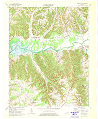 1970 Dunnville1972 Print · USGSAdair and Casey counties appear during the early 1970s as the Green River Lake reservoir reshapes the valley. Researchers can find numerous family burial grounds and country churches like Williams Cem, Shady Grove Ch, and the Mt Calvary Cem Ch.
 - 1973 Map of Eli, 1974 Print
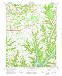 1973 Eli1974 Print · USGSRussell and Pulaski counties are shown here in the early seventies as the region balanced its agrarian roots with modern infrastructure. Genealogists and historians can trace family locations near Irvins Store, Old Friendship Cem, and Locust Grove Ch.
 - 1973 Map of Faubush, 1974 Print
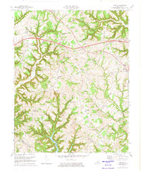 1973 Faubush1974 Print · USGSPulaski County’s rolling ridge country is documented here in the early 1970s as the Cumberland Parkway bisects the rural landscape. Researchers can trace family roots at Cedar Point Cemetery, Mt Zion Ch, and the settlement of Faubush.2 unique versions available
 - 1973 Map of Russell Springs, 1974 Print
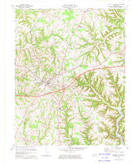 1973 Russell Springs1974 Print · USGSRussell County and the Adair County line are captured here in the early seventies as the region balanced its rural roots with new infrastructure. Genealogists can trace family landmarks like Mt Hope Ch, Hillcrest Cem, and the old settlements of Sano and Humble.
 - 1973 Map of Montpelier, 1974 Print
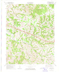 1973 Montpelier1974 Print · USGSAdair and Russell Counties are shown here during the early seventies as the modern highway system began to intersect with old ridge-top settlements. Researchers can locate numerous rural landmarks like Gentrys Mill, New Concord Ch, and Wildcat Cave Hol.2 unique versions available
 - 1978 Map of Wolf Creek Dam
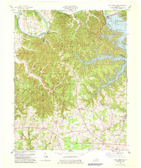 1978 Wolf Creek Dam1978 Print · USGSThe Lake Cumberland shoreline and the Cumberland River valley are captured in the late seventies as the region balanced local industry and recreation. Trace family roots and old landmarks from Winfreys Ferry to the community of Seventy Six and the Seventy Six Falls.3 unique versions available
Showing maps 1-25 of 98
Top cities of Russell County
Frequently asked questions
- What are the different types of historical maps available for Russell County?
- What is the oldest map of Russell County?
- Where can I purchase historical maps of Russell County for my home or office?
- Where can I download high-res historical maps of Russell County?
- Are there historical topographic maps available for Russell County?
- Is there historical aerial imagery available for Russell County?
- Where are historical maps of Russell County sourced from?