1900s (20th Century) Maps of Todd County, Kentucky
Explore 31 historic maps of Todd County from the 1900s (20th Century). These maps offer a rare glimpse into what life looked like during the 1900s — showing old roads, neighborhoods, homes, and landmarks that have changed or disappeared over time.
Whether you're researching your family's past, planning a metal detecting trip, or studying how Todd County's landscape evolved across the 1900s, these high-resolution maps are a powerful tool for exploring the history of this region.
- Focus on a specific era: All maps on this page are from the 1900s, giving you a focused view of this time period.
- See what’s changed: Compare century-old streets, trails, and buildings to today's modern landscape using overlays and satellite layers.
- Research with precision: Use these maps for genealogy, historical research, land use analysis, or educational projects.
- View, download, or print: Maps are fully viewable online in high resolution, and can be downloaded or printed for your own records.
Start exploring Todd County's history through authentic maps from the 1900s. This is your window into the past.
Todd County, KY maps
(31)- 1911 Map of Drakesboro
 1911 Drakesboro1911 Print · USGSMuhlenberg County was a landscape of dense rural school districts and emerging rail towns just before the Great War. Genealogists can trace family names through landmarks like Mays Store, Rhodes Chapel, and the uniquely named settlement of Lickskillet.
 - 1912 Map of Nortonville
 1912 Nortonville1912 Print · USGSWestern Kentucky at the start of the decade is defined here by its busy rail junctions and rural merchant economy. Genealogists and historians can trace family roots through numerous country schools and stores, including Clement School, Jordons Store, and Greens Chapel.3 unique versions available
 - 1913 Map of Drakesboro
 1913 Drakesboro1913 Print · USGSMuhlenberg County in the early twentieth century was a bustling intersection of coal mining and major rail lines. Genealogists and historians can trace dozens of early rural schools and crossroads stores like Liberty Hill School, Belton Jost PO, and Dixon's Store.2 unique versions available
 - 1944 Map of Clarksville, 1946 Print
 1944 Clarksville1946 Print · USGSThe Kentucky-Tennessee border during the mid-forties shows a landscape transformed by the massive expansion of Camp Campbell. Researchers can trace the early layout of the base and its Small Arms Ranges alongside historic sites like Dunbar Cave and the Sunnyside Church.
 - 1950 Map of Allensville, 1952 Print
 1950 Allensville1952 Print · USGSSpanning the Kentucky and Tennessee border in the early 1950s, this area centers on the vital Louisville and Nashville rail line. Researchers can trace the rural communities of Allensville and Keysburg or locate the Belmont Cem near the winding Red River.2 unique versions available
 - 1950 Map of Guthrie, 1952 Print
 1950 Guthrie1952 Print · USGSGuthrie and the Kentucky-Tennessee borderlands are shown here at the mid-century, where the rail lines of the Louisville and Nashville meet. Researchers can trace rural life through landmarks like Warfield School, Lester Chapel, and the small settlement at Pinchem.3 unique versions available
 - 1950 Map of Pembroke, 1968 Print
 1950 Pembroke1968 Print · USGSAgricultural Christian County comes alive in this mid-century portrait, showing the area as it transitioned from rail-focused trade to highway travel. Genealogists can trace family lines through numerous sites like Rosedale Cem, Barnetts Chapel, and the County Home.2 unique versions available
 - 1950 Map of Olmstead, 1985 Print
 1950 Olmstead1985 Print · USGSThe rural borderlands of Logan and Todd Counties are captured here at mid-century, showing a landscape of family farms and small hamlets. Genealogists can trace family names through landmarks like Bennett Cem, Johnson Chapel, and the community of Gordonsville.
 - 1951 Map of Pembroke
 1951 Pembroke1951 Print · USGSChristian and Todd counties are shown here in the early fifties, where the railroad and highway networks intersect. Genealogists can trace family names and rural landmarks like Rosedale Cem, Barnetts Chapel, and the Jefferson Davis State Park monument.2 unique versions available
 - 1951 Map of Elkton
 1951 Elkton1951 Print · USGSElkton and the surrounding Todd County countryside are captured here in the early fifties as a network of rural schools, churches, and rail-side commerce. Genealogists can locate family landmarks like Stokes Chapel, Little Union School, and Glenwood Cemetery.3 unique versions available
 - 1951 Map of Olmstead
 1951 Olmstead1951 Print · USGSSouthern Logan County and the Todd County line are captured here in the early fifties, centered on the railroad hub of Olmstead. Researchers can trace rural school locations like Mt Gilead Sch and family burial grounds including the Browder Cem and Bennett Cem.3 unique versions available
 - 1951 Map of Hammacksville, 1953 Print
 1951 Hammacksville1953 Print · USGSThe Kentucky-Tennessee borderlands in the early fifties show a landscape of winding river bends and railroad-aligned settlements. Genealogists can trace family roots through numerous local landmarks, from Rosenwald Sch to the rural Barkers Mill community.
 - 1952 Map of Sharon Grove, 1953 Print
 1952 Sharon Grove1953 Print · USGSThe rural borderlands of Todd and Logan Counties are captured here in the early 1950s, showing a landscape of ridge-top schools and creek-side settlements. Researchers can trace family sites like Tunstall Cem or visit local centers like Sharon Grove and Mineral Spring Ch.3 unique versions available
 - 1952 Map of Allegre, 1953 Print
 1952 Allegre1953 Print · USGSTodd County's rural landscape is captured here in the early fifties, showing a network of upland farms and small settlements. Researchers can trace family origins through several named sites like Allegre, Kirkman Cem, and Tabernacle Ch.3 unique versions available
 - 1952 Map of Honey Grove, 1953 Print
 1952 Honey Grove1953 Print · USGSChristian and Todd counties at the start of the fifties show a landscape of small farming communities and family-named landmarks. Genealogists can trace family roots at O'Daniel Cem or locate vanished local schools like Lacy Sch and Flat Rock Sch.3 unique versions available
 - 1953 Map of Haleys Mill, 1954 Print
 1953 Haleys Mill1954 Print · USGSNorthwestern Christian County in the early fifties is captured here as a network of creek-side settlements and family homesteads. Genealogists can locate numerous burial grounds and rural congregations like Prowse Cem, Haleys Mill, and Judge Chapel.2 unique versions available
 - 1953 Map of Rosewood, 1954 Print
 1953 Rosewood1954 Print · USGSThe intersection of Muhlenberg, Todd, and Logan Counties in the early 1950s reveals a classic Kentucky ridge-and-hollow landscape. Genealogists can trace family footprints through rural landmarks like Tyewhoppety, New Harmony Ch, and Greenbrier Sch.
 - 1953 Map of Kirkmansville, 1955 Print
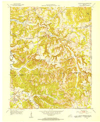 1953 Kirkmansville1955 Print · USGSThe rural border of Muhlenberg and Todd counties comes to life in the early 1950s, showing a landscape of ridge-top farms and creek-bottom roads. Family historians can trace ancestral roots through dozens of local sites like Kirkmansville, Cherry Grove Ch, and the Sears Home Cem.2 unique versions available
 - 1954 Map of Evansville
 1954 Evansville1954 Print · USGSThe Ohio River borderlands between Indiana and Kentucky appear here during a period of robust industrial and military growth. Genealogists and researchers can trace the rail corridors of the Illinois Central and find landmarks like US Lock and Dam No 48 or Camp Breckinridge.
 - 1956 Map of Nashville, 1971 Print
 1956 Nashville1971 Print · USGSThe Tennessee-Kentucky borderlands come into focus in the mid-1960s as major reservoir projects transformed the Cumberland and Tennessee river valleys. Researchers can trace the rail networks of the Louisville and Nashville and visit sites like Fort Campbell and Fort Donelson National Military Park.2 unique versions available
 - 1957 Map of Hammacksville, 1960 Print
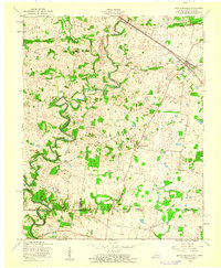 1957 Hammacksville1960 Print · USGSTodd County, Kentucky, and Montgomery County, Tennessee, meet here in the late fifties along the meandering river and rail lines. Genealogists can trace family roots at Rosenwald Sch, Edgewood Cem, and the riverside site of Barkers Mill.
 - 1957 Map of Clarksville, 1963 Print
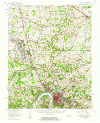 1957 Clarksville1963 Print · USGSThe Clarksville region and the Kentucky-Tennessee border are shown here during the mid-century expansion of Fort Campbell. Researchers can trace old family sites and rural landmarks like Barkers Mill, St Bethlehem, and the Tennessee Central railroad.
 - 1957 Map of Evansville, 1969 Print
 1957 Evansville1969 Print · USGSIndiana and Kentucky meet along the Ohio River in this mid-century survey of a vital industrial and transport corridor. Genealogists and historians can trace the development of river towns like Owensboro and Newburgh or locate old rail lines like the Southern Ry.3 unique versions available
 - 1959 Map of Nashville
 1959 Nashville1959 Print · USGSMiddle Tennessee and Southern Kentucky come into focus during the late fifties, showing the region's transition into a modern transportation and military hub. Researchers can trace the sprawling Fort Campbell Military Reservation or locate historic rail stops along the Tennessee Central Ry and Illinois Central RR.
 - 1961 Map of Evansville
 1961 Evansville1961 Print · USGSThe Ohio River valley and its surrounding coalfields are captured here during the late fifties and early sixties. Trace the industrial rail networks of the Illinois Central RR and explore regional landmarks like Mammoth Cave National Park and Angel Mounds State Memorial.2 unique versions available
Showing maps 1-25 of 31
Top cities of Todd County
Frequently asked questions
- What are the different types of historical maps available for Todd County?
- What is the oldest map of Todd County?
- Where can I purchase historical maps of Todd County for my home or office?
- Where can I download high-res historical maps of Todd County?
- Are there historical topographic maps available for Todd County?
- Is there historical aerial imagery available for Todd County?
- Where are historical maps of Todd County sourced from?