Old Maps of Trimble County, Kentucky for Metal Detecting
Plan your next treasure hunt with 59 historic maps of Trimble County. Find old homesites, ghost towns, trails, and gathering spots that may be lost to time — perfect for identifying promising metal detecting locations.
- Locate forgotten sites: Uncover places like long-lost settlements, abandoned rail lines, or gathering spots.
- Plan better hunts: Use map overlays combined with LiDAR or satellite views to narrow in on historically rich areas.
- Made for detectorists: Thousands of hobbyists use these maps to discover relics, coins, and hidden history.
Use these historic maps to boost your research and find new opportunities beneath the surface of Trimble County.
Trimble County, KY maps
(59)- 1932 Map of La Grange
 1932 La Grange1932 Print · USGSThe Bluegrass region in the early thirties reveals a landscape defined by the Louisville and Nashville Railroad and the Ohio River. Genealogists can locate family landmarks like Henrysville Cemetery and several rural schoolhouses including Sweeney Sch.
 - 1939 Map of Bethlehem
 1939 Bethlehem1939 Print · USGSSouthern Indiana river life and upland farming are frozen in time just before the war. Genealogists and local historians can trace family roots through markers like Turner Cem, Elizabeth Ch, and the rural Fairview Sch.2 unique versions available
 - 1939 Map of Madison West
 1939 Madison West1939 Print · USGSThe river bluffs of Jefferson County are captured here just before the Second World War, showing the steep topography of the Ohio River valley. Researchers can trace local landmarks like Hanover College, Clifty Falls State Park, and rural sites like Antioch Grange.3 unique versions available
 - 1943 Map of Brooksburg
 1943 Brooksburg1943 Print · USGSJefferson and Switzerland counties meet along the Ohio River in this early 1940s survey of the Indiana-Kentucky border. Trace the river-based economy and rural transit of the era through the Carrollton Ferry and family landmarks like Mc Kay Cem and McKay Sch.
 - 1948 Map of Bethlehem
 1948 Bethlehem1948 Print · USGSThe Indiana-Kentucky borderlands along the great bend of the Ohio River appear here in the late thirties. Local historians can trace the foundations of riverside life at Bethlehem and Miles Point, or find family-named landmarks like Turner Cem and Elizabeth Ch.2 unique versions available
 - 1948 Map of Madison West
 1948 Madison West1948 Print · USGSThe river bluffs of Jefferson County are captured here in the late 1930s, showing the early development of Clifty Falls State Park and Hanover College. Researchers can trace the Pennsylvania railroad tracks or locate early landmarks like Antioch Grange and Springdale Cem.2 unique versions available
 - 1952 Map of Campbellsburg, 1954 Print
 1952 Campbellsburg1954 Print · USGSThe Henry County highlands come alive in the early fifties, showing the interplay of rail and river near Campbellsburg. Genealogists can trace family footprints near Hopewell Ch or along the Louisville and Nashville line through Turners Station.
 - 1953 Map of Madison West, 1954 Print
 1953 Madison West1954 Print · USGSThe bluffs of the Ohio River define this mid-century portrait of the Indiana and Kentucky borderlands. Genealogists and local historians can trace the foundations of Hanover College, find rural landmarks like Old Bethel Cem, and locate the old path of the Pennsylvania RR.2 unique versions available
 - 1953 Map of Bedford, 1954 Print
 1953 Bedford1954 Print · USGSBedford and the surrounding Trimble County hills appear here in the early fifties, showing a landscape shaped by the Little Kentucky River. Researchers can locate family landmarks such as Hickory Grove Ch, Poplar Ridge, and the Louisville and Nashville rail line.3 unique versions available
 - 1953 Map of Carrollton, 1954 Print
 1953 Carrollton1954 Print · USGSThe confluence of the Ohio and Kentucky Rivers comes alive in the early 1950s, showing the riverside growth of Carrollton and Prestonville. Researchers can trace ancestral roots through sites like McKay Cemetery, Spring Branch Church, and River View School.2 unique versions available
 - 1953 Map of Madison East, 1955 Print
 1953 Madison East1955 Print · USGSThe Ohio River valley and the Kentucky uplands are captured in the early fifties, documenting a landscape of ridge-top farms and river towns. Genealogists can trace family connections through numerous rural landmarks like Mt Carmel Ch, Hunters Bottom, and Locust Sch.2 unique versions available
 - 1953 Map of Bethlehem, 1955 Print
 1953 Bethlehem1955 Print · USGSThe Ohio River border between Indiana and Kentucky is documented here in the early fifties, showing the ferry and landing points of the era. Researchers can locate family landmarks like Elizabeth Ch, Wises Landing, and the Mahoney Cem.6 unique versions available
 - 1954 Map of Smithfield, 1955 Print
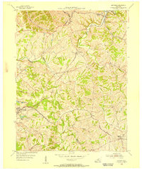 1954 Smithfield1955 Print · USGSThe rural borderlands of Henry and Oldham counties come to life in the mid-1950s as a vital railroad corridor. Researchers can trace family-named landmarks and rail-side settlements from La Grange to Smithfield, including the IOOF Cem and the Little Kentucky River.
 - 1956 Map of Louisville, 1971 Print
 1956 Louisville1971 Print · USGSThe Ohio River valley and the Kentucky Bluegrass are captured here during a period of rapid mid-century growth and industrial activity. Genealogists and historians can trace rail-centered towns and military land use at Fort Knox and the Jefferson Proving Ground.2 unique versions available
 - 1961 Map of Smithfield, 1962 Print
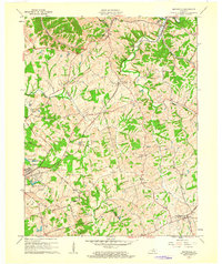 1961 Smithfield1962 Print · USGSHenry County in the early sixties remains a landscape of rail-side towns and winding creek valleys. Genealogists and local historians can trace family-named roads and rural settlements like Smithfield, Pendleton, and the Sulphur Cem.
 - 1964 Map of Louisville
 1964 Louisville1964 Print · USGSThe Ohio River valley and Kentucky Bluegrass are captured in the mid-1960s, showing a region balanced between industrial growth and its agrarian roots. Genealogists and historians can trace the development of county seats like Shelbyville and Paris, or locate established institutions such as Georgetown College and Bernheim Forest.
 - 1964 Map of Madison West, 1966 Print
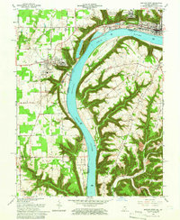 1964 Madison West1966 Print · USGSThe Indiana-Kentucky borderlands come into focus during the mid-sixties, dominated by the winding river and the bluff-top campuses of the Madison area. Researchers can trace the grounds of Hanover College, the Madison State Hospital, and numerous family burial sites like Moffett Cem and Zion Cem.5 unique versions available
 - 1967 Map of Carrollton, 1970 Print
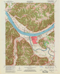 1967 Carrollton1970 Print · USGSThe confluence of the Kentucky and Ohio Rivers defines this late 1960s landscape, where the bustling streets of Carrollton meet the river economy. Genealogists and historians can trace local landmarks like St Johns Sch, the IOOF Cem, and the rural Old Bethel Cem across the Indiana border.4 unique versions available
 - 1969 Map of Smithfield, 1971 Print
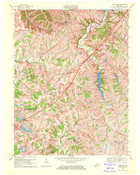 1969 Smithfield1971 Print · USGSIn the late sixties, this portion of Kentucky saw the arrival of the interstate era alongside deep-rooted rail towns. Genealogists and historians can trace local landmarks like Sulphur Ch, the Ballard School, and the Louisville and Nashville rail corridor.5 unique versions available
 - 1969 Map of Campbellsburg, 1972 Print
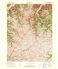 1969 Campbellsburg1972 Print · USGSHenry County is captured in the late sixties as a landscape of ridge-top farms and busy rail corridors. Genealogists and local historians can trace family-named routes like Monfort Lane or locate centers of community like Hopewell Ch and Turners Station.
 - 1971 Map of Madison East, 1973 Print
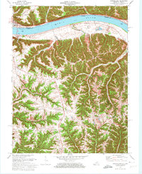 1971 Madison East1973 Print · USGSThe Ohio River corridor at the Indiana-Kentucky border is shown here in the early seventies, featuring the riverfront hub of Madison. Researchers can trace old ridge-top settlements and rural landmarks like St Peters Ch, Monitor, and Mt Carmel Ch.4 unique versions available
 - 1986 Map of Louisville
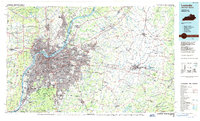 1986 Louisville1986 Print · USGSMid-1980s Louisville and southern Indiana are shown here during a decade of significant suburban growth and infrastructure development. Researchers can trace the layout of Cave Hill Cemetery, the expansion of Standiford Field, and industrial sites like the Indiana Army Ammunition Plant.2 unique versions available
 - 1986 Map of Madison
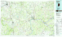 1986 Madison1986 Print · USGSSouthern Indiana and Northern Kentucky are shown here in the mid-eighties, centered on the river corridor and the sprawling Jefferson Proving Ground. Genealogists and historians can trace rail lines like the Seaboard System and locate river towns from Madison to Bethlehem.
 - 1990 Map of Madison, 1991 Print
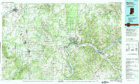 1990 Madison1991 Print · USGSThe Ohio River valley and the southern Indiana plains are documented here in the final decade of the twentieth century. Genealogists and historians can trace family-named crossroads and established rail towns like Dudleytown, Austin, and Crothersville along the P C RR line.
 - 2010 Map of Bedford, 2010 Print
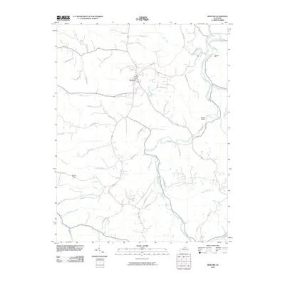 2010 Bedford2010 Print · USGSTrimble County at the start of the 2010s shows a landscape defined by the winding Little Kentucky River and the crossroads of Bedford. Genealogists and local historians can trace family land ties along Taylor Farm Rd or explore the ridges around Bunker Hill and Science Hollow.
Showing maps 1-25 of 59
Top cities of Trimble County
Frequently asked questions
- What are the different types of historical maps available for Trimble County?
- What is the oldest map of Trimble County?
- Where can I purchase historical maps of Trimble County for my home or office?
- Where can I download high-res historical maps of Trimble County?
- Are there historical topographic maps available for Trimble County?
- Is there historical aerial imagery available for Trimble County?
- Where are historical maps of Trimble County sourced from?