Old Maps of Donaldsonville, Louisiana for Genealogy
Trace your family roots with 27 historic maps of Donaldsonville. These high-res maps reveal old neighborhoods, homesites, landmarks, and streets — helping you uncover where your ancestors lived and how the area evolved over time.
- Explore historic neighborhoods: Identify where your relatives may have lived in the 1800s or 1900s.
- Compare maps over time: Trace the changes in streets, buildings, and landmarks for multi-generational research.
- Perfect for genealogy & ancestry research: Used by family historians and researchers to map out lineage and migration.
These maps are an incredible resource for exploring your personal connection to Donaldsonville's past.
Donaldsonville, LA maps
(27)- 1892 Map of Donaldsonville
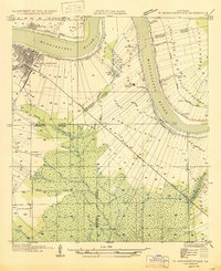
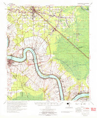
 1892 Donaldsonville1892 Print · USGSLouisiana river life in the early 1890s centered on the great meanders and landings of the river parishes. Genealogists and historians can trace the early footprints of Donaldsonville, locate the Indian Mounds, and see the impact of the Nita Crevasse on the shoreline.12 unique versions available
 - 1936 Map of White Castle, 1937 Print
 1936 White Castle1937 Print · USGSThe Mississippi River corridor and its sprawling plantation estates are captured here in the mid-1930s. Researchers can trace family roots at Pierre Part Settlement or locate landmarks like the Leper Colony and St Marys Ch & Cem.2 unique versions available
 - 1939 Map of Donaldsonville, 1953 Print
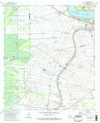
 1939 Donaldsonville1953 Print · USGSLouisiana's river parishes are captured here in the late 1930s, showing a landscape defined by the winding Mississippi River and its rich agricultural traditions. Genealogists and historians can trace family roots through numerous combined school and church sites like Little Zion Sch Ch & Cem or the sprawling riverside Monroe Plantation.5 unique versions available
 - 1947 Map of Donaldsonville
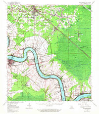
 1947 Donaldsonville1947 Print · USGSThe Mississippi River corridor near Donaldsonville comes to life in this mid-century survey of the river's winding path and industrial shoreline. Researchers can trace the rail lines of the Texas and Pacific, find the Saulsberg Refinery, and locate rural landmarks like the Brulie Maurin Sch.
 - 1954 Map of Baton Rouge, 1974 Print
 1954 Baton Rouge1974 Print · USGSSoutheast Louisiana in the mid-fifties is captured here during a period of transition for its river and rail economies. Researchers can trace the path of the Mississippi River and find landmarks like the Bonnet Carre Spillway and Bayou Plaquemine.2 unique versions available
 - 1956 Map of Baton Rouge
 1956 Baton Rouge1956 Print · USGSSouth Louisiana at the height of the mid-century oil boom shows a landscape of river oxbows and rising industry. Researchers can trace family roots through river towns like Scotlandville or locate early industrial sites and Oil wells near Lake Maurepas.
 - 1961 Map of Baton Rouge, 1966 Print
 1961 Baton Rouge1966 Print · USGSSoutheastern Louisiana in the early sixties remains a landscape of deep river bends and sprawling coastal lakes. Genealogists and historians can trace the rail-and-river economy through landmarks like Free-Nigger Point, Donaldsonville, and the Illinois Central Railroad.
 - 1962 Map of Baton Rouge
 1962 Baton Rouge1962 Print · USGSSouth Louisiana in the early sixties reveals a landscape of river-bend parishes and emerging interstate corridors. Genealogists and historians can trace family roots through historic river towns like Donaldsonville and Plaquemine, or follow the path of the Illinois Central Railroad through the swamp basins.
 - 1962 Map of Donaldsonville, 1963 Print
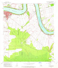
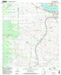
 1962 Donaldsonville1963 Print · USGSThe Mississippi River parishes of Ascension and St. James are shown here in the early sixties as industrial oil fields began to emerge alongside historic riverfront settlements. Researchers can trace family roots through numerous sites like St Michael Cem, Burnside Cem, and the small community of Brulie Maurin.
 - 1962 Map of Donaldsonville, 1963 Print
 1962 Donaldsonville1963 Print · USGSLouisiana river life in the early sixties is anchored by the historic bend at Donaldsonville and the surrounding plantation tracts. Genealogists and historians can trace family-named lands like Dugas Plantation or locate local landmarks including Ebenezer & Mt Zion Cemetery and the Lapice Oil Field.4 unique versions available
 - 1963 Map of White Castle, 1966 Print
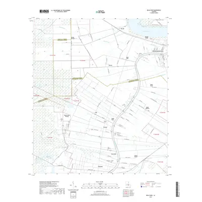
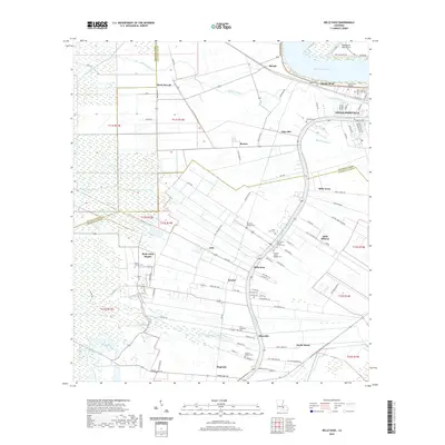
 1963 White Castle1966 Print · USGSThe riverfront and sugar lands of Iberville and Ascension Parishes are captured here in the early 1960s. Researchers can trace family sites from White Castle to Bellerose, including numerous river landings like Hard Times Ldg and the National Leprosarium.3 unique versions available
 - 1965 Map of Donaldsonville
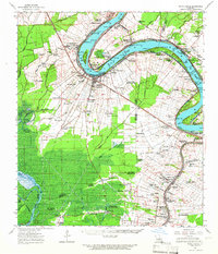
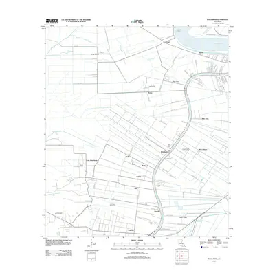
 1965 Donaldsonville1965 Print · USGSThe Mississippi River corridor south of Baton Rouge comes into focus in the 1960s, showing a transition between plantation heritage and the petroleum age. Genealogists can trace family names and local landmarks through sites like Belle Helene Plantation, Brulie Maurin, and St Landry Ch Cem.
 - 1974 Map of Belle Rose, 1975 Print
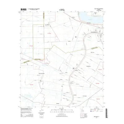
 1974 Belle Rose1975 Print · USGSAssumption and Ascension Parishes come alive in the mid-seventies, showing the distinctive long-lot patterns along the Mississippi River and Bayou Lafourche. Genealogists and local historians can trace family-named settlements like Smoke Bend, Belle Alliance, and Klotzville as they appeared decades ago.
 - 1983 Map of Ponchatoula, 1984 Print
 1983 Ponchatoula1984 Print · USGSThe Lake Pontchartrain Basin and the River Parishes come into focus during the early 1980s, showcasing the region's complex water-dependent geography. Researchers can trace the rail routes of the Illinois Central Gulf Railroad and explore landmarks from Pass Manchac to Donaldsonville.2 unique versions available
 - 1984 Map of Baton Rouge
 1984 Baton Rouge1984 Print · USGSBaton Rouge and the surrounding river country are captured in the mid-eighties as the industrial corridor met the deep wetlands of the basin. Researchers can trace the winding Bayou Teche, locate family roots in St Martinville, or study the massive Atchafalaya Basin Floodway.2 unique versions available
 - 1999 Map of Belle Rose, 2000 Print
 1999 Belle Rose2000 Print · USGSAssumption and Ascension Parishes are shown at the turn of the millennium as the local economy balances traditional bayou settlement with modern industry. Trace the historical footprint of Donaldsonville and small communities like Belle Alliance or Sweet Home.
 - 1999 Map of Donaldsonville, 2000 Print
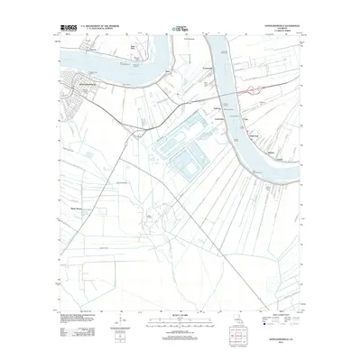
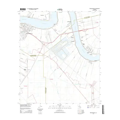
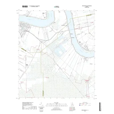
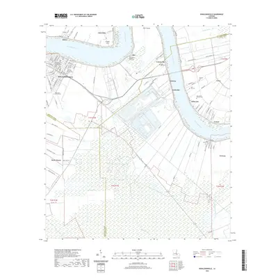
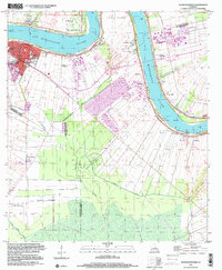 1999 Donaldsonville2000 Print · USGSThe Mississippi River corridor near Donaldsonville appears at a moment of industrial change at the close of the century. Genealogists and local historians can trace legacy sites like Union Plantation, Buena Vista Cem, and Brulie Maurin.
 - 2012 Map of Donaldsonville, 2012 Print
 2012 Donaldsonville2012 Print · USGSCovers Donaldsonville, including White Hall, Lauderdale, and other nearby areas
 - 2012 Map of Belle Rose, 2012 Print
 2012 Belle Rose2012 Print · USGSCovers Donaldsonville, including Palo Alto, Smoke Bend, and other nearby areas
 - 2015 Map of Belle Rose, 2015 Print
 2015 Belle Rose2015 Print · USGSCovers Donaldsonville, including Palo Alto, Smoke Bend, and other nearby areas
 - 2015 Map of Donaldsonville, 2015 Print
 2015 Donaldsonville2015 Print · USGSCovers Donaldsonville, including White Hall, Lauderdale, and other nearby areas
 - 2018 Map of Donaldsonville, 2018 Print
 2018 Donaldsonville2018 Print · USGSCovers Donaldsonville, including White Hall, Lauderdale, and other nearby areas
 - 2018 Map of Belle Rose, 2018 Print
 2018 Belle Rose2018 Print · USGSCovers Donaldsonville, including Palo Alto, Smoke Bend, and other nearby areas
 - 2020 Map of Belle Rose, 2020 Print
 2020 Belle Rose2020 Print · USGSCovers Donaldsonville, including Palo Alto, Smoke Bend, and other nearby areas
 - 2020 Map of Donaldsonville, 2020 Print
 2020 Donaldsonville2020 Print · USGSCovers Donaldsonville, including White Hall, Lauderdale, and other nearby areas
Showing maps 1-25 of 27
Top cities near Donaldsonville
- St. George historical maps
- Prairieville historical maps
- Gonzales historical maps
- White Castle historical maps
- Sorrento historical maps
- French Settlement historical maps
See more
Frequently asked questions
- What are the different types of historical maps available for Donaldsonville?
- What is the oldest map of Donaldsonville?
- Where can I purchase historical maps of Donaldsonville for my home or office?
- Where can I download high-res historical maps of Donaldsonville?
- Are there historical topographic maps available for Donaldsonville?
- Is there historical aerial imagery available for Donaldsonville?
- Where are historical maps of Donaldsonville sourced from?