1960s Maps of Avoyelles Parish, Louisiana
Explore 19 historic maps of Avoyelles Parish from the 1960s. These maps offer a rare glimpse into what life looked like during the 1960s — showing old roads, neighborhoods, homes, and landmarks that have changed or disappeared over time.
Whether you're researching your family's past, planning a metal detecting trip, or studying how Avoyelles Parish's landscape evolved across the 1960s, these high-resolution maps are a powerful tool for exploring the history of this region.
- Focus on a specific era: All maps on this page are from the 1960s, giving you a focused view of this time period.
- See what’s changed: Compare century-old streets, trails, and buildings to today's modern landscape using overlays and satellite layers.
- Research with precision: Use these maps for genealogy, historical research, land use analysis, or educational projects.
- View, download, or print: Maps are fully viewable online in high resolution, and can be downloaded or printed for your own records.
Start exploring Avoyelles Parish's history through authentic maps from the 1960s. This is your window into the past.
Avoyelles Parish, LA maps
(19)- 1960 Map of Eva, 1961 Print
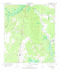
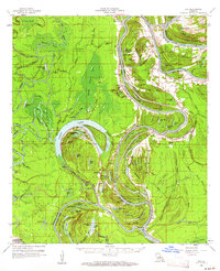 1960 Eva1961 Print · USGSCatahoula and Concordia Parishes in the early sixties reveal a landscape defined by the winding Black River and the rural communities of Mayna and Acme. Genealogists and local historians can trace family-named landmarks, old cemeteries like Dewey Cem, and rural churches including Glade Ch.3 unique versions available
 - 1961 Map of Baton Rouge, 1966 Print
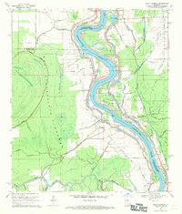
 1961 Baton Rouge1966 Print · USGSSoutheastern Louisiana in the early sixties remains a landscape of deep river bends and sprawling coastal lakes. Genealogists and historians can trace the rail-and-river economy through landmarks like Free-Nigger Point, Donaldsonville, and the Illinois Central Railroad.
 - 1962 Map of Baton Rouge
 1962 Baton Rouge1962 Print · USGSSouth Louisiana in the early sixties reveals a landscape of river-bend parishes and emerging interstate corridors. Genealogists and historians can trace family roots through historic river towns like Donaldsonville and Plaquemine, or follow the path of the Illinois Central Railroad through the swamp basins.
 - 1962 Map of Moreauville, 1963 Print
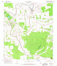
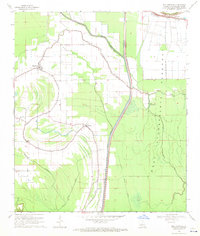
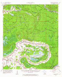 1962 Moreauville1963 Print · USGSAvoyelles Parish in the early sixties reveals a landscape of river meanders and bayou settlements shaped by the Atchafalaya. Researchers can trace rural life through landmarks like St Mark Ch, the Kansas City Southern line, and Bordelonville.2 unique versions available
 - 1962 Map of Marksville, 1964 Print
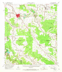
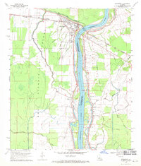
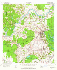 1962 Marksville1964 Print · USGSAvoyelles Parish in the early sixties remains a landscape shaped by river bends and rail lines before the modern highway era. Genealogists and historians can trace family locations near St Pauls Ch, Waddill Cem, and the historic Indian Mounds outside Marksville.3 unique versions available
 - 1965 Map of Shaw, 1966 Print
 1965 Shaw1966 Print · USGSConcordia Parish in the mid-1960s reveals a labyrinth of delta waterways and riverfront settlements shaped by the Great River. You can trace the rural infrastructure of the era through the Union Point Oil Field, the river landing at Black Hawk, and Cocodrie Ch.3 unique versions available
 - 1965 Map of Turnbull Island, 1966 Print
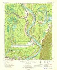
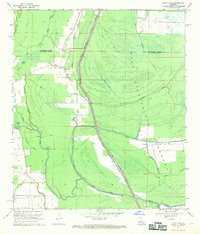
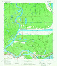 1965 Turnbull Island1966 Print · USGSTurnbull Island is captured in the mid-1960s at the junction of the Red and Mississippi Rivers. Researchers can trace the remnants of an Old Railroad Grade and locate family landmarks like Oak Grove Ch and Turnbull Cem.3 unique versions available
 - 1965 Map of Morrow, 1967 Print
 1965 Morrow1967 Print · USGSThe borderlands of St. Landry and Avoyelles Parishes were a grid of rail-side settlements and bayou-side farms in the mid-sixties. Local history researchers can trace the old rail corridors of the Texas and Pacific and locate rural landmarks like Lincoln Sch and Morrow Cem.2 unique versions available
 - 1965 Map of Bunkie, 1967 Print
 1965 Bunkie1967 Print · USGSBunkie and its surrounding parish lands are caught here in the mid-1960s at the junction of two major railroads and an expanding oil industry. Genealogists and local researchers can locate family sites at Pythian Cem, the settlement of Homesville, or the Booneville Ch outside the main town.3 unique versions available
 - 1966 Map of Whiteville, 1967 Print
 1966 Whiteville1967 Print · USGSSt. Landry Parish in the mid-1960s was a landscape defined by Bayou waterways and the crossing of two major railroads. Researchers can trace the rail-and-river economy through sites like the Ville Platte Oil and Gas Field and communities like Gold Dust or St Louis.3 unique versions available
 - 1966 Map of Cottonport, 1967 Print
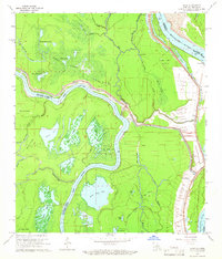
 1966 Cottonport1967 Print · USGSMid-century Avoyelles Parish centers on the rail and bayou networks surrounding Cottonport and Evergreen. Researchers can trace rural church history at Old Zion Ch and New Light Ch or explore the landscape around Big Buttonwood Lake.3 unique versions available
 - 1966 Map of Bunkie, 1967 Print
 1966 Bunkie1967 Print · USGSBunkie and the surrounding bayou country are captured in the mid-1960s as the regional rail and oil economies flourished. Genealogists can locate family landmarks like Lincoln Sch, Snowden Cem, and the Morning Star Ch Cem near Evergreen.
 - 1967 Map of Artonish, 1968 Print
 1967 Artonish1968 Print · USGSThe river country of the Mississippi-Louisiana border is captured here during a period of massive hydraulic engineering. Genealogists and researchers can locate historic sites like Fort Adams, the Lake Mary Oil Field, and family burial grounds such as Good Hope Cem and Ward Cem.
 - 1967 Map of Lone Pine, 1968 Print
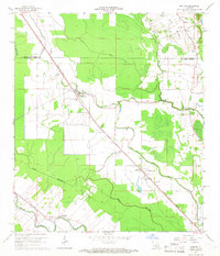
 1967 Lone Pine1968 Print · USGSLouisiana's wetlands and agricultural prairies meet in the late sixties at the border of Evangeline and Rapides Parishes. Researchers can locate rural family sites at Johnson Cem, trace the Southern Pacific rail line through Haas, or find the Dyer Airport landing strip.2 unique versions available
 - 1967 Map of Turkey Creek, 1969 Print
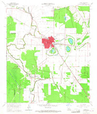
 1967 Turkey Creek1969 Print · USGSEvangeline Parish and the surrounding timberlands are shown here in the late sixties, a landscape defined by rail lines and swampy brakes. Genealogists and historians can trace the Chicago Rock Island and Pacific Railroad through Pine Prairie or locate family markers at Belle Chaney Springs Cem and Griffin Cem.
 - 1968 Map of Plaucheville, 1971 Print
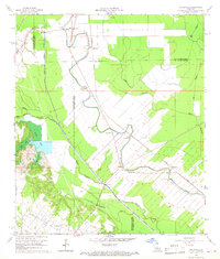
 1968 Plaucheville1971 Print · USGSIn the late 1960s, the Avoyelles Parish landscape near Plaucheville was a study in flood control and rural settlement. Genealogists and local historians can trace family locations near Dupont, Bodoc, and the Bayou Jacque Ch while surveying the massive West Atchafalaya Floodway.3 unique versions available
 - 1969 Map of Simmesport, 1970 Print
 1969 Simmesport1970 Print · USGSSimmesport and the Atchafalaya River basin are captured here in the late sixties at a peak of regional rail and river coordination. Genealogists and local historians can trace family locations through rural landmarks like Dunbar High Sch, St Pauls Cem, and the community at Odenburg.2 unique versions available
 - 1969 Map of Bayou Jack, 1971 Print
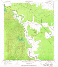
 1969 Bayou Jack1971 Print · USGSThe Atchafalaya Basin transition in the late 1960s reveals a landscape defined by flood control and rural bayou settlements. Genealogists and researchers can trace family landmarks like Mt Olive Ch Cem and Cason Cem near the banks of Bayou Rouge.3 unique versions available
 - 1969 Map of Bayou Current, 1971 Print
 1969 Bayou Current1971 Print · USGSThe Atchafalaya River basin in the late sixties reveals a landscape of riverfront settlements and vast flood control works. Researchers can trace the river's human history through the Old Railroad Grade, an ancient Indian Mound, and numerous rural sites like Mason Chapel Cem.2 unique versions available
End of results
Showing maps 1-19 of 19
Top cities of Avoyelles Parish
- Marksville historical maps
- Bunkie historical maps
- Cottonport historical maps
- Simmesport historical maps
- Mansura historical maps
- Moreauville historical maps
See more
Frequently asked questions
- What are the different types of historical maps available for Avoyelles Parish?
- What is the oldest map of Avoyelles Parish?
- Where can I purchase historical maps of Avoyelles Parish for my home or office?
- Where can I download high-res historical maps of Avoyelles Parish?
- Are there historical topographic maps available for Avoyelles Parish?
- Is there historical aerial imagery available for Avoyelles Parish?
- Where are historical maps of Avoyelles Parish sourced from?