Old Maps of Gekop, Louisiana for Genealogy
Trace your family roots with 12 historic maps of Gekop. These high-res maps reveal old neighborhoods, homesites, landmarks, and streets — helping you uncover where your ancestors lived and how the area evolved over time.
- Explore historic neighborhoods: Identify where your relatives may have lived in the 1800s or 1900s.
- Compare maps over time: Trace the changes in streets, buildings, and landmarks for multi-generational research.
- Perfect for genealogy & ancestry research: Used by family historians and researchers to map out lineage and migration.
These maps are an incredible resource for exploring your personal connection to Gekop's past.
Gekop, LA maps
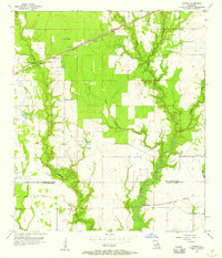
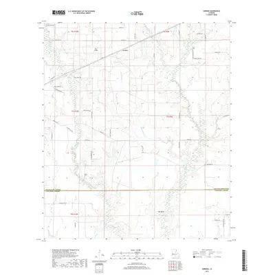
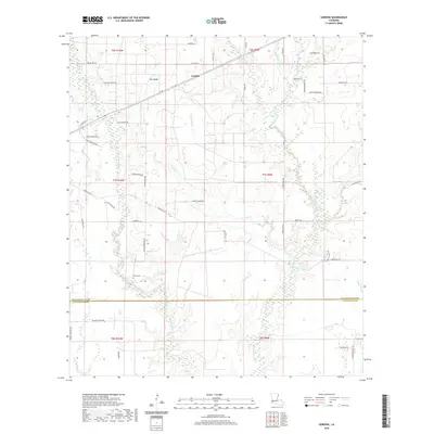
(12)- 1935 Map of Gordon
 1935 Gordon1935 Print · USGSLouisiana timber and rail history intersect at the small settlement of Gordon during the mid-1930s. Genealogists and researchers can trace early transport networks through the Old Logging Railroad, Pilgrims Rest Ch, and the Missouri Pacific line.
 - 1952 Map of Lake Charles
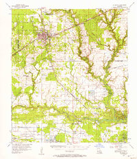
 1952 Lake Charles1952 Print · USGSSouthwest Louisiana is captured here in the mid-fifties, showing a landscape defined by the rise of the petrochemical industry and deep-water navigation. Researchers can trace family roots through numerous small-town settlements and oil developments like Nibletts Bluff, the Lockport Oil Field, and Starks.
 - 1954 Map of Lake Charles, 1964 Print
 1954 Lake Charles1964 Print · USGSSouthwest Louisiana in the mid-fifties is defined by its massive petroleum industry and its complex network of bayous and rail lines. Researchers can trace the development of the Sulphur Mines Oil Field or locate historic settlements like Longville and De Quincy.3 unique versions available
 - 1956 Map of Gordon, 1957 Print
 1956 Gordon1957 Print · USGSThe timber and oil lands of the Beauregard-Calcasieu border are captured here in the mid-fifties as industrial infrastructure expanded. Researchers can trace family roots at Gillie Cem, find old congregations like Pilgrim Rest Ch, or locate the Gordon rail siding.2 unique versions available
 - 1956 Map of De Quincy, 1957 Print
 1956 De Quincy1957 Print · USGSCalcasieu Parish comes alive in the mid-1950s as a bustling crossroads of rail, river commerce, and oil extraction. Researchers can trace the heritage of local families at Rigmaiden Cemetery, explore the rail junction at De Quincy, and locate rural landmarks like New Hope Church.3 unique versions available
 - 1986 Map of Lake Charles
 1986 Lake Charles1986 Print · USGSThe Louisiana-Texas borderlands are captured here in the mid-1980s, showcasing the industrial growth of the Lake Charles region and its rail-linked satellite towns. Trace the evolution of coastal settlements and family landmarks from Sulphur to the Highland Cem.2 unique versions available
 - 1994 Map of Gordon, 1996 Print
 1994 Gordon1996 Print · USGSThe Beauregard and Calcasieu Parish border comes into focus in the mid-1990s, showing a landscape shaped by timber and oil. Genealogists can locate Gillie Cem and Alston Cem while tracing landmarks like the Lookout Tower and Boy Scout Camp.
 - 2012 Map of Gordon, 2012 Print
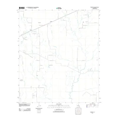 2012 Gordon2012 Print · USGSCovers Gekop, including Gordon, Calcasieu Parish, and other nearby areas
 - 2015 Map of Gordon, 2015 Print
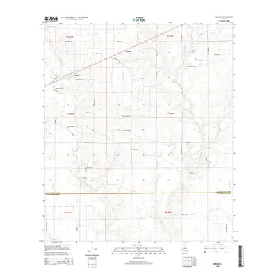 2015 Gordon2015 Print · USGSCovers Gekop, including Gordon, Calcasieu Parish, and other nearby areas
 - 2018 Map of Gordon, 2018 Print
 2018 Gordon2018 Print · USGSCovers Gekop, including Gordon, Calcasieu Parish, and other nearby areas
 - 2020 Map of Gordon, 2020 Print
 2020 Gordon2020 Print · USGSCovers Gekop, including Gordon, Calcasieu Parish, and other nearby areas
 - 2024 Map of Gordon, 2024 Print
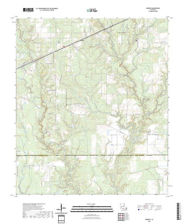 2024 Gordon2024 Print · USGSIn the timberlands and wetlands of Southwest Louisiana, this contemporary survey captures the rural landscape near Gordon. Researchers can trace family history through Hagar Cem, Alston Cem, and family-named roads like Bill Gilbert Rd.
End of results
Showing maps 1-12 of 12
Top cities near Gekop
Frequently asked questions
- What are the different types of historical maps available for Gekop?
- What is the oldest map of Gekop?
- Where can I purchase historical maps of Gekop for my home or office?
- Where can I download high-res historical maps of Gekop?
- Are there historical topographic maps available for Gekop?
- Is there historical aerial imagery available for Gekop?
- Where are historical maps of Gekop sourced from?