Old Maps of Junction, Louisiana for Academic Research
Study the evolution of Junction with 13 high-resolution historic maps. Whether you're teaching, researching, or modeling changes in land use, these maps provide essential visual documentation of urban, environmental, and geographic change.
- Analyze long-term change: Track patterns in development, transportation, and natural features.
- Ideal for environmental or urban studies: Support academic projects with primary historical map data.
- Use in the classroom or lab: Educators and researchers rely on these maps to bring historical context to life.
These maps are a powerful tool for teaching, research, and visualizing how Junction has changed over the decades.
Junction, LA maps
(13)- 1946 Map of Merryville
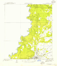
 1946 Merryville1946 Print · USGSMerryville and the Sabine River basin are shown here during the mid-forties, capturing the intersection of river transport and the timber industry. Genealogists can locate family landmarks like Hennigan Cem, Bethlehem Ch, and the site of Clines Ferry.
 - 1952 Map of Lake Charles
 1952 Lake Charles1952 Print · USGSSouthwest Louisiana is captured here in the mid-fifties, showing a landscape defined by the rise of the petrochemical industry and deep-water navigation. Researchers can trace family roots through numerous small-town settlements and oil developments like Nibletts Bluff, the Lockport Oil Field, and Starks.
 - 1954 Map of Merryville
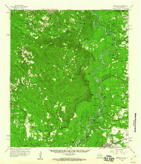
 1954 Merryville1954 Print · USGSMerryville and the Sabine River borderlands are shown here in the mid-1950s, during an era defined by timber and rail transit. Genealogists and local historians can trace family-named sites like Hennican Cem, the path of an old Logging Railroad, and the location of Clines Ferry (Abandoned).
 - 1954 Map of Lake Charles, 1964 Print
 1954 Lake Charles1964 Print · USGSSouthwest Louisiana in the mid-fifties is defined by its massive petroleum industry and its complex network of bayous and rail lines. Researchers can trace the development of the Sulphur Mines Oil Field or locate historic settlements like Longville and De Quincy.3 unique versions available
 - 1959 Map of Merryville, 1960 Print
 1959 Merryville1960 Print · USGSThe Sabine River bottomlands and the timber country of Newton County and Beauregard Parish are captured here in the late fifties. Genealogists and historians can locate rural landmarks like Shankleville, the Merryville Oil Field, and West Bethlehem.2 unique versions available
 - 1984 Map of Merryville North, 1985 Print
 1984 Merryville North1985 Print · USGSThe Sabine River bottomlands in the early eighties were a network of oxbow lakes and railroad corridors along the Texas border. Researchers can trace the path of the K. C. S. Ry. through Merryville and locate river features like Steamboat Bend and Horseshoe Lake.
 - 1986 Map of DeRidder
 1986 DeRidder1986 Print · USGSThe Louisiana-Texas borderlands come to life in the mid-eighties, showcasing the timber country and rail corridors of the Sabine River valley. Researchers can trace the legacy of small communities and transit lines through Merryville, Holly Springs, and the Missouri Pacific railroad.2 unique versions available
 - 2010 Map of Merryville North, 2010 Print
 2010 Merryville North2010 Print · USGSCovers Junction, including Merryville, Vernon Parish, and other nearby areas
 - 2012 Map of Merryville North, 2012 Print
 2012 Merryville North2012 Print · USGSCovers Junction, including Merryville, Vernon Parish, and other nearby areas
 - 2015 Map of Merryville North, 2015 Print
 2015 Merryville North2015 Print · USGSCovers Junction, including Merryville, Vernon Parish, and other nearby areas
 - 2018 Map of Merryville North, 2018 Print
 2018 Merryville North2018 Print · USGSCovers Junction, including Merryville, Vernon Parish, and other nearby areas
 - 2020 Map of Merryville North, 2020 Print
 2020 Merryville North2020 Print · USGSCovers Junction, including Merryville, Vernon Parish, and other nearby areas
 - 2024 Map of Merryville North, 2024 Print
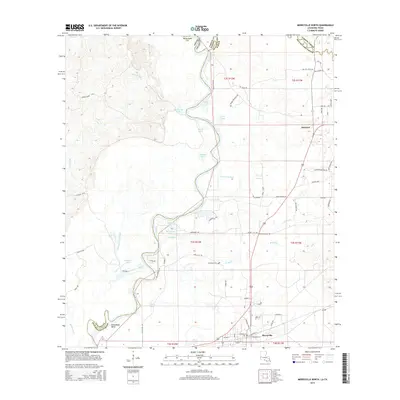
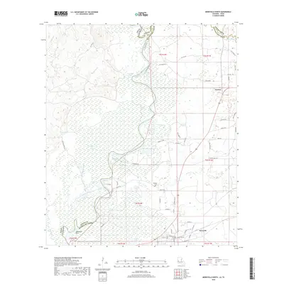
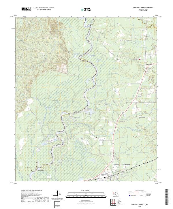 2024 Merryville North2024 Print · USGSThe Sabine River bottomlands in Beauregard Parish were a critical crossing point between Louisiana and Texas long before modern highways. Modern researchers can still trace the locations of Clines Ferry and Steamboat Bend, alongside local landmarks like Hennigan Cem and Alligator Lake.
End of results
Showing maps 1-13 of 13
Top cities near Junction
Frequently asked questions
- What are the different types of historical maps available for Junction?
- What is the oldest map of Junction?
- Where can I purchase historical maps of Junction for my home or office?
- Where can I download high-res historical maps of Junction?
- Are there historical topographic maps available for Junction?
- Is there historical aerial imagery available for Junction?
- Where are historical maps of Junction sourced from?