Old Maps of Belcher, Louisiana for Hiking & Exploration
Hike through history with 23 historic maps of Belcher. Explore old trails, ghost towns, and forgotten backroads — perfect for outdoor adventurers and local explorers.
- Rediscover forgotten places: Map out old mining camps, roads, and footpaths that no longer exist on modern maps.
- Layer with modern tools: Combine with LiDAR or satellite views to plan hikes through historical terrain.
- Made for exploration: Popular among hikers, overlanders, and local history lovers.
Use these maps to find adventure and explore the hidden past of Belcher.
Belcher, LA maps
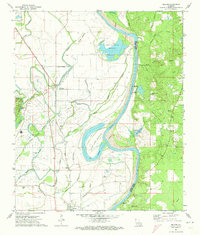
(23)- 1932 Map of Hosston SE
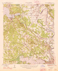
 1932 Hosston SE1932 Print · USGSCaddo and Bossier Parishes are captured here in the early thirties along the winding Red River. Local historians can locate river crossings like Peru Ferry and a network of community anchors including Rosenwald Sch and Gilliam.
 - 1932 Map of Shreveport NE
 1932 Shreveport NE1932 Print · USGSCaddo and Bossier parishes are captured in the early 1930s, showing a river-bottom landscape of shifting bayous and cotton-country settlements. Genealogists and local historians can trace family roots through landmarks like the Rosenwald Sch, St James Ch, and the Briarfield Ferry crossing.
 - 1948 Map of Mooringsport
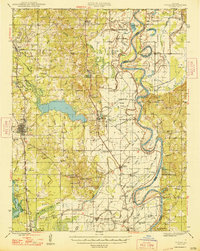
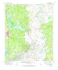
 1948 Mooringsport1948 Print · USGSNorthwest Louisiana's oil and river country is captured here during the late 1940s, showing the early growth of Mooringsport and Oil City. Researchers can trace rural lineages through numerous local landmarks like the Evening Star Sch and Albany Ferry.
 - 1948 Map of Vivian
 1948 Vivian1948 Print · USGSUpper Caddo Parish in the late 1940s is defined by the winding Red River and a thriving rail-and-oil economy. Genealogists can trace family roots through numerous rural landmarks like the Oil Refinery near Lewis, the Miller Bluff Ferry, and Egypt Hill Cem.
 - 1955 Map of Shreveport
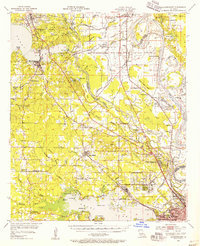
 1955 Shreveport1955 Print · USGSNorthern Louisiana in the mid-fifties is captured here as a landscape of military bases, vast oil fields, and burgeoning college towns. Genealogists and historians can trace the rail-and-river economy through the Monroe Gas Field, Grambling College, and Barksdale Air Force Base.3 unique versions available
 - 1955 Map of Mooringsport, 1956 Print
 1955 Mooringsport1956 Print · USGSNorth of Shreveport in the mid-fifties, the landscape was a complex mix of active oil fields, bayou drainage projects, and rural plantations. Researchers can trace family sites at Sentell Plantation, Walker Hill Cem, or the Reed Spring Sch.3 unique versions available
 - 1956 Map of Shreveport
 1956 Shreveport1956 Print · USGSNorthern Louisiana during the mid-fifties presents a complex landscape of booming oil fields and strategic military installations. Genealogists and historians can trace the infrastructure of the Monroe Gas Field and family-named locales from Cotton Valley to Jonesboro.
 - 1956 Map of Vivian, 1958 Print
 1956 Vivian1958 Print · USGSCaddo Parish was a hub of energy production and river commerce in the mid-1950s as the oil industry transformed rural Louisiana. Researchers can trace family history through local landmarks like Centerville Cem, St Marks Ch, and North Caddo High Sch.2 unique versions available
 - 1971 Map of Gilliam, 1973 Print
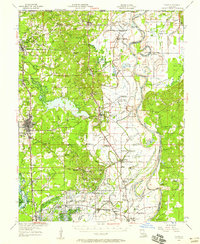
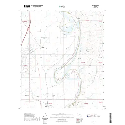
 1971 Gilliam1973 Print · USGSThe Red River valley in the early 1970s shows a landscape of deep-rooted rural communities and heavy industry. Genealogists and historians can trace numerous country churches like St Elmo Ch and Union Chapel or locate the TEXAS AND PACIFIC rail stops at Cavett and Belcher.
 - 1971 Map of Vivian, 1974 Print
 1971 Vivian1974 Print · USGSCaddo Parish at the start of the 1970s shows a landscape transformed by the energy industry and an intricate network of bayous. Researchers can trace family sites at Centerville Cem and Antioch Ch or explore the rail hubs of Vivian and Oil City.2 unique versions available
 - 1982 Map of Dixie
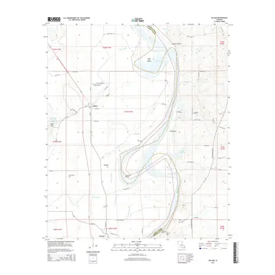
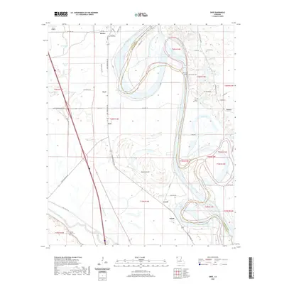
 1982 Dixie1982 Print · USGSThe alluvial plains of Northwest Louisiana are captured here in the early eighties as the river dictates the local geography. Researchers can trace the legacy of Sentell Plantation, the small community of Belcher, and the winding course of Red River oxbows.
 - 1984 Map of Shreveport
 1984 Shreveport1984 Print · USGSNorthern Louisiana at the peak of the 1980s reveals a landscape of massive water management projects and Cold War military hubs. Trace the rail lines of the Kansas City Southern Ry past Barksdale Air Force Base and the high ground of Driskill Mountain.2 unique versions available
 - 1986 Map of Shreveport North
 1986 Shreveport North1986 Print · USGSNorthern Louisiana in the mid-eighties shows a landscape of expansive river bottoms and growing suburban centers. Genealogists and historians can trace the development of Shreveport, the infrastructure of Barksdale Air Force Base, and rural life in Rocky Mount.2 unique versions available
 - 2012 Map of Gilliam, 2012 Print
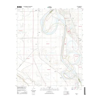
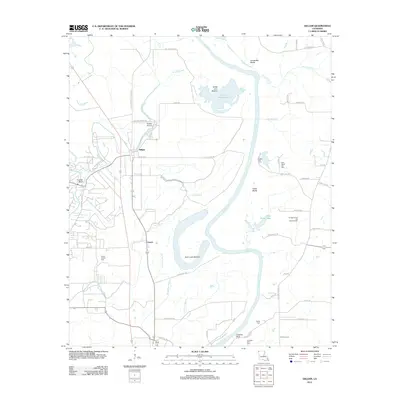 2012 Gilliam2012 Print · USGSCovers Belcher, including Hosston, Gilliam, and other nearby areas
 - 2012 Map of Dixie, 2012 Print
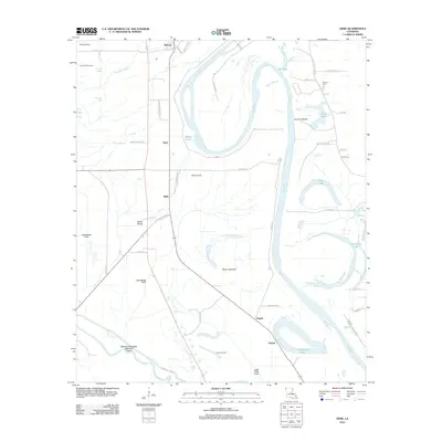 2012 Dixie2012 Print · USGSCovers Belcher, including Benton, Sentell, and other nearby areas
 - 2015 Map of Gilliam, 2015 Print
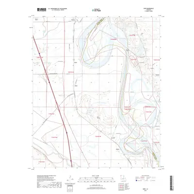
 2015 Gilliam2015 Print · USGSCovers Belcher, including Hosston, Gilliam, and other nearby areas
 - 2015 Map of Dixie, 2015 Print
 2015 Dixie2015 Print · USGSCovers Belcher, including Benton, Sentell, and other nearby areas
 - 2018 Map of Gilliam, 2018 Print
 2018 Gilliam2018 Print · USGSCovers Belcher, including Hosston, Gilliam, and other nearby areas
 - 2018 Map of Dixie, 2018 Print
 2018 Dixie2018 Print · USGSCovers Belcher, including Benton, Sentell, and other nearby areas
 - 2020 Map of Dixie, 2020 Print
 2020 Dixie2020 Print · USGSCovers Belcher, including Benton, Sentell, and other nearby areas
 - 2020 Map of Gilliam, 2020 Print
 2020 Gilliam2020 Print · USGSCovers Belcher, including Hosston, Gilliam, and other nearby areas
 - 2024 Map of Gilliam, 2024 Print
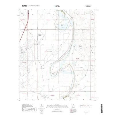
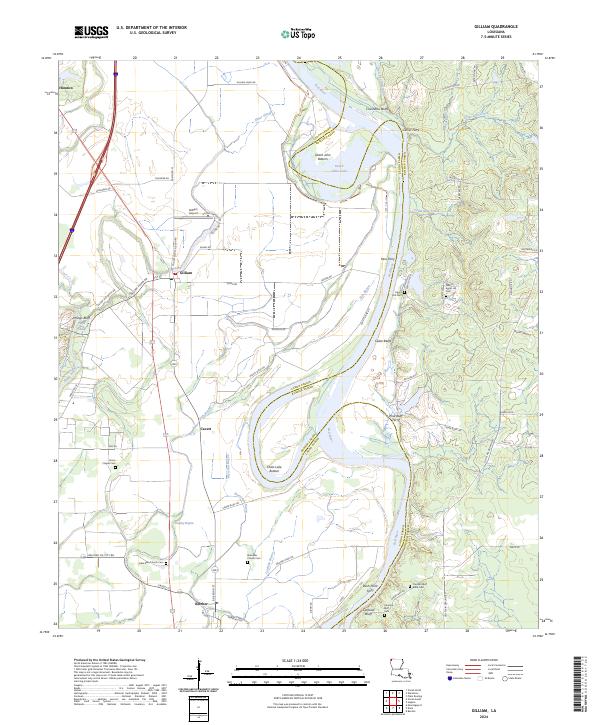 2024 Gilliam2024 Print · USGSNorthwest Louisiana's river country comes to life in this survey of the parishes bordering the Red River. Researchers can trace old ferry landings like Peru Ferry and Pine Bluff Ferry or locate family burial grounds including Union Chapel Cem and Egypt Hill Cem.
 - 2024 Map of Dixie, 2024 Print
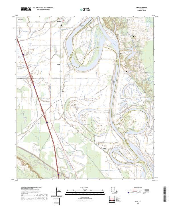 2024 Dixie2024 Print · USGSThe Red River bottomlands of Caddo and Bossier Parishes are documented here in the early twenty-first century. Researchers can trace family history through the Saint Paul Church Cem and locate river crossings like Brier Field Ferry.
End of results
Showing maps 1-23 of 23
Top cities near Belcher
- Shreveport historical maps
- Bossier City historical maps
- Vivian historical maps
- Blanchard historical maps
- Benton historical maps
- Oil City historical maps
See more
Frequently asked questions
- What are the different types of historical maps available for Belcher?
- What is the oldest map of Belcher?
- Where can I purchase historical maps of Belcher for my home or office?
- Where can I download high-res historical maps of Belcher?
- Are there historical topographic maps available for Belcher?
- Is there historical aerial imagery available for Belcher?
- Where are historical maps of Belcher sourced from?