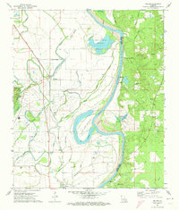
1971 Map of Gilliam
USGS Topo · Published 1973About this map
Gilliam and Hosston anchor the industrial landscape of the Caddo-Pine Island region in northern Louisiana. This survey details a transition from the heavy industrial infrastructure of the Gas Field and Oil Field to the meandering, alluvial lowlands of the Red River. The Texas and Pacific railroad serves as the primary spine for transport, connecting the small settlements of Cavett and Belcher while passing by Gilliam Airfield. This era reveals a high density of rural institutions, particularly churches such as New Avery Ch, St Elmo Ch, Union Chapel, and Williams Chapel. To the east, the landscape shifts dramatically as the river creates complex oxbows and backwaters like Holm Lake Bottom and Ollie Holm Lake along the Caddo Parish and Bossier Parish boundary, illustrating the dynamic hydrology of the Red River valley.
Find a feature on this map
52 named features on this map. Tap any name to fly to it.
Don’t see what you’re looking for? This feature index may not catch every label — zoom into the map to look around manually.
Map Details
Editions of this 1971 Gilliam Map
This is the sole edition of this map. No revisions or reprints were ever made.
Other maps of this area

1932 · Hosston NW
USGS Topo · 1:31,680

1932 · Hosston NE
USGS Topo · 1:31,680

1932 · Hosston SW
USGS Topo · 1:31,680

1932 · Hosston SE
USGS Topo · 1:31,680

1932 · Bossier NW
USGS Topo · 1:31,680

1932 · Shreveport NE
USGS Topo · 1:31,680

1948 · Mooringsport
USGS Topo · 1:62,500

1948 · Vivian
USGS Topo · 1:62,500

1948 · Bossier City
USGS Topo · 1:62,500

1950 · Plain Dealing SW
USGS Topo · 1:31,680