1950s Maps of Ida, Louisiana
Explore 7 historic maps of Ida from the 1950s. These maps offer a rare glimpse into what life looked like during the 1950s — showing old roads, neighborhoods, homes, and landmarks that have changed or disappeared over time.
Whether you're researching your family's past, planning a metal detecting trip, or studying how Ida's landscape evolved across the 1950s, these high-resolution maps are a powerful tool for exploring the history of this region.
- Focus on a specific era: All maps on this page are from the 1950s, giving you a focused view of this time period.
- See what’s changed: Compare century-old streets, trails, and buildings to today's modern landscape using overlays and satellite layers.
- Research with precision: Use these maps for genealogy, historical research, land use analysis, or educational projects.
- View, download, or print: Maps are fully viewable online in high resolution, and can be downloaded or printed for your own records.
Start exploring Ida's history through authentic maps from the 1950s. This is your window into the past.
Ida, LA maps
(7)- 1952 Map of Doddridge, 1953 Print
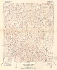 1952 Doddridge1953 Print · USGSThe Arkansas-Louisiana borderlands come alive in this mid-century survey of Miller County and Caddo Parish. Genealogists can locate family-named landmarks like Capps City or Brightstar and trace rural congregations at Concord Ch and Oak Grove Ch.5 unique versions available
 - 1953 Map of El Dorado, 1967 Print
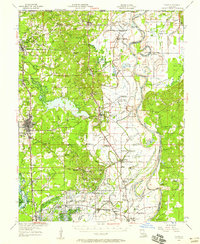
 1953 El Dorado1967 Print · USGSSouth Arkansas in the mid-1960s was a landscape of industrial growth and river-fed commerce. Researchers can trace the extensive Oil and Gas Fields around Magnolia, the expansive U S Naval Ammunition Depot, and the busy rail lines of the Missouri Pacific.3 unique versions available
 - 1955 Map of Shreveport
 1955 Shreveport1955 Print · USGSNorthern Louisiana in the mid-fifties is captured here as a landscape of military bases, vast oil fields, and burgeoning college towns. Genealogists and historians can trace the rail-and-river economy through the Monroe Gas Field, Grambling College, and Barksdale Air Force Base.3 unique versions available
 - 1956 Map of Shreveport
 1956 Shreveport1956 Print · USGSNorthern Louisiana during the mid-fifties presents a complex landscape of booming oil fields and strategic military installations. Genealogists and historians can trace the infrastructure of the Monroe Gas Field and family-named locales from Cotton Valley to Jonesboro.
 - 1956 Map of Vivian, 1958 Print
 1956 Vivian1958 Print · USGSCaddo Parish was a hub of energy production and river commerce in the mid-1950s as the oil industry transformed rural Louisiana. Researchers can trace family history through local landmarks like Centerville Cem, St Marks Ch, and North Caddo High Sch.2 unique versions available
 - 1957 Map of El Dorado
 1957 El Dorado1957 Print · USGSSouth Arkansas in the mid-1950s was a critical hub of military logistics and rail-river commerce. Genealogists and historians can trace family land across the Arkansas Louisiana border and locate sites like the U.S. Naval Ammunition Depot or the rail junctions at Magnolia and Camden.
 - 1958 Map of El Dorado
 1958 El Dorado1958 Print · USGSSouthern Arkansas and the Louisiana borderlands are shown during a period of heavy rail traffic and defense industry activity. Researchers can trace the legacy of the U. S. Naval Ammunition Depot or locate family roots in Smackover, Huttig, and Nashville.3 unique versions available
End of results
Showing maps 1-7 of 7
Top cities near Ida
- Atlanta historical maps
- Vivian historical maps
- Plain Dealing historical maps
- Hosston historical maps
- Bloomburg historical maps
- Rodessa historical maps
See more
Frequently asked questions
- What are the different types of historical maps available for Ida?
- What is the oldest map of Ida?
- Where can I purchase historical maps of Ida for my home or office?
- Where can I download high-res historical maps of Ida?
- Are there historical topographic maps available for Ida?
- Is there historical aerial imagery available for Ida?
- Where are historical maps of Ida sourced from?