
1952 Map of Doddridge
USGS Topo · Published 1953About this map
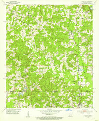
The Texas and Pacific railroad bisects this borderland landscape in the early 1950s, connecting the small communities of Doddridge and Kiblah as it runs parallel to Kelly Bayou. This region, where Miller County, Arkansas, meets Caddo Parish, Louisiana, is a mosaic of creek branches and rural development. The southern portion of the map reveals the industrial footprint of the era, notably an Oil Refinery and Oil Tanks near the town of Ida.
Find a feature on this map
28 named features on this map. Tap any name to fly to it.
Don’t see what you’re looking for? This feature index may not catch every label — zoom into the map to look around manually.
Map Details
Editions of this 1952 Doddridge Map
5 editions found
Other maps of this area

1907 · Atlanta
USGS Topo · 1:62,500

1910 · Atlanta
USGS Topo · 1:62,500

1932 · Hosston NW
USGS Topo · 1:31,680

1932 · Hosston NE
USGS Topo · 1:31,680

1944 · Kildare
USGS Topo · 1:62,500

1948 · Kildare
USGS Topo · 1:62,500

1948 · Vivian
USGS Topo · 1:62,500

1952 · Doddridge SE
USGS Topo · 1:24,000

1952 · Doddridge NW
USGS Topo · 1:24,000

1952 · Doddridge NE
USGS Topo · 1:24,000