Old Maps of Gillis, Louisiana for Academic Research
Study the evolution of Gillis with 13 high-resolution historic maps. Whether you're teaching, researching, or modeling changes in land use, these maps provide essential visual documentation of urban, environmental, and geographic change.
- Analyze long-term change: Track patterns in development, transportation, and natural features.
- Ideal for environmental or urban studies: Support academic projects with primary historical map data.
- Use in the classroom or lab: Educators and researchers rely on these maps to bring historical context to life.
These maps are a powerful tool for teaching, research, and visualizing how Gillis has changed over the decades.
Gillis, LA maps
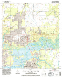
(13)- 1935 Map of Moss Bluff
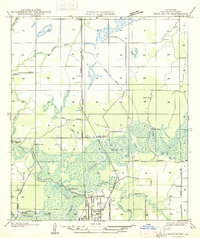 1935 Moss Bluff1935 Print · USGSCalcasieu Parish at the midpoint of the thirties reveals a river-driven landscape being reshaped by the Southern Pacific railroad. Genealogists and historians can locate family landmarks like Ritchie Cem, the old Moser Mill, and river crossings at Goss Ferry.
 - 1947 Map of Moss Bluff
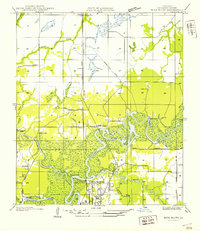 1947 Moss Bluff1947 Print · USGSCalcasieu Parish's river-driven geography comes alive in this mid-century survey as the northern edge of Lake Charles begins to expand. Researchers can trace the era's vital river crossings at Goss Ferry and Perkins Ferry or locate the historic Ritchie Cem.
 - 1952 Map of Lake Charles
 1952 Lake Charles1952 Print · USGSSouthwest Louisiana is captured here in the mid-fifties, showing a landscape defined by the rise of the petrochemical industry and deep-water navigation. Researchers can trace family roots through numerous small-town settlements and oil developments like Nibletts Bluff, the Lockport Oil Field, and Starks.
 - 1954 Map of Lake Charles, 1964 Print
 1954 Lake Charles1964 Print · USGSSouthwest Louisiana in the mid-fifties is defined by its massive petroleum industry and its complex network of bayous and rail lines. Researchers can trace the development of the Sulphur Mines Oil Field or locate historic settlements like Longville and De Quincy.3 unique versions available
 - 1955 Map of Moss Bluff, 1956 Print
 1955 Moss Bluff1956 Print · USGSCoastal Louisiana's river country comes to life in this mid-century survey of the Calcasieu basin north of Lake Charles. Trace historical river crossings and early settlements like Indian Bayou Ferry, Moss Bluff, and the Bagdad Cem.4 unique versions available
 - 1957 Map of Moss Bluff, 1958 Print
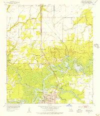
 1957 Moss Bluff1958 Print · USGSCalcasieu Parish and its surrounding bayous are captured here in the late fifties as the river economy transitions toward industry. Researchers can trace family roots at Birdnest Cem or locate historic river crossings like Perkins Ferry.3 unique versions available
 - 1986 Map of Lake Charles
 1986 Lake Charles1986 Print · USGSThe Louisiana-Texas borderlands are captured here in the mid-1980s, showcasing the industrial growth of the Lake Charles region and its rail-linked satellite towns. Trace the evolution of coastal settlements and family landmarks from Sulphur to the Highland Cem.2 unique versions available
 - 1994 Map of Moss Bluff, 1996 Print
 1994 Moss Bluff1996 Print · USGSCoastal Louisiana north of Lake Charles comes into focus in the mid-nineties as Moss Bluff expands amidst a dense network of bayous and wetlands. Researchers can trace historic family burial sites like Rhodes Cem and West Fork Cem or explore the river-driven landscape around Bridge Junction.
 - 2012 Map of Moss Bluff, 2012 Print
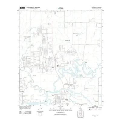 2012 Moss Bluff2012 Print · USGSCovers Gillis, including Lake Charles, Westlake, and other nearby areas
 - 2015 Map of Moss Bluff, 2015 Print
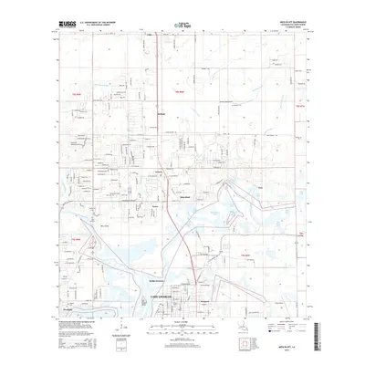 2015 Moss Bluff2015 Print · USGSCovers Gillis, including Lake Charles, Westlake, and other nearby areas
 - 2018 Map of Moss Bluff, 2018 Print
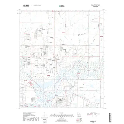 2018 Moss Bluff2018 Print · USGSCovers Gillis, including Lake Charles, Westlake, and other nearby areas
 - 2020 Map of Moss Bluff, 2020 Print
 2020 Moss Bluff2020 Print · USGSCovers Gillis, including Lake Charles, Westlake, and other nearby areas
 - 2024 Map of Moss Bluff, 2024 Print
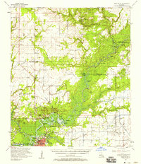
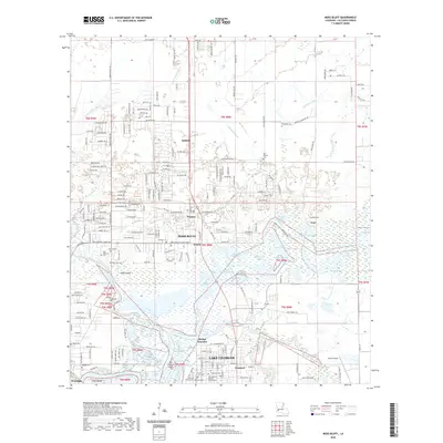
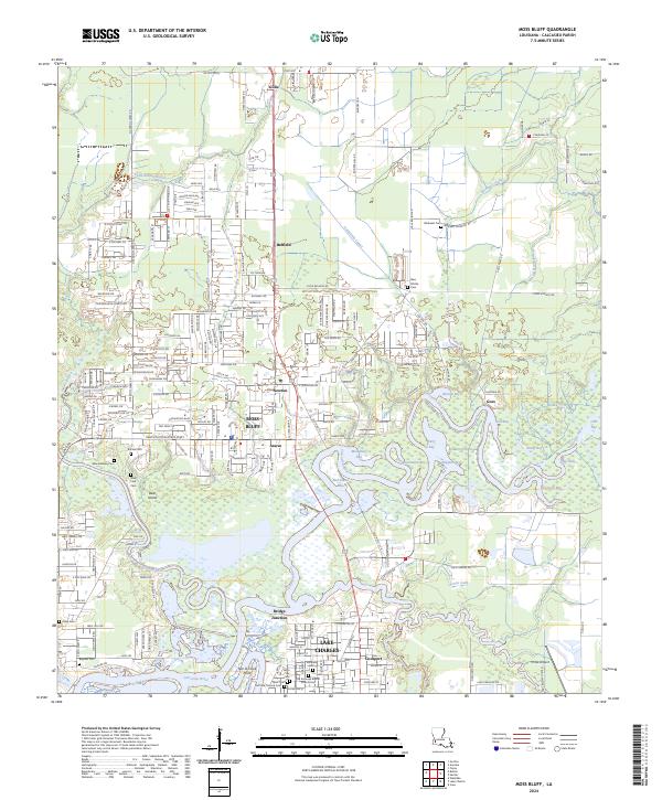 2024 Moss Bluff2024 Print · USGSNorth of Lake Charles in the modern era, this survey captures the bayou landscape and growing communities of Calcasieu Parish. Researchers can locate numerous family burial sites such as Goos Cem and Birdsnest Cem, alongside the waters of Burnett Bay.
End of results
Showing maps 1-13 of 13
Top cities near Gillis
- Lake Charles historical maps
- Sulphur historical maps
- Westlake historical maps
- DeQuincy historical maps
- Iowa historical maps
- Reeves historical maps
Frequently asked questions
- What are the different types of historical maps available for Gillis?
- What is the oldest map of Gillis?
- Where can I purchase historical maps of Gillis for my home or office?
- Where can I download high-res historical maps of Gillis?
- Are there historical topographic maps available for Gillis?
- Is there historical aerial imagery available for Gillis?
- Where are historical maps of Gillis sourced from?