Old Maps of DeSoto Parish, Louisiana for Hiking & Exploration
Hike through history with 207 historic maps of DeSoto Parish. Explore old trails, ghost towns, and forgotten backroads — perfect for outdoor adventurers and local explorers.
- Rediscover forgotten places: Map out old mining camps, roads, and footpaths that no longer exist on modern maps.
- Layer with modern tools: Combine with LiDAR or satellite views to plan hikes through historical terrain.
- Made for exploration: Popular among hikers, overlanders, and local history lovers.
Use these maps to find adventure and explore the hidden past of DeSoto Parish.
DeSoto Parish, LA maps
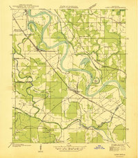
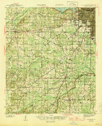
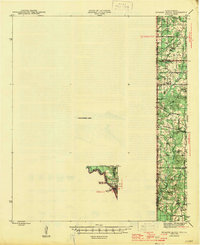
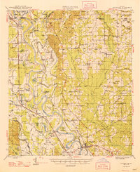
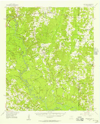
(207)- 1938 Map of Chemard Lake
 1938 Chemard Lake1938 Print · USGSIn the late 1930s, the De Soto Parish riverlands were a complex world of winding bayous and small rural schoolhouses. Genealogists and historians can trace the foundations of local life at Rambin Store, Ajax, and country schools like Egypt Sch and Summer Hill Sch.
 - 1938 Map of Hollis Creek
 1938 Hollis Creek1938 Print · USGSThe crossroads of De Soto, Sabine, and Natchitoches Parishes are shown here just before the Second World War. Genealogists can trace family connections through numerous rural landmarks like Ajax Cem, Jennings Chapel, and the Lovick Sch.
 - 1938 Map of Lake End
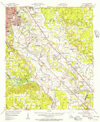
 1938 Lake End1938 Print · USGSThe Red River valley comes alive in the late 1930s, showing the intersection of three Louisiana parishes and their vital rail corridors. Genealogists and historians can trace community life through old landmarks like Logan Chapel, Ajax Church, and the riverfront settlement of Lake End.
 - 1941 Map of Pelican, 1942 Print
 1941 Pelican1942 Print · USGSDe Soto and Sabine Parishes are captured here in the early 1940s, when rail lines still drove the local economy. Researchers can locate family landmarks like Guy Cem, rural schoolhouses such as Pelican Sch, and the layout of the CCC Camp at Pleasant Hill.
 - 1943 Map of Pleasant Hill, 1955 Print
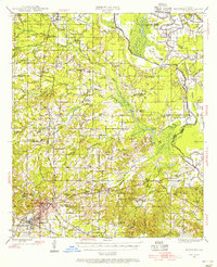
 1943 Pleasant Hill1955 Print · USGSNorthwest Louisiana's piney woods and bayous are documented here in the 1940s, a period when rural schools and railroad towns thrived. You can trace the path of the Texas and Pacific railroad through Pelican and locate family landmarks like Sebastian Cem and New Benson Sch.
 - 1944 Map of Logansport
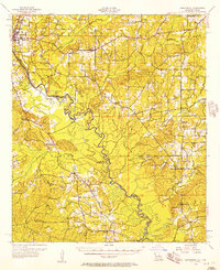
 1944 Logansport1944 Print · USGSDe Soto and Sabine Parishes are shown in the early 1940s as the Sabine River snakes through a landscape of bayous and forest. Genealogists and local historians can trace family roots through numerous sites like Prude Cem, Morning Glory Sch, and Pauls Store.
 - 1944 Map of Pleasant Hill
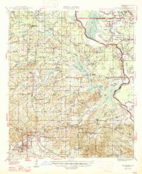
 1944 Pleasant Hill1944 Print · USGSDe Soto and Sabine Parishes are mapped here in the mid-1940s, showing a landscape defined by timber, small-scale farming, and rail transport. Genealogists can trace family landmarks like Stephenson Cem, Spring Hill Ch, and the rural community at Converse.
 - 1945 Map of Grand Cane
 1945 Grand Cane1945 Print · USGSDe Soto Parish during the mid-1940s is defined by its rural settlements and sprawling agricultural estates. Researchers can locate numerous local landmarks including the Longstreet Rosenwald School, Park Dots Plantation, and Smyrna Church.
 - 1945 Map of Greenwood
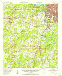
 1945 Greenwood1945 Print · USGSShreveport's southwestern outskirts and the rural reaches of Caddo Parish are captured here during the mid-forties. Genealogists can trace family names through numerous landmarks like Marshall Cem, Hall Grove Sch, and the Caddo Parish Penal Farm.
 - 1945 Map of Socagee Bayou
 1945 Socagee Bayou1945 Print · USGSThe Texas-Louisiana borderlands come alive in the mid-1940s as the Sabine River winds past rural homesteads and timber tracks. Researchers can trace the foundations of local life through the Southern Pacific rail line at Logansport and historic sites like Hogeye Cem and Shiloh Sch.2 unique versions available
 - 1945 Map of Mansfield, 1956 Print
 1945 Mansfield1956 Print · USGSDe Soto Parish in the mid-1940s centers on the rail junction at Mansfield just as the local landscape transitioned toward the post-war era. Genealogists can locate family sites at Evergreen Cem, Rock Chapel, and the historic Mansfield Battle Memorial Park.
 - 1947 Map of Mansfield
 1947 Mansfield1947 Print · USGSIn the late 1940s, the De Soto Parish landscape centered on the rail hub of Mansfield and its surrounding plantation lands. Genealogists can trace family roots through numerous rural landmarks like the Lands End Plantation, Rock Chapel, and the Evergreen Cem.
 - 1947 Map of Hanna
 1947 Hanna1947 Print · USGSRed River Parish and Natchitoches Parish are shown in the late 1940s, a period when the river valley remained a landscape of ferries, rural schools, and bayous. Genealogists can trace family landmarks like the Rambin Store, Jordon Ferry, and St James Cem.
 - 1948 Map of Coushatta
 1948 Coushatta1948 Print · USGSRed River Parish and the surrounding hill country are captured here just after the war, showing the intricate river-and-rail network. Genealogists can trace family names through dozens of landmarks like Elizabeth Sch, St Pauls Cem, and Hall Summit.
 - 1948 Map of Caspiana
 1948 Caspiana1948 Print · USGSNorthwest Louisiana south of Shreveport is captured here in the late 1940s as the river-and-rail economy shaped the Red River Valley. Genealogists can trace family footprints across dozens of rural landmarks like Blenheim Sch, Robinson Chapel, and Evergreen Cem.
 - 1953 Map of Alexandria, 1963 Print
 1953 Alexandria1963 Print · USGSCentral Louisiana during the early fifties is mapped here at the intersection of the piney woods and the Red River valley. Genealogists and historians can trace the rail-and-river network connecting towns like Alexandria, Natchitoches, and the grounds of Camp Beauregard.3 unique versions available
 - 1953 Map of Palestine, 1964 Print
 1953 Palestine1964 Print · USGSEast Texas was defined by its deep pine forests and burgeoning energy sector in the mid-1950s. Genealogists and historians can trace the rail-and-river economy through settlements like Tennessee Colony and Pollok or explore the early footprints of the Cayuga Oil Field and Davy Crockett National Forest.2 unique versions available
 - 1955 Map of Shreveport
 1955 Shreveport1955 Print · USGSNorthern Louisiana in the mid-fifties is captured here as a landscape of military bases, vast oil fields, and burgeoning college towns. Genealogists and historians can trace the rail-and-river economy through the Monroe Gas Field, Grambling College, and Barksdale Air Force Base.3 unique versions available
 - 1955 Map of Alexandria
 1955 Alexandria1955 Print · USGSCentral Louisiana in the mid-fifties is a landscape of river-port cities, sprawling timberlands, and massive military reservations. Genealogists and historians can trace the rail networks of the Texas & Pacific RR and locate sites like Camp Polk Military Reservation and Natchitoches.
 - 1955 Map of Caspiana, 1956 Print
 1955 Caspiana1956 Print · USGSShreveport and the Red River valley are captured here in the mid-fifties, just as the region's military and agricultural footprint was expanding. Researchers can trace the boundaries of Barksdale Air Force Base or locate rural landmarks like Daisy Grove Sch and Oakland Cem.3 unique versions available
 - 1955 Map of Greenwood, 1956 Print
 1955 Greenwood1956 Print · USGSShreveport and Caddo Parish undergo a mid-century transformation as suburban growth reaches the new airport and the Texas and Pacific rail lines. Genealogists and local historians can trace family-named sites like Pollard Cem, legacy schools like Greenwood Sch, and rural hubs like Keithville.2 unique versions available
 - 1956 Map of Shreveport
 1956 Shreveport1956 Print · USGSNorthern Louisiana during the mid-fifties presents a complex landscape of booming oil fields and strategic military installations. Genealogists and historians can trace the infrastructure of the Monroe Gas Field and family-named locales from Cotton Valley to Jonesboro.
 - 1956 Map of Tyler
 1956 Tyler1956 Print · USGSEast Texas was a powerhouse of oil production and rail transport during the mid-fifties, centered on the sprawling East Texas Oil Field. Researchers can trace the heritage of industrial hubs like Kilgore, military sites such as the Longhorn Ordnance Works, and many rural landmarks like Mount Enterprise.5 unique versions available
 - 1956 Map of Logansport, 1957 Print
 1956 Logansport1957 Print · USGSDe Soto Parish and the Texas borderlands come alive in this mid-century survey of the Sabine River valley. Genealogists can trace local landmarks like Pauls Store, Mt Olivet Ch, and the Third Ward Sch across a landscape of rails and river bends.4 unique versions available
 - 1956 Map of Deadwood, 1957 Print
 1956 Deadwood1957 Print · USGSThe Texas-Louisiana borderlands along the Sabine River are shown here in the mid-fifties as the Carthage Gas Field reshaped the local landscape. Genealogists can trace family roots through numerous rural landmarks, including the Centennial Cem, Shiloh Baptist Ch, and the settlement at Deadwood.4 unique versions available
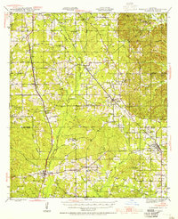
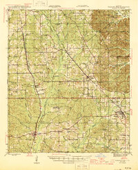
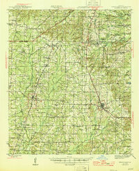
Showing maps 1-25 of 207
Top cities of DeSoto Parish
- Mansfield historical maps
- Stonewall historical maps
- Logansport historical maps
- Grand Cane historical maps
- Longstreet historical maps
- Stanley historical maps
Frequently asked questions
- What are the different types of historical maps available for DeSoto Parish?
- What is the oldest map of DeSoto Parish?
- Where can I purchase historical maps of DeSoto Parish for my home or office?
- Where can I download high-res historical maps of DeSoto Parish?
- Are there historical topographic maps available for DeSoto Parish?
- Is there historical aerial imagery available for DeSoto Parish?
- Where are historical maps of DeSoto Parish sourced from?