1990s Maps of DeSoto Parish, Louisiana
Explore 7 historic maps of DeSoto Parish from the 1990s. These maps offer a rare glimpse into what life looked like during the 1990s — showing old roads, neighborhoods, homes, and landmarks that have changed or disappeared over time.
Whether you're researching your family's past, planning a metal detecting trip, or studying how DeSoto Parish's landscape evolved across the 1990s, these high-resolution maps are a powerful tool for exploring the history of this region.
- Focus on a specific era: All maps on this page are from the 1990s, giving you a focused view of this time period.
- See what’s changed: Compare century-old streets, trails, and buildings to today's modern landscape using overlays and satellite layers.
- Research with precision: Use these maps for genealogy, historical research, land use analysis, or educational projects.
- View, download, or print: Maps are fully viewable online in high resolution, and can be downloaded or printed for your own records.
Start exploring DeSoto Parish's history through authentic maps from the 1990s. This is your window into the past.
DeSoto Parish, LA maps
(7)- 1992 Map of Hanna
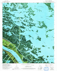 1992 Hanna1992 Print · USGSCoastal Plaquemines Parish reveals its intricate water network and riverfront settlements in the early nineties. Genealogists and historians can trace family locations in Happy Jack, Encalade, and Port Sulphur or locate the McBride School and Cem along the river road.
 - 1992 Map of Nacogdoches
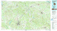 1992 Nacogdoches1992 Print · USGSEast Texas timberlands and river valleys are captured here in the early nineties, centered on the historic regional hub of Nacogdoches. Trace family roots and old rail lines through Cushing, San Augustine, and Logansport along the Southern Pacific RR.
 - 1994 Map of Converse, 1996 Print
 1994 Converse1996 Print · USGSThe borderlands of De Soto and Sabine Parishes are captured here in the mid-1990s as a landscape of timberlands and bayous. Researchers can locate the small-town footprints of Converse and Benson or trace the winding course of San Patricio Bayou and Horsehead Creek.
 - 1994 Map of Grand Cane, 1997 Print
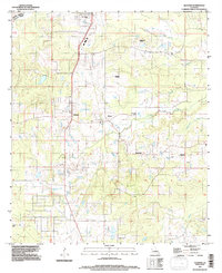
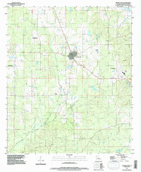 1994 Grand Cane1997 Print · USGSGrand Cane and the surrounding De Soto Parish countryside are captured in the mid-nineties, showing a landscape defined by timber, oil, and gas. Researchers can locate local landmarks like Zion Hill Cem, the De Soto Parish Airfield, and the Spider Gas Field.
 - 1994 Map of Mansfield, 1997 Print
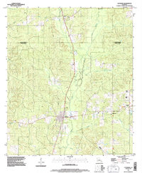
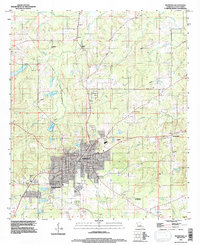 1994 Mansfield1997 Print · USGSMansfield and its surroundings are shown in the mid-1990s, blending civil war history with modern De Soto Parish growth. Researchers can locate Mansfield Battle Memorial Park, the Allen Cem, and older communities like New Rockdale.
 - 1994 Map of Gloster, 1997 Print
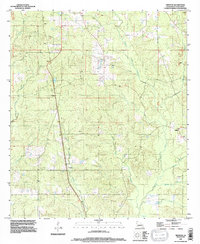
 1994 Gloster1997 Print · USGSDe Soto Parish and the Caddo line come alive in the 1990s, showing a rural landscape shaped by large plantations and cross-parish bayous. Genealogists can trace family connections through Beauna Vista Plantation, Trinity Cem, and Gloster.
 - 1995 Map of Trenton, 1997 Print
 1995 Trenton1997 Print · USGSDe Soto Parish in the mid-1990s remained a landscape of quiet timberlands and scattered rural settlements. Researchers can trace family-named locales like Trenton, Oxford, and Catuna along the banks of Bayou San Patricio and Green Cane Bayou.
End of results
Showing maps 1-7 of 7
Top cities of DeSoto Parish
- Mansfield historical maps
- Stonewall historical maps
- Logansport historical maps
- Grand Cane historical maps
- Longstreet historical maps
- Stanley historical maps
Frequently asked questions
- What are the different types of historical maps available for DeSoto Parish?
- What is the oldest map of DeSoto Parish?
- Where can I purchase historical maps of DeSoto Parish for my home or office?
- Where can I download high-res historical maps of DeSoto Parish?
- Are there historical topographic maps available for DeSoto Parish?
- Is there historical aerial imagery available for DeSoto Parish?
- Where are historical maps of DeSoto Parish sourced from?