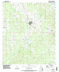
1994 Map of Grand Cane
USGS Topo · Published 1997About this map
Grand Cane serves as the focal point of this De Soto Parish landscape, showing a concentrated grid of streets surrounded by a complex network of resource extraction and rural landmarks. The 1994 data reveals a region defined by its energy production, with the Spider Gas Field, Canadian Bayou Oil and Gas Field, and North Grand Cane Oil and Gas Field carving into the terrain. Outside the developed center, the land is etched by numerous watercourses like Grand Cane Bayou and Cook Creek, leading toward the lowlands of Southerland Bottom. Genealogists and local researchers can identify several rural burial sites, including Zion Hill Cem, Friendship Cem, and Cook Cem. The presence of the De Soto Parish Airfield and a dedicated Roadside Park along the highway indicates the parish's mid-century infrastructure and transportation development.
Find a feature on this map
26 named features on this map. Tap any name to fly to it.
Don’t see what you’re looking for? This feature index may not catch every label — zoom into the map to look around manually.
Map Details
Editions of this 1994 Grand Cane Map
This is the sole edition of this map. No revisions or reprints were ever made.
Other maps of this area

1941 · Pelican
USGS Topo · 1:62,500

1943 · Pleasant Hill
USGS Topo · 1:62,500

1944 · Logansport
USGS Topo · 1:62,500

1944 · Pleasant Hill
USGS Topo · 1:62,500

1945 · Grand Cane
USGS Topo · 1:62,500

1945 · Mansfield
USGS Topo · 1:62,500

1947 · Mansfield
USGS Topo · 1:62,500

1953 · Alexandria
USGS Topo · 1:250,000

1955 · Shreveport
USGS Topo · 1:250,000

1955 · Alexandria
USGS Topo · 1:250,000