Old Maps of Baskin, Louisiana for Hiking & Exploration
Hike through history with 29 historic maps of Baskin. Explore old trails, ghost towns, and forgotten backroads — perfect for outdoor adventurers and local explorers.
- Rediscover forgotten places: Map out old mining camps, roads, and footpaths that no longer exist on modern maps.
- Layer with modern tools: Combine with LiDAR or satellite views to plan hikes through historical terrain.
- Made for exploration: Popular among hikers, overlanders, and local history lovers.
Use these maps to find adventure and explore the hidden past of Baskin.
Baskin, LA maps
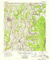
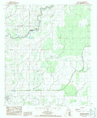
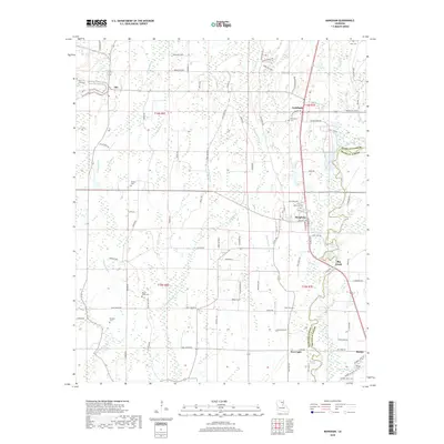
(29)- 1935 Map of Winnsboro, 1936 Print
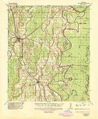 1935 Winnsboro1936 Print · USGSFranklin Parish in the mid-1930s is a landscape of railroad towns and timber landings defined by the winding Macon Bayou. Researchers can trace the Missouri Pacific line through Winnsboro or locate the many historic river crossings like Eureka Ferry and Killens Ferry.2 unique versions available
 - 1935 Map of Alto, 1936 Print
 1935 Alto1936 Print · USGSRichland Parish in the mid-1930s shows a landscape of river-bottom agriculture and an early industrial energy boom. Researchers can trace the legacy of local river travel at Douciere Ferry and locate commercial sites like Rhymes Store or the Century Carbon Company.2 unique versions available
 - 1935 Map of Baskinton, 1936 Print
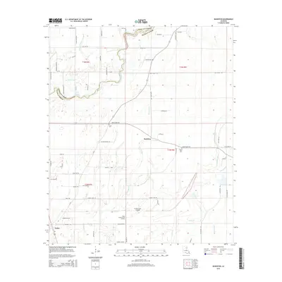
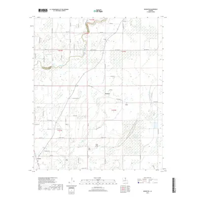
 1935 Baskinton1936 Print · USGSNortheast Louisiana in the mid-1930s is defined by its drainage basins and river landings between the rail towns of Rayville and Delhi. Genealogists can locate rural landmarks such as Hill Ridge Ch & Sch, Baskinton, and landings like Sunrise Ldg.
 - 1955 Map of Jackson
 1955 Jackson1955 Print · USGSThe Lower Mississippi Valley at the middle of the century reveals a landscape of deep river meanders and growing rail hubs. Genealogists and historians can trace the mid-century footprints of Vicksburg National Military Park, old river landings at Port Gibson, and the rail corridors of the Illinois Central Railroad.3 unique versions available
 - 1957 Map of Mangham, 1958 Print
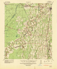
 1957 Mangham1958 Print · USGSRichland and Franklin Parishes in the late fifties reveal a landscape of river-bottom agriculture and small rail towns. Genealogists can trace family roots through numerous local landmarks like Rhymes High Sch, St Luke Cem, and Mt Zion Ch.3 unique versions available
 - 1958 Map of Baskinton
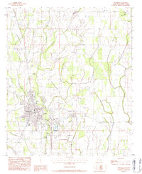
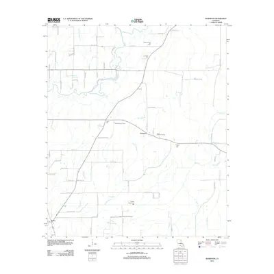
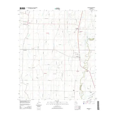
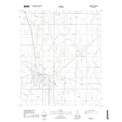
 1958 Baskinton1958 Print · USGSRichland and Franklin Parishes in the late fifties show a landscape transitioning between traditional bayou life and the post-war energy boom. Researchers can locate vanished rural landmarks like Hunters Chapel, the Delhi Refining Co, and old river stops like Indian Ldg.2 unique versions available
 - 1958 Map of Winnsboro
 1958 Winnsboro1958 Print · USGSThe fertile landscape of Franklin Parish comes to life in the late 1950s, showing a region defined by the Missouri Pacific Railroad and the winding Macon Bayou. Genealogists and local historians can trace family locations near landmarks like True Light Cem & Ch, the Franklin Parish Training Sch, and Lorelein.
 - 1961 Map of Jackson
 1961 Jackson1961 Print · USGSThe Lower Mississippi Delta and the state capital area are captured here during the post-war era of infrastructure expansion. Researchers can trace the complex river oxbows and rail lines connecting Vicksburg, Yazoo City, and the Illinois Central Railroad network.
 - 1962 Map of Jackson
 1962 Jackson1962 Print · USGSThe Mississippi Delta and the state capital region are mapped here in the early sixties, showing a landscape defined by the great river and the growing city of JACKSON. Genealogists can trace family roots through numerous landmarks like Cedar Hill Cem, rural stops on the Illinois Central RR, and historic sites like Champion Hill.2 unique versions available
 - 1976 Map of Winnsboro NW, 1977 Print
 1976 Winnsboro NW1977 Print · USGSFranklin Parish farmland and the growing town of Winnsboro are captured in high detail in the mid-1970s. Researchers can trace the exact 1976 boundaries of Winnsboro and the evolving agricultural drainage patterns of the Louisiana delta.
 - 1982 Map of Tallulah, 1983 Print
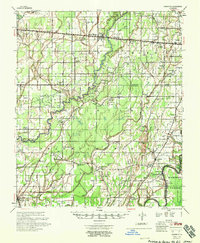
 1982 Tallulah1983 Print · USGSNortheast Louisiana in the early eighties was a landscape of intricate oxbow lakes and railroad towns. Researchers can trace the heritage of parish centers like Tallulah and Winnsboro, or locate rural landmarks near Yucatan Lake and the Illinois Central Gulf tracks.
 - 1982 Map of Mangham, 1983 Print
 1982 Mangham1983 Print · USGSThe Richland and Franklin Parish line comes alive in the early eighties as a network of rail and water. Genealogists can trace family roots at Gwin Mem Cem, China Grove Ch, and the settlement of Archibald along the Missouri Pacific.
 - 1983 Map of Winnsboro, 1984 Print
 1983 Winnsboro1984 Print · USGSFranklin Parish during the early eighties shows a landscape defined by the intersection of rail, agriculture, and bayou. Researchers can trace family sites at Old Winnsboro Cem, Wayside Ch, and the Macon Ridge Agr Exper Sta.
 - 1987 Map of Baskinton
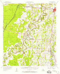
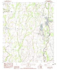
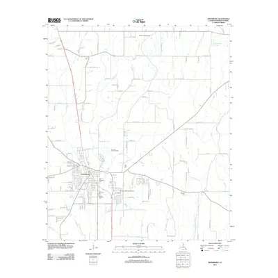
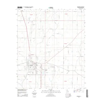
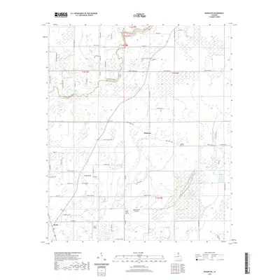
 1987 Baskinton1987 Print · USGSRichland and Franklin Parishes in the late 1980s are defined by a network of engineered waterways and rural farmsteads. Researchers can trace the path of Big Creek and locate landmarks such as the Lookout Tower or the settlements of Baskin and Baskinton.
 - 2012 Map of Baskinton, 2012 Print
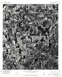
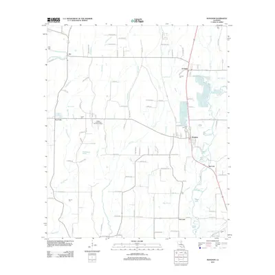
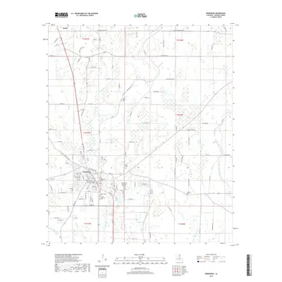
 2012 Baskinton2012 Print · USGSCovers Baskin, including Baskinton, Richland Parish, and other nearby areas
 - 2012 Map of Winnsboro, 2012 Print
 2012 Winnsboro2012 Print · USGSCovers Baskin, including Winnsboro, Franklin Parish, and other nearby areas
 - 2012 Map of Mangham, 2012 Print
 2012 Mangham2012 Print · USGSCovers Baskin, including Mangham, Alto, and other nearby areas
 - 2015 Map of Winnsboro, 2015 Print
 2015 Winnsboro2015 Print · USGSCovers Baskin, including Winnsboro, Franklin Parish, and other nearby areas
 - 2015 Map of Mangham, 2015 Print
 2015 Mangham2015 Print · USGSCovers Baskin, including Mangham, Alto, and other nearby areas
 - 2015 Map of Baskinton, 2015 Print
 2015 Baskinton2015 Print · USGSCovers Baskin, including Baskinton, Richland Parish, and other nearby areas
 - 2018 Map of Winnsboro, 2018 Print
 2018 Winnsboro2018 Print · USGSCovers Baskin, including Winnsboro, Franklin Parish, and other nearby areas
 - 2018 Map of Baskinton, 2018 Print
 2018 Baskinton2018 Print · USGSCovers Baskin, including Baskinton, Richland Parish, and other nearby areas
 - 2018 Map of Mangham, 2018 Print
 2018 Mangham2018 Print · USGSCovers Baskin, including Mangham, Alto, and other nearby areas
 - 2020 Map of Winnsboro, 2020 Print
 2020 Winnsboro2020 Print · USGSCovers Baskin, including Winnsboro, Franklin Parish, and other nearby areas
 - 2020 Map of Baskinton, 2020 Print
 2020 Baskinton2020 Print · USGSCovers Baskin, including Baskinton, Richland Parish, and other nearby areas
Showing maps 1-25 of 29
Top cities near Baskin
Frequently asked questions
- What are the different types of historical maps available for Baskin?
- What is the oldest map of Baskin?
- Where can I purchase historical maps of Baskin for my home or office?
- Where can I download high-res historical maps of Baskin?
- Are there historical topographic maps available for Baskin?
- Is there historical aerial imagery available for Baskin?
- Where are historical maps of Baskin sourced from?