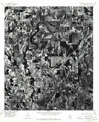
1976 Map of Winnsboro NW
USGS Topo · Published 1977About this map
Agricultural patterns and meandering watercourses dominate the landscape of Franklin Parish in this orthophotomap derived from 1976 aerial photography. The residential and commercial footprint of Winnsboro occupies the southwestern portion of the sheet, where organized street grids meet the surrounding farmland. The imagery reveals the intricate drainage and oxbow patterns typical of the Louisiana delta, showing the clear boundary between cultivated fields and the remaining wooded tracts following the bayous. Produced in cooperation with the Louisiana Department of Public Works, this document provides a high-resolution visual record of the region's land use and hydrology during the mid-1970s, before decades of further development and agricultural shift changed these rural boundaries.
Find a feature on this map
1 named feature on this map. Tap any name to fly to it.
Don’t see what you’re looking for? This feature index may not catch every label — zoom into the map to look around manually.
Map Details
Editions of this 1976 Winnsboro NW Map
This is the sole edition of this map. No revisions or reprints were ever made.
Other maps of this area

1935 · Winnsboro
USGS Topo · 1:62,500

1935 · Alto
USGS Topo · 1:62,500

1935 · Baskinton
USGS Topo · 1:62,500

1939 · Fort Necessity
USGS Topo · 1:62,500

1955 · Jackson
USGS Topo · 1:250,000

1957 · Mangham
USGS Topo · 1:62,500

1958 · Baskinton
USGS Topo · 1:62,500

1958 · Winnsboro
USGS Topo · 1:62,500

1958 · Fort Necessity
USGS Topo · 1:62,500

1961 · Jackson
USGS Topo · 1:250,000