Old Maps of Lincoln Parish, Louisiana for Genealogy
Trace your family roots with 124 historic maps of Lincoln Parish. These high-res maps reveal old neighborhoods, homesites, landmarks, and streets — helping you uncover where your ancestors lived and how the area evolved over time.
- Explore historic neighborhoods: Identify where your relatives may have lived in the 1800s or 1900s.
- Compare maps over time: Trace the changes in streets, buildings, and landmarks for multi-generational research.
- Perfect for genealogy & ancestry research: Used by family historians and researchers to map out lineage and migration.
These maps are an incredible resource for exploring your personal connection to Lincoln Parish's past.
Lincoln Parish, LA maps
(124)- 1947 Map of Bienville, 1963 Print
 1947 Bienville1963 Print · USGSNorth central Louisiana is shown here in the mid-forties, characterized by a mix of timber, rail, and early gas exploration. Researchers can find numerous rural landmarks like Raspberry School, the Louisiana and Arkansas Railroad, and Driskill Mountain.2 unique versions available
 - 1949 Map of Bienville
 1949 Bienville1949 Print · USGSNorthern Louisiana hill country is documented here in the late 1940s, showing the rural communities of Bienville Parish and its neighbors. Researchers can locate dozens of country churches and schools, including Raspberry School and Mt Villa Ch Cem, or trace the Louisiana and North West Railroad.2 unique versions available
 - 1950 Map of Ruston, 1956 Print
 1950 Ruston1956 Print · USGSLincoln Parish at mid-century centers on the expansion of Ruston and the campus of Grambling College during a period of steady growth. Researchers can trace rural lineages through numerous country landmarks like New Prospect Ch, Macedonia Cem, and Culbertson Sch.2 unique versions available
 - 1950 Map of Arcadia, 1960 Print
 1950 Arcadia1960 Print · USGSNorthern Louisiana during the mid-century was a landscape of dense rail corridors and rural schoolhouses. Genealogists can trace the ILLINOIS CENTRAL line through ARCADIA and find remote landmarks like Macedonia Ch and Point Pleasant Cem.4 unique versions available
 - 1951 Map of Arcadia
 1951 Arcadia1951 Print · USGSNorth Louisiana at mid-century reveals a landscape of tight-knit rural communities and emerging energy fields. Genealogists can trace family roots through numerous country landmarks like Alabama Ch, Givens McGuire Cem, and the Hurricane Sch along the Illinois Central line.
 - 1951 Map of Ruston
 1951 Ruston1951 Print · USGSNorth Louisiana in the early fifties was a landscape of rail-driven towns and deep-rooted rural parishes. Genealogists can trace family landmarks like Henry Cem and Macedonia Ch, or explore the early campus footprint of Grambling College.
 - 1951 Map of Summerfield, 1952 Print
 1951 Summerfield1952 Print · USGSClaiborne Parish in the early fifties is a landscape of rural crossroads and growing industry. Genealogists can locate family landmarks like Aycock Cem or Sharon Sch, and trace the development of settlements from Lisbon to the Gas Refinery near the parish line.5 unique versions available
 - 1951 Map of Bernice, 1952 Print
 1951 Bernice1952 Print · USGSNorthern Louisiana life centered on the rail lines and creek bottoms in the early fifties. Genealogists can trace family roots through numerous rural landmarks like Hard Shell Cem, Harmony Chapel, and the community of Spearsville.4 unique versions available
 - 1952 Map of Calhoun, 1953 Print
 1952 Calhoun1953 Print · USGSNorth Louisiana life in the early fifties centered on the rural crossroads and rail lines of Union and Ouachita Parishes. Genealogists can trace family footprints through numerous local landmarks like Millard Hill Cem, Auld Chapel, and the Experiment Station at Calhoun.3 unique versions available
 - 1953 Map of Chatham, 1954 Print
 1953 Chatham1954 Print · USGSLouisiana's piney hills and creek bottoms are meticulously detailed here in the early fifties, showing a network of rural parishes. Researchers can locate family landmarks like Mt Moriah Cem, the settlement of Indian Village, and the Old Railroad Grade.3 unique versions available
 - 1953 Map of Hodge, 1954 Print
 1953 Hodge1954 Print · USGSJackson Parish in the early fifties shows a landscape of timber and rail, centered on the busy mills of Hodge and Jonesboro. Genealogists and historians can trace the foundations of local life at China Grove Sch and Saints Rest Ch.5 unique versions available
 - 1955 Map of Shreveport
 1955 Shreveport1955 Print · USGSNorthern Louisiana in the mid-fifties is captured here as a landscape of military bases, vast oil fields, and burgeoning college towns. Genealogists and historians can trace the rail-and-river economy through the Monroe Gas Field, Grambling College, and Barksdale Air Force Base.3 unique versions available
 - 1956 Map of Shreveport
 1956 Shreveport1956 Print · USGSNorthern Louisiana during the mid-fifties presents a complex landscape of booming oil fields and strategic military installations. Genealogists and historians can trace the infrastructure of the Monroe Gas Field and family-named locales from Cotton Valley to Jonesboro.
 - 1982 Map of Downsville North, 1983 Print
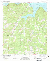 1982 Downsville North1983 Print · USGSUnion and Lincoln Parishes are captured here in the early eighties as the energy industry and timberlands defined the rural landscape. Researchers can locate family landmarks like the Feazel Cem, Cedar Grove Cem, and Millard Hill Ch near the banks of Bayou D'Arbonne Lake.
 - 1982 Map of Eros, 1983 Print
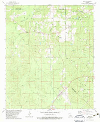 1982 Eros1983 Print · USGSNorth central Louisiana during the early eighties shows a landscape of small timber-and-gas settlements along the parish lines. Researchers can trace family sites like Old Zeigler Cem and Bonett Cem or explore the rural layout of Eros and Indian Village.
 - 1982 Map of Downsville South, 1983 Print
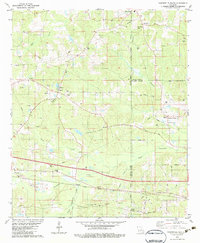 1982 Downsville South1983 Print · USGSLincoln and Ouachita Parishes in the early eighties were shaped by a busy energy industry and deep-rooted rural communities. Trace family history and land use through Lanes Chapel Cemeteries, the Illinois Central Gulf rail line, and Choudrant School.
 - 1984 Map of Shreveport
 1984 Shreveport1984 Print · USGSNorthern Louisiana at the peak of the 1980s reveals a landscape of massive water management projects and Cold War military hubs. Trace the rail lines of the Kansas City Southern Ry past Barksdale Air Force Base and the high ground of Driskill Mountain.2 unique versions available
 - 1985 Map of Monroe South
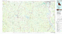 1985 Monroe South1985 Print · USGSNorth Central Louisiana in the mid-1980s was a hub of timber production and rail transport spanning from the Dugdemona River to the Ouachita valley. Family researchers and historians can trace the rail lines of the Midsouth Railroad through Jonesboro or find local landmarks like Mineral Springs and Punkin Center.2 unique versions available
 - 1985 Map of Monroe North, 1986 Print
 1985 Monroe North1986 Print · USGSNorth-central Louisiana in the mid-eighties was a landscape defined by the growth of university towns and the expansion of the natural gas industry. Researchers can trace rural family roots through landmarks like Lisbon Cem, New Hope Ch, and the many schools in Farmerville or Bernice.2 unique versions available
 - 1985 Map of Ruston East, 1986 Print
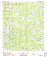 1985 Ruston East1986 Print · USGSLincoln Parish comes into focus during the mid-eighties as the eastern expansion of Ruston meets the rural village of Choudrant. Researchers can trace old family burial sites at various Cem locations and locate industrial landmarks like the local Clay Pit.
 - 1985 Map of Bernice, 1986 Print
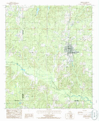 1985 Bernice1986 Print · USGSNorth Louisiana in the early eighties is captured here, centering on the grid of Bernice and the rural reaches of the surrounding parishes. Researchers can trace land ties along Middle Fork Bayou D'Arbonne or locate rural landmarks like Weldon and several old Cem sites.
 - 1985 Map of Shiloh, 1986 Print
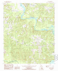 1985 Shiloh1986 Print · USGSUnion Parish during the 1980s shows a landscape shaped by the waters of the Bayou D'Arbonne. Researchers can trace rural lineages through the settlement of Shiloh or explore the early footprint of Lake D'Arbonne State Park and Corney Bayou.
 - 1985 Map of Ruston West, 1986 Print
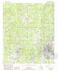 1985 Ruston West1986 Print · USGSLincoln Parish in the mid-1980s reveals a landscape shaped by growing university campuses and the winding paths of North Louisiana creeks. Researchers can trace the development of Grambling State University, the rural community of Vienna, and family-named landmarks like Barnet Springs.
 - 1985 Map of Clay, 1986 Print
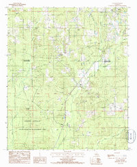 1985 Clay1986 Print · USGSNorthern Louisiana timber and hill country are captured here in the mid-eighties, revealing a landscape of small settlements and resource extraction. Researchers can trace family roots at several rural cemeteries or locate the old Gravel Pit Redwine and Ansley.
 - 1985 Map of Dubach, 1986 Print
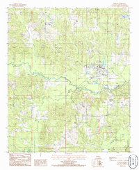 1985 Dubach1986 Print · USGSLincoln Parish in the mid-1980s reveals a quiet landscape of rural crossroads and bayou-side settlements. Researchers can trace family history through locations like Mount Zion, Unionville, and Hilly, or follow the winding course of Bayou D'Arbonne.
Showing maps 1-25 of 124
Top cities of Lincoln Parish
- Ruston historical maps
- Grambling historical maps
- Dubach historical maps
- Simsboro historical maps
- Choudrant historical maps
- Vienna historical maps
Frequently asked questions
- What are the different types of historical maps available for Lincoln Parish?
- What is the oldest map of Lincoln Parish?
- Where can I purchase historical maps of Lincoln Parish for my home or office?
- Where can I download high-res historical maps of Lincoln Parish?
- Are there historical topographic maps available for Lincoln Parish?
- Is there historical aerial imagery available for Lincoln Parish?
- Where are historical maps of Lincoln Parish sourced from?