Old Maps of Walker, Louisiana for Metal Detecting
Plan your next treasure hunt with 37 historic maps of Walker. Find old homesites, ghost towns, trails, and gathering spots that may be lost to time — perfect for identifying promising metal detecting locations.
- Locate forgotten sites: Uncover places like long-lost settlements, abandoned rail lines, or gathering spots.
- Plan better hunts: Use map overlays combined with LiDAR or satellite views to narrow in on historically rich areas.
- Made for detectorists: Thousands of hobbyists use these maps to discover relics, coins, and hidden history.
Use these historic maps to boost your research and find new opportunities beneath the surface of Walker.
Walker, LA maps
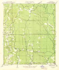
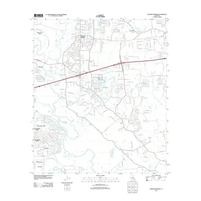
(37)- 1934 Map of Denham Springs
 1934 Denham Springs1934 Print · USGSLouisiana's river parishes come to life in the early 1930s as settlement spreads from the railroads into the bayous. Genealogists can trace family names at Broussard Grove Ch, locate the Rosenwald Sch, or find the old French Settlement Ferry crossing.2 unique versions available
 - 1939 Map of Denham Springs, 1942 Print
 1939 Denham Springs1942 Print · USGSLouisiana's river country comes alive in this pre-war survey of the Amite River basin during its transition to the modern highway era. Researchers can locate family roots at St Josephs Ch & Cem, track the old French Settlement Ferry, or find the Hoo Shoo Too Club.2 unique versions available
 - 1942 Map of Satsuma
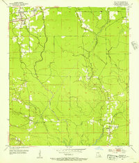
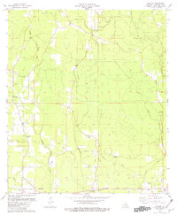
 1942 Satsuma1942 Print · USGSLivingston Parish at the start of the 1940s reveals a rural landscape defined by logging, rail, and small-town life. Genealogists can locate family landmarks like Vickers Cem and Mangum Chapel or trace the early paths of Friendship and Satsuma.
 - 1953 Map of Walker, 1954 Print
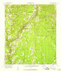
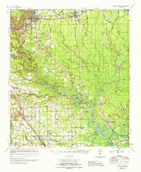
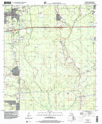
 1953 Walker1954 Print · USGSLivingston Parish in the early fifties is defined by the Illinois Central rail line and the sprawling Colyell Creek drainage system. Genealogists and local historians can locate the Petes Rest Cem, the Walker Lookout Tower, and the Frost Sch.2 unique versions available
 - 1953 Map of Denham Springs, 1954 Print
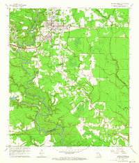
 1953 Denham Springs1954 Print · USGSDenham Springs and the surrounding parishes are captured here in the early fifties, showing a landscape defined by river bends and rail lines. Researchers can trace family history through sites like Palmetto Cem, Eden Ch, and the 7th Ward Sch.2 unique versions available
 - 1953 Map of Satsuma, 1954 Print
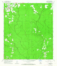
 1953 Satsuma1954 Print · USGSLivingston Parish in the early fifties shows a rural landscape defined by the Illinois Central railroad and winding creek bottoms. Genealogists can locate family landmarks like S Stafford Cem, Judson Ch, and the Vickers Cem near the town of Walker.2 unique versions available
 - 1954 Map of Baton Rouge, 1974 Print
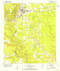
 1954 Baton Rouge1974 Print · USGSSoutheast Louisiana in the mid-fifties is captured here during a period of transition for its river and rail economies. Researchers can trace the path of the Mississippi River and find landmarks like the Bonnet Carre Spillway and Bayou Plaquemine.2 unique versions available
 - 1956 Map of Baton Rouge
 1956 Baton Rouge1956 Print · USGSSouth Louisiana at the height of the mid-century oil boom shows a landscape of river oxbows and rising industry. Researchers can trace family roots through river towns like Scotlandville or locate early industrial sites and Oil wells near Lake Maurepas.
 - 1958 Map of Pine Grove, 1959 Print
 1958 Pine Grove1959 Print · USGSLouisiana's river-bottom parishes are shown here in the late fifties, when small timber and rail-stop communities still defined the rural landscape. Genealogists and researchers can trace lineage through dozens of local sites like Judson Ch Cem, Pride Chapel, and the vanished tracks of the Old Railroad Grade.3 unique versions available
 - 1961 Map of Baton Rouge, 1966 Print
 1961 Baton Rouge1966 Print · USGSSoutheastern Louisiana in the early sixties remains a landscape of deep river bends and sprawling coastal lakes. Genealogists and historians can trace the rail-and-river economy through landmarks like Free-Nigger Point, Donaldsonville, and the Illinois Central Railroad.
 - 1962 Map of Baton Rouge
 1962 Baton Rouge1962 Print · USGSSouth Louisiana in the early sixties reveals a landscape of river-bend parishes and emerging interstate corridors. Genealogists and historians can trace family roots through historic river towns like Donaldsonville and Plaquemine, or follow the path of the Illinois Central Railroad through the swamp basins.
 - 1962 Map of Walker, 1964 Print
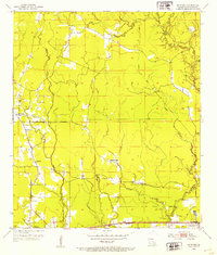
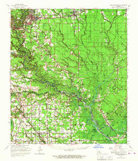
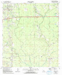
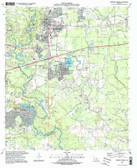
 1962 Walker1964 Print · USGSLivingston Parish comes into focus in the early sixties as the railroad corridor through Walker and Corbin anchors the rural landscape. Researchers can pinpoint early landmarks like the Walker Lookout Tower and family burial sites such as Petes Rest Cem.4 unique versions available
 - 1963 Map of Denham Springs, 1964 Print
 1963 Denham Springs1964 Print · USGSDenham Springs and the surrounding river country are captured here in the early sixties as the suburban landscape began to expand. Genealogists and local historians can trace family roots through sites like Palmetto Cem, Hebron Ch, and the old 7th Ward Sch.3 unique versions available
 - 1963 Map of Denham Springs, 1967 Print
 1963 Denham Springs1967 Print · USGSLouisiana's river-and-bayou country comes alive in the mid-1960s, showing the settlement patterns of Livingston and Ascension Parishes. Researchers can trace family roots at Palmetto Cem, locate the Walker Lookout Tower, or find old school sites like Frost Sch.2 unique versions available
 - 1965 Map of Denham Springs
 1965 Denham Springs1965 Print · USGSLivingston and Ascension Parishes are captured here in the mid-1960s, showing a landscape defined by the winding Amite River and its many bayous. Researchers can locate family landmarks like Petes Rest Cem, Port Vincent, and rural schoolhouses including 7th Ward Sch.
 - 1980 Map of Satsuma, 1981 Print
 1980 Satsuma1981 Print · USGSLivingston Parish in the late seventies is captured here as a landscape of rural churches and family cemeteries connected by an extensive network of creeks. Researchers can trace the Illinois Central Gulf Railroad Grade or locate historic sites like Salem Cem, Sibley Cem, and the Livingston Lookout Tower.
 - 1983 Map of Amite
 1983 Amite1983 Print · USGSThe Florida Parishes and southern Mississippi are captured here in the early 1980s, centered on the Illinois Central Gulf rail corridor. Genealogists and historians can trace family-named sites like the Camp Moore Confederate Cem, Magnolia Ch, and the Idlewild Plantation (State University).
 - 1983 Map of Ponchatoula, 1984 Print
 1983 Ponchatoula1984 Print · USGSThe Lake Pontchartrain Basin and the River Parishes come into focus during the early 1980s, showcasing the region's complex water-dependent geography. Researchers can trace the rail routes of the Illinois Central Gulf Railroad and explore landmarks from Pass Manchac to Donaldsonville.2 unique versions available
 - 1991 Map of Walker
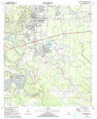
 1991 Walker1991 Print · USGSLivingston Parish in the early nineties reveals a landscape of growing rural communities and deep family roots along the Colyell Creek forks. Genealogists and local historians can trace burial sites like Walker Cem and Blount Cem or find landmarks such as Revival Temple and the Doyle Sch.
 - 1991 Map of Denham Springs
 1991 Denham Springs1991 Print · USGSLivingston Parish at the start of the 1990s shows the suburban expansion of Denham Springs and Walker alongside the vital Amite River corridor. Genealogists and local historians can trace family locations near O Neal Cem, Hebron Ch, and several historic schools.2 unique versions available
 - 1995 Map of Denham Springs, 1998 Print
 1995 Denham Springs1998 Print · USGSDenham Springs and the surrounding parishes are shown during a period of steady growth along the Amite River in the mid-nineties. Genealogists and local historians can trace legacy landmarks including the O'Neal Cem, Hebron Ch, and the State Police Camp.
 - 1998 Map of Walker, 2000 Print
 1998 Walker2000 Print · USGSLivingston Parish at the end of the century shows a landscape defined by its creek bottoms and rural crossroads. Family historians can trace the locations of the Minton Cem, Frost Sch, and the small community of Satsuma along the rail and road corridors.
 - 2012 Map of Satsuma, 2012 Print
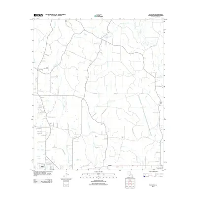 2012 Satsuma2012 Print · USGSCovers Walker, including Livingston, Satsuma, and other nearby areas
 - 2012 Map of Walker, 2012 Print
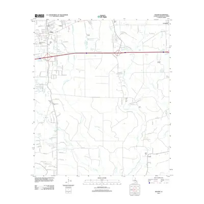 2012 Walker2012 Print · USGSCovers Walker, including Livingston, Colyell, and other nearby areas
 - 2012 Map of Denham Springs, 2012 Print
 2012 Denham Springs2012 Print · USGSCovers Walker, including Baton Rouge, St. George, and other nearby areas
Showing maps 1-25 of 37
Top cities near Walker
- Baton Rouge historical maps
- Saint George historical maps
- St. George historical maps
- Prairieville historical maps
- Central historical maps
- Denham Springs historical maps
See more
Top neighborhoods of Walker
Frequently asked questions
- What are the different types of historical maps available for Walker?
- What is the oldest map of Walker?
- Where can I purchase historical maps of Walker for my home or office?
- Where can I download high-res historical maps of Walker?
- Are there historical topographic maps available for Walker?
- Is there historical aerial imagery available for Walker?
- Where are historical maps of Walker sourced from?