1960s Maps of Orleans Parish, Louisiana
Explore 26 historic maps of Orleans Parish from the 1960s. These maps offer a rare glimpse into what life looked like during the 1960s — showing old roads, neighborhoods, homes, and landmarks that have changed or disappeared over time.
Whether you're researching your family's past, planning a metal detecting trip, or studying how Orleans Parish's landscape evolved across the 1960s, these high-resolution maps are a powerful tool for exploring the history of this region.
- Focus on a specific era: All maps on this page are from the 1960s, giving you a focused view of this time period.
- See what’s changed: Compare century-old streets, trails, and buildings to today's modern landscape using overlays and satellite layers.
- Research with precision: Use these maps for genealogy, historical research, land use analysis, or educational projects.
- View, download, or print: Maps are fully viewable online in high resolution, and can be downloaded or printed for your own records.
Start exploring Orleans Parish's history through authentic maps from the 1960s. This is your window into the past.
Orleans Parish, LA maps
(26)- 1960 Map of Mobile
 1960 Mobile1960 Print · USGSThe Gulf Coast at the dawn of the sixties shows a landscape of busy ports, military airbases, and barrier islands. Trace the rail lines of the Louisville & Nashville through BILOXI and Pascagoula or find family history in towns like Bayou La Batre and Poplarville.
 - 1961 Map of Breton Sound
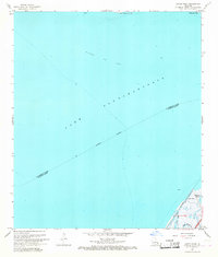
 1961 Breton Sound1961 Print · USGSThe Louisiana delta and the outer marshes of Plaquemines Parish are captured here at the start of the 1960s. Researchers can trace the river settlements from Davant to Venice, locate isolated stations like Port Eads, and find old sites such as Fort Jackson.
 - 1961 Map of Baton Rouge, 1966 Print
 1961 Baton Rouge1966 Print · USGSSoutheastern Louisiana in the early sixties remains a landscape of deep river bends and sprawling coastal lakes. Genealogists and historians can trace the rail-and-river economy through landmarks like Free-Nigger Point, Donaldsonville, and the Illinois Central Railroad.
 - 1962 Map of Baton Rouge
 1962 Baton Rouge1962 Print · USGSSouth Louisiana in the early sixties reveals a landscape of river-bend parishes and emerging interstate corridors. Genealogists and historians can trace family roots through historic river towns like Donaldsonville and Plaquemine, or follow the path of the Illinois Central Railroad through the swamp basins.
 - 1963 Map of New Orleans
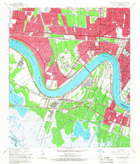
 1963 New Orleans1963 Print · USGSCoastal Louisiana in the mid-twentieth century reveals a complex world of bayou settlements, expanding oil fields, and vital rail networks. Genealogists and historians can trace family roots through river towns like Thibodaux or follow the Southern Pacific line through Franklin and Patterson.4 unique versions available
 - 1963 Map of Mobile
 1963 Mobile1963 Print · USGSThe Gulf Coast at the dawn of the sixties shows a thriving maritime and military corridor from Louisiana to Alabama. Genealogists and historians can trace rail lines like the Louisville & Nashville RR and find landmarks from Brookley AFB to Fort Morgan.
 - 1965 Map of Mobile
 1965 Mobile1965 Print · USGSThe Gulf Coast at mid-century reveals a landscape of expanding ports and vital military installations from Louisiana to Alabama. Genealogists and historians can trace the growth of Biloxi, Pascagoula, and Mobile, alongside the sprawling De Soto National Forest.
 - 1965 Map of New Orleans West, 1966 Print
 1965 New Orleans West1966 Print · USGSThe Jefferson Parish suburbs and Mississippi West Bank are shown here during a period of intense mid-century growth. Genealogists and historians can trace the development of Bonnabel Place, identify family plots in Providence Memorial Park, and locate the old Westwego Airport.5 unique versions available
 - 1965 Map of Spanish Fort, 1966 Print
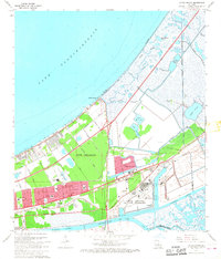
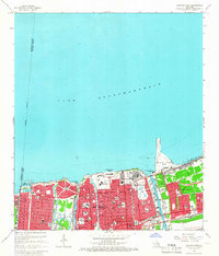 1965 Spanish Fort1966 Print · USGSNew Orleans along the southern shore of Lake Pontchartrain reached a height of mid-century development just before significant urban changes. Researchers can trace the layout of City Park, the Spanish Fort Ruins, and numerous parochial institutions like St Joseph Academy.4 unique versions available
 - 1965 Map of Spanish Fort NE, 1966 Print
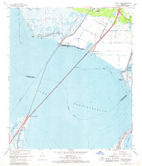
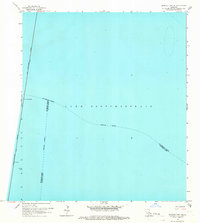 1965 Spanish Fort NE1966 Print · USGSThe open waters of the Gulf Coast are captured in the mid-1960s at the intersection of three Louisiana parishes. Researchers can trace the path of the Lake Pontchartrain Causeway (Toll) and the Indefinite Boundary between St Tammany, Jefferson, and Orleans.2 unique versions available
 - 1966 Map of New Orleans
 1966 New Orleans1966 Print · USGSCoastal Louisiana in the mid-1960s reveals a transition from traditional bayou life to an intensive offshore oil and gas economy. Researchers can trace the rail lines of the Southern Pacific RR through Morgan City or locate the Eugene Island Lighthouse among the delta's shifting marshes.
 - 1966 Map of New Orleans East, 1967 Print
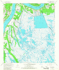
 1966 New Orleans East1967 Print · USGSNew Orleans and its riverfront parishes are captured in the mid-1960s as the city expanded across its historic levees. Researchers can trace family roots through numerous sites like Metairie Cemetery, locate old schools like Behrman High Sch, or explore the industrial waterfront at the New Orleans Army Base.5 unique versions available
 - 1966 Map of Belle Chasse, 1968 Print
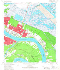
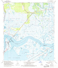
 1966 Belle Chasse1968 Print · USGSThe Mississippi River's shifting path and industrial riverfront dominate the landscape of Plaquemines Parish in the mid-sixties. Genealogists and historians can locate legacy landmarks like Bethlehem Ch, the English Turn Cem, and the Sea Train Terminal near Belle Chasse.6 unique versions available
 - 1967 Map of Chef Menteur, 1968 Print
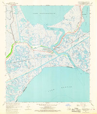 1967 Chef Menteur1968 Print · USGSThe eastern reaches of Orleans Parish come into focus during the late sixties, where the tides of the Gulf meet the city's outskirts. Genealogists and historians can trace the paths of Bayou Sauvage, locate the site of Fort Macomb, and see the early layout of Venetian Isles.4 unique versions available
 - 1967 Map of Martello Castle, 1968 Print
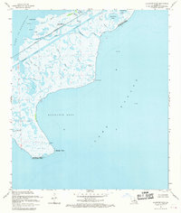
 1967 Martello Castle1968 Print · USGSSt. Bernard Parish in the late sixties reveals a coastal landscape where historic sites and modern maritime engineering meet. Genealogists and local historians can locate Shell Beach, the St Bernard High Sch, and the landmark MARTELLO CASTLE near the newly cut Gulf Outlet Canal.6 unique versions available
 - 1967 Map of Chalmette, 1968 Print
 1967 Chalmette1968 Print · USGSCoastal St. Bernard Parish and the New Orleans riverfront are captured during a period of industrial and residential expansion in the late sixties. Trace the historical footprint of Chalmette and find local landmarks like Merrit Cem and Chalmette National Historical Park.7 unique versions available
 - 1967 Map of South Point, 1968 Print
 1967 South Point1968 Print · USGSLake Pontchartrain and its coastal marshes are captured in the late sixties as industrial and transit networks expanded across the parish lines. Researchers can trace the early path of Interstate 10 near South Point and the underwater footprint of the Big Point Gas Field.3 unique versions available
 - 1967 Map of North Shore, 1968 Print
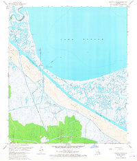
 1967 North Shore1968 Print · USGSThe northern reaches of Lake Pontchartrain appear here in the late sixties as the coastal communities near Slidell began to take shape. Genealogists and local historians can trace family sites like Fields Cem, North Shore Chapel, and the waterfront at North Shore Beach.5 unique versions available
 - 1967 Map of Little Woods, 1968 Print
 1967 Little Woods1968 Print · USGSNew Orleans and the lakefront are seen here in the late sixties as suburban expansion and industrial aerospace hubs reach into the eastern wetlands. Researchers can trace local landmarks like Little Woods, the NASA facility at Michoud, and St Maria Goretti Ch.4 unique versions available
 - 1967 Map of New Orleans, 1969 Print
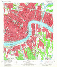
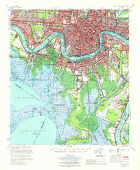 1967 New Orleans1969 Print · USGSGreater New Orleans in the mid-1960s reveals a landscape of massive engineering and urban expansion along the Mississippi River. Genealogists and local historians can trace family roots through the grids of Metairie, Gretna, and Harvey, or locate specific sites like Metairie High Sch and St Vincent de Paul Cem.
 - 1967 Map of Spanish Fort, 1969 Print
 1967 Spanish Fort1969 Print · USGSThe Jefferson and Orleans Parish lakefronts are shown here in the late sixties as suburban expansion reached the shores of Lake Pontchartrain. Trace the development of neighborhoods like Bucktown and Indian Beach alongside the New Orleans Lakefront Airport.
 - 1968 Map of Rigolets, 1969 Print
 1968 Rigolets1969 Print · USGSThe Louisiana coast at the edge of the Rigolets shows a complex world of tidal passes and marsh islands in the late sixties. Trace the historic Fort Pike State Monument, the path of the Louisville and Nashville railroad, and landmarks like White Kitchen.4 unique versions available
 - 1968 Map of Alligator Point, 1969 Print
 1968 Alligator Point1969 Print · USGSThe coastal marshes of Orleans Parish in the late sixties reveal a landscape of working waterways and remote rail lines. Researchers can trace the Louisville and Nashville tracks across the swamp or locate early energy infrastructure like Gas Wells near Truloix Point.3 unique versions available
 - 1969 Map of Rigolets, 1970 Print
 1969 Rigolets1970 Print · USGSThe Louisiana coast meets the Mississippi line in the late sixties, showing a landscape of tidal passes and railroad outposts. Researchers can trace the tracks of the Louisville and Nashville Railroad past English Lookout or locate the historic Port Pike State Monument.
 - 1969 Map of Chef Menteur, 1970 Print
 1969 Chef Menteur1970 Print · USGSEastern New Orleans and the Lake Pontchartrain shores are captured here during a decade of massive aerospace and industrial growth. Researchers can locate the sprawling Michoud Station, trace the Southern Railway through Slidell, and identify local sites like Abramson High Sch.
Showing maps 1-25 of 26
Top cities of Orleans Parish
Frequently asked questions
- What are the different types of historical maps available for Orleans Parish?
- What is the oldest map of Orleans Parish?
- Where can I purchase historical maps of Orleans Parish for my home or office?
- Where can I download high-res historical maps of Orleans Parish?
- Are there historical topographic maps available for Orleans Parish?
- Is there historical aerial imagery available for Orleans Parish?
- Where are historical maps of Orleans Parish sourced from?