Old Maps of Trace Estates, Ouachita Parish for Genealogy
Trace your family roots with 23 historic maps of Trace Estates. These high-res maps reveal old neighborhoods, homesites, landmarks, and streets — helping you uncover where your ancestors lived and how the area evolved over time.
- Explore historic neighborhoods: Identify where your relatives may have lived in the 1800s or 1900s.
- Compare maps over time: Trace the changes in streets, buildings, and landmarks for multi-generational research.
- Perfect for genealogy & ancestry research: Used by family historians and researchers to map out lineage and migration.
These maps are an incredible resource for exploring your personal connection to Trace Estates's past.
Trace Estates, Ouachita Parish maps
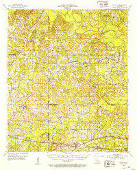
(23)- 1935 Map of Drew, 1947 Print
 1935 Drew1947 Print · USGSNorthern Louisiana's river country was defined by winding waterways and emerging energy infrastructure in the 1930s. Genealogists can trace early crossings like Whites Ferry and family-named locales such as Guthrie or the Childrens Home in Monroe.
 - 1952 Map of Calhoun, 1953 Print
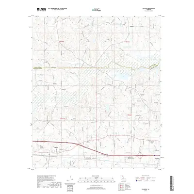
 1952 Calhoun1953 Print · USGSNorth Louisiana life in the early fifties centered on the rural crossroads and rail lines of Union and Ouachita Parishes. Genealogists can trace family footprints through numerous local landmarks like Millard Hill Cem, Auld Chapel, and the Experiment Station at Calhoun.3 unique versions available
 - 1955 Map of Shreveport
 1955 Shreveport1955 Print · USGSNorthern Louisiana in the mid-fifties is captured here as a landscape of military bases, vast oil fields, and burgeoning college towns. Genealogists and historians can trace the rail-and-river economy through the Monroe Gas Field, Grambling College, and Barksdale Air Force Base.3 unique versions available
 - 1956 Map of Shreveport
 1956 Shreveport1956 Print · USGSNorthern Louisiana during the mid-fifties presents a complex landscape of booming oil fields and strategic military installations. Genealogists and historians can trace the infrastructure of the Monroe Gas Field and family-named locales from Cotton Valley to Jonesboro.
 - 1957 Map of Monroe North, 1958 Print
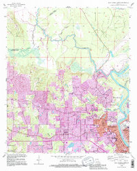
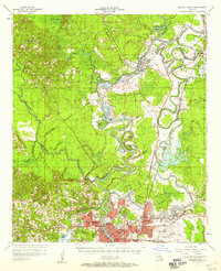 1957 Monroe North1958 Print · USGSNorth of the city center in the late fifties, the riverfront and bayous define a landscape of growing neighborhoods and industrial sites. Researchers can trace family roots through landmarks like Bean Chapel, Neville High Sch, and the grounds of Selman Airport.2 unique versions available
 - 1957 Map of West Monroe North, 1958 Print
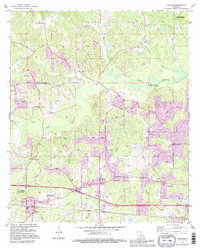
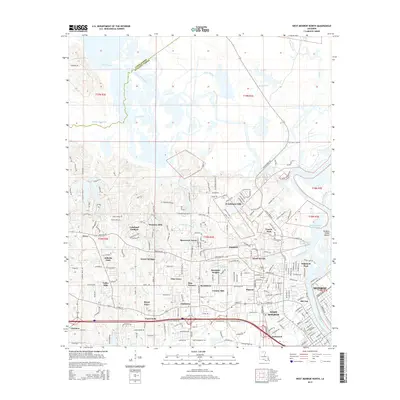
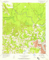 1957 West Monroe North1958 Print · USGSWest Monroe and its northern rural reaches are captured here during a period of steady mid-century development. Researchers can trace ancestral footprints at Hasley Cem, locate rural landmarks like Goodhope Ch, or follow the Illinois Central rail line through the bayou country.4 unique versions available
 - 1969 Map of Monroe North
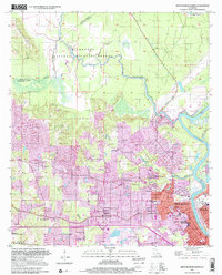
 1969 Monroe North1969 Print · USGSMonroe and West Monroe enter a period of rapid growth during the late sixties as urban development pushes into the surrounding bayous. Genealogists can trace family names and local sites from Northeast Louisiana State College to the quiet grounds of Memorial Park Cem and rural Ouachita City.
 - 1982 Map of Calhoun
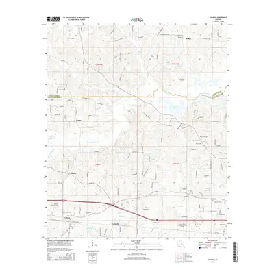
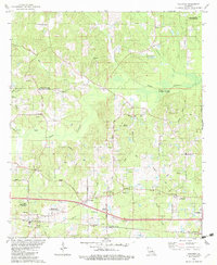 1982 Calhoun1982 Print · USGSOuachita Parish in the early eighties shows a landscape of petroleum extraction and rural communities. Genealogists can trace family landmarks like Spillers Cem and Aulds Chapel, or explore the rail corridor of the Illinois Central Gulf.
 - 1984 Map of Shreveport
 1984 Shreveport1984 Print · USGSNorthern Louisiana at the peak of the 1980s reveals a landscape of massive water management projects and Cold War military hubs. Trace the rail lines of the Kansas City Southern Ry past Barksdale Air Force Base and the high ground of Driskill Mountain.2 unique versions available
 - 1985 Map of Monroe North, 1986 Print
 1985 Monroe North1986 Print · USGSNorth-central Louisiana in the mid-eighties was a landscape defined by the growth of university towns and the expansion of the natural gas industry. Researchers can trace rural family roots through landmarks like Lisbon Cem, New Hope Ch, and the many schools in Farmerville or Bernice.2 unique versions available
 - 1994 Map of West Monroe North, 1995 Print
 1994 West Monroe North1995 Print · USGSWest Monroe and the surrounding bayous are captured here in the mid-nineties during a period of suburban expansion and industrial activity. Genealogists and local historians can locate family landmarks like Hasley Cem, Goodhope Ch, and the vanished Drive-in Theater.
 - 1994 Map of Calhoun, 1995 Print
 1994 Calhoun1995 Print · USGSLouisiana's rolling interior at the edge of the D'Arbonne basin is captured here as a landscape of timber, agriculture, and oil. Genealogists and local historians can trace rural family roots through landmarks like Mt Zion Cem, Aulds Chapel, and the North Louisiana Experimental Station.
 - 1999 Map of West Monroe North, 2001 Print
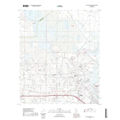
 1999 West Monroe North2001 Print · USGSNorth Ouachita Parish at the end of the twentieth century shows a landscape where the D'Arbonne National Wildlife Refuge meets the expanding urban footprint of WEST MONROE. Researchers can trace local genealogy and civic history through sites like Hasley Cem, Boley High Sch, and Mt Horeb Ch.
 - 2012 Map of Calhoun, 2012 Print
 2012 Calhoun2012 Print · USGSCovers Trace Estates, including Eureka, Wilhite, and other nearby areas
 - 2012 Map of West Monroe North, 2012 Print
 2012 West Monroe North2012 Print · USGSCovers Trace Estates, including Monroe, West Monroe, and other nearby areas
 - 2015 Map of Calhoun, 2015 Print
 2015 Calhoun2015 Print · USGSCovers Trace Estates, including Eureka, Wilhite, and other nearby areas
 - 2015 Map of West Monroe North, 2015 Print
 2015 West Monroe North2015 Print · USGSCovers Trace Estates, including Monroe, West Monroe, and other nearby areas
 - 2018 Map of West Monroe North, 2018 Print
 2018 West Monroe North2018 Print · USGSCovers Trace Estates, including Monroe, West Monroe, and other nearby areas
 - 2018 Map of Calhoun, 2018 Print
 2018 Calhoun2018 Print · USGSCovers Trace Estates, including Eureka, Wilhite, and other nearby areas
 - 2020 Map of West Monroe North, 2020 Print
 2020 West Monroe North2020 Print · USGSCovers Trace Estates, including Monroe, West Monroe, and other nearby areas
 - 2020 Map of Calhoun, 2020 Print
 2020 Calhoun2020 Print · USGSCovers Trace Estates, including Eureka, Wilhite, and other nearby areas
 - 2024 Map of West Monroe North, 2024 Print
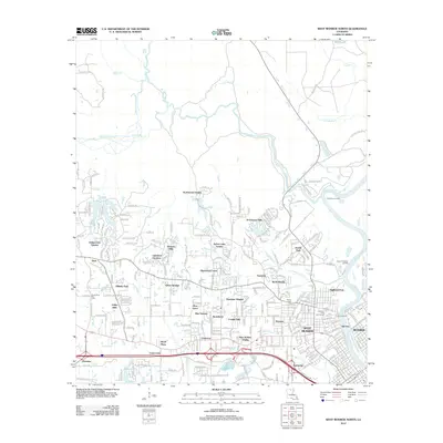
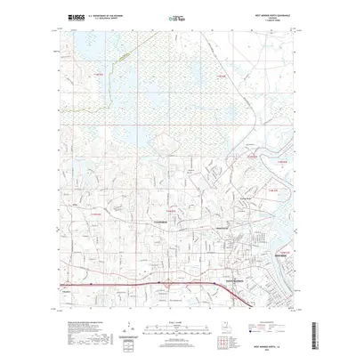
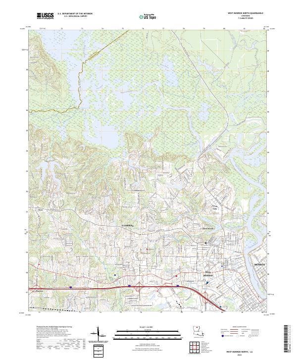 2024 West Monroe North2024 Print · USGSWest Monroe and its western suburbs are captured in high detail during a period of significant residential expansion along the Ouachita River. Genealogists and local historians can pinpoint the Hasley Cem or trace the early paths of Cheniere and Drew near the D'Arbonne National Wildlife Refuge.
 - 2024 Map of Calhoun, 2024 Print
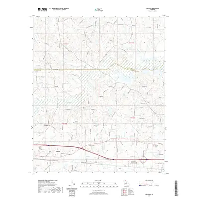
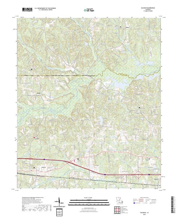 2024 Calhoun2024 Print · USGSLouisiana's rolling interior near the Union and Ouachita Parish line is documented in this contemporary survey of rural crossroads and wetlands. Researchers can locate numerous family burial grounds like Wilhite Cem and McCormick Cem or trace the winding course of Bayou Choudrant.
End of results
Showing maps 1-23 of 23
Frequently asked questions
- What are the different types of historical maps available for Trace Estates?
- What is the oldest map of Trace Estates?
- Where can I purchase historical maps of Trace Estates for my home or office?
- Where can I download high-res historical maps of Trace Estates?
- Are there historical topographic maps available for Trace Estates?
- Is there historical aerial imagery available for Trace Estates?
- Where are historical maps of Trace Estates sourced from?