Old Maps of West Monroe, Louisiana for Metal Detecting
Plan your next treasure hunt with 41 historic maps of West Monroe. Find old homesites, ghost towns, trails, and gathering spots that may be lost to time — perfect for identifying promising metal detecting locations.
- Locate forgotten sites: Uncover places like long-lost settlements, abandoned rail lines, or gathering spots.
- Plan better hunts: Use map overlays combined with LiDAR or satellite views to narrow in on historically rich areas.
- Made for detectorists: Thousands of hobbyists use these maps to discover relics, coins, and hidden history.
Use these historic maps to boost your research and find new opportunities beneath the surface of West Monroe.
West Monroe, LA maps
(41)- 1935 Map of Drew, 1947 Print
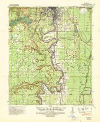
 1935 Drew1947 Print · USGSNorthern Louisiana's river country was defined by winding waterways and emerging energy infrastructure in the 1930s. Genealogists can trace early crossings like Whites Ferry and family-named locales such as Guthrie or the Childrens Home in Monroe.
 - 1940 Map of Monroe, 1942 Print
 1940 Monroe1942 Print · USGSThe Ouachita River valley at the onset of the 1940s shows a landscape defined by its waterways and burgeoning river towns. Genealogists and historians can trace family roots through numerous country landmarks like Logtown Ch, Faulks Sch, and the La Training Institute for Boys.2 unique versions available
 - 1955 Map of Shreveport
 1955 Shreveport1955 Print · USGSNorthern Louisiana in the mid-fifties is captured here as a landscape of military bases, vast oil fields, and burgeoning college towns. Genealogists and historians can trace the rail-and-river economy through the Monroe Gas Field, Grambling College, and Barksdale Air Force Base.3 unique versions available
 - 1956 Map of Shreveport
 1956 Shreveport1956 Print · USGSNorthern Louisiana during the mid-fifties presents a complex landscape of booming oil fields and strategic military installations. Genealogists and historians can trace the infrastructure of the Monroe Gas Field and family-named locales from Cotton Valley to Jonesboro.
 - 1957 Map of Monroe North, 1958 Print
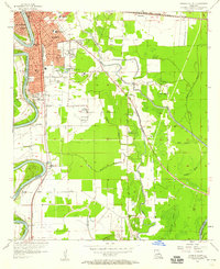
 1957 Monroe North1958 Print · USGSNorth of the city center in the late fifties, the riverfront and bayous define a landscape of growing neighborhoods and industrial sites. Researchers can trace family roots through landmarks like Bean Chapel, Neville High Sch, and the grounds of Selman Airport.2 unique versions available
 - 1957 Map of West Monroe North, 1958 Print
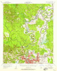
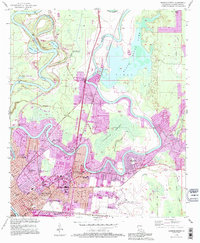
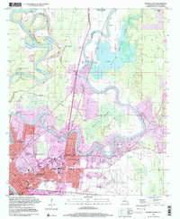
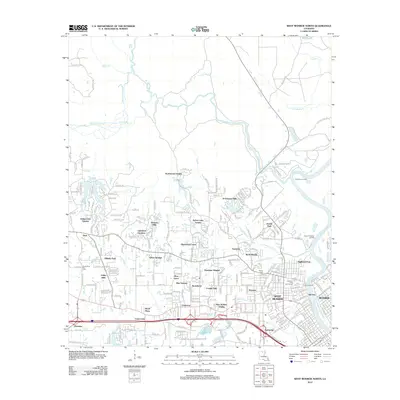
 1957 West Monroe North1958 Print · USGSWest Monroe and its northern rural reaches are captured here during a period of steady mid-century development. Researchers can trace ancestral footprints at Hasley Cem, locate rural landmarks like Goodhope Ch, or follow the Illinois Central rail line through the bayou country.4 unique versions available
 - 1957 Map of West Monroe South, 1958 Print
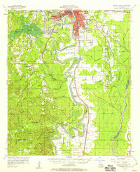
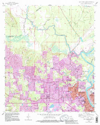
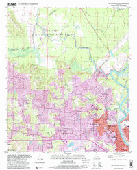
 1957 West Monroe South1958 Print · USGSOuachita Parish in the late fifties shows a landscape defined by the winding Ouachita River and the vast Cheniere Brake wetlands. Researchers can trace family sites at Old Sardis Cem or locate former landmarks like the Drive-in Theater and Woodlawn Sch.4 unique versions available
 - 1957 Map of Monroe South, 1958 Print
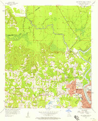
 1957 Monroe South1958 Print · USGSOuachita Parish at the peak of the 1950s reveals a bustling riverfront economy and expanding neighborhoods. Genealogists and local historians can trace the foundations of West Monroe and rural landmarks like Old St James Ch and Ballard Cem.5 unique versions available
 - 1957 Map of Monroe South, 1958 Print
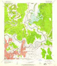
 1957 Monroe South1958 Print · USGSThe southern Ouachita Parish riverlands are captured here in the late fifties, showcasing a landscape of deep river bends and rural crossroads. Genealogists and researchers can locate ancestral sites like the Furlough Cemetery, Bawcomville, and the Union School along the Ouachita River banks.3 unique versions available
 - 1957 Map of Monroe North, 1958 Print
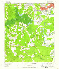
 1957 Monroe North1958 Print · USGSMonroe and the Ouachita River valley are captured in the late fifties as the city expanded northward toward the gas fields. Researchers can trace local history through NE Louisiana State College, Selman Airport, and family landmarks like Cosper Cem.4 unique versions available
 - 1969 Map of Monroe North
 1969 Monroe North1969 Print · USGSMonroe and West Monroe enter a period of rapid growth during the late sixties as urban development pushes into the surrounding bayous. Genealogists can trace family names and local sites from Northeast Louisiana State College to the quiet grounds of Memorial Park Cem and rural Ouachita City.
 - 1984 Map of Shreveport
 1984 Shreveport1984 Print · USGSNorthern Louisiana at the peak of the 1980s reveals a landscape of massive water management projects and Cold War military hubs. Trace the rail lines of the Kansas City Southern Ry past Barksdale Air Force Base and the high ground of Driskill Mountain.2 unique versions available
 - 1985 Map of Monroe South
 1985 Monroe South1985 Print · USGSNorth Central Louisiana in the mid-1980s was a hub of timber production and rail transport spanning from the Dugdemona River to the Ouachita valley. Family researchers and historians can trace the rail lines of the Midsouth Railroad through Jonesboro or find local landmarks like Mineral Springs and Punkin Center.2 unique versions available
 - 1985 Map of Monroe North, 1986 Print
 1985 Monroe North1986 Print · USGSNorth-central Louisiana in the mid-eighties was a landscape defined by the growth of university towns and the expansion of the natural gas industry. Researchers can trace rural family roots through landmarks like Lisbon Cem, New Hope Ch, and the many schools in Farmerville or Bernice.2 unique versions available
 - 1994 Map of West Monroe South, 1995 Print
 1994 West Monroe South1995 Print · USGSThe Ouachita River valley south of West Monroe comes into focus during the mid-nineties as suburban growth meets the bayou landscape. Trace family history at Old Sardis Cem, Behy Cem, and Woodlawn Sch while exploring the banks of Cheniere Brake.
 - 1994 Map of Monroe North, 1995 Print
 1994 Monroe North1995 Print · USGSMonroe and its northern bayous are captured here in the mid-1990s, showcasing a landscape of winding river loops and growing neighborhoods. Genealogists and local historians can trace landmarks like NE Louisiana State College, St Matthew Cem, and the old Selman Airport.
 - 1994 Map of West Monroe North, 1995 Print
 1994 West Monroe North1995 Print · USGSWest Monroe and the surrounding bayous are captured here in the mid-nineties during a period of suburban expansion and industrial activity. Genealogists and local historians can locate family landmarks like Hasley Cem, Goodhope Ch, and the vanished Drive-in Theater.
 - 1994 Map of Monroe South, 1995 Print
 1994 Monroe South1995 Print · USGSThe Ouachita River corridor south of Monroe shows a region of suburban growth and vast wildlife preserves in the mid-nineties. Trace local landmarks like the Louisiana Training Institute, Gibson Chapel, and Ballard Cem.
 - 1999 Map of Monroe South, 2000 Print
 1999 Monroe South2000 Print · USGSThe Ouachita River corridor at the end of the century reveals the growth of Monroe and its southern outskirts. Trace family history and land patterns through New City Cemetery, Shady Grove Sch, and the rail lines of the Illinois Central Railroad.
 - 1999 Map of Monroe North, 2001 Print
 1999 Monroe North2001 Print · USGSMonroe and its surrounding wetlands are captured here at the close of the twentieth century. Researchers can trace the development of NE Louisiana State College and locate numerous family landmarks including St Matthew Cem and the Lakeshore Sch.
 - 1999 Map of West Monroe North, 2001 Print
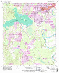
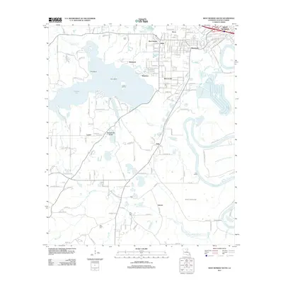
 1999 West Monroe North2001 Print · USGSNorth Ouachita Parish at the end of the twentieth century shows a landscape where the D'Arbonne National Wildlife Refuge meets the expanding urban footprint of WEST MONROE. Researchers can trace local genealogy and civic history through sites like Hasley Cem, Boley High Sch, and Mt Horeb Ch.
 - 2012 Map of Monroe North, 2012 Print
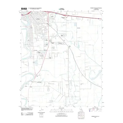
 2012 Monroe North2012 Print · USGSCovers West Monroe, including Monroe, North Monroe, and other nearby areas
 - 2012 Map of Monroe South, 2012 Print
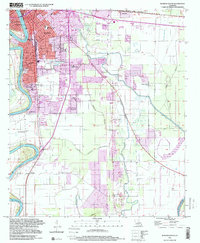
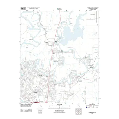
 2012 Monroe South2012 Print · USGSCovers West Monroe, including Monroe, Richwood, and other nearby areas
 - 2012 Map of West Monroe North, 2012 Print
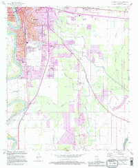
 2012 West Monroe North2012 Print · USGSCovers West Monroe, including Monroe, Claiborne, and other nearby areas
 - 2012 Map of West Monroe South, 2012 Print
 2012 West Monroe South2012 Print · USGSCovers West Monroe, including Monroe, Bawcomville, and other nearby areas
Showing maps 1-25 of 41
Top cities near West Monroe
- Monroe historical maps
- Claiborne historical maps
- Swartz historical maps
- Richwood historical maps
- Sterlington historical maps
Top neighborhoods of West Monroe
- Dopson historical maps
- Old Ten historical maps
- Tupawek historical maps
- Steven historical maps
- Parkwood historical maps
- Highland Park historical maps
See more
Frequently asked questions
- What are the different types of historical maps available for West Monroe?
- What is the oldest map of West Monroe?
- Where can I purchase historical maps of West Monroe for my home or office?
- Where can I download high-res historical maps of West Monroe?
- Are there historical topographic maps available for West Monroe?
- Is there historical aerial imagery available for West Monroe?
- Where are historical maps of West Monroe sourced from?