Old Maps of Sparks, Louisiana for Genealogy
Trace your family roots with 17 historic maps of Sparks. These high-res maps reveal old neighborhoods, homesites, landmarks, and streets — helping you uncover where your ancestors lived and how the area evolved over time.
- Explore historic neighborhoods: Identify where your relatives may have lived in the 1800s or 1900s.
- Compare maps over time: Trace the changes in streets, buildings, and landmarks for multi-generational research.
- Perfect for genealogy & ancestry research: Used by family historians and researchers to map out lineage and migration.
These maps are an incredible resource for exploring your personal connection to Sparks's past.
Sparks, LA maps
(17)- 1935 Map of Osca Bayou, 1938 Print
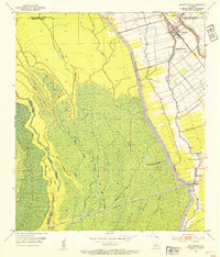
 1935 Osca Bayou1938 Print · USGSThe Atchafalaya Basin in the mid-1930s is a complex web of wetlands and early river engineering projects. Researchers can trace historic family locations and transit routes near Maringouin, Butte La Rose, and the St Joseph Ch & Cem.
 - 1953 Map of Maringouin, 1954 Print
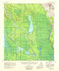
 1953 Maringouin1954 Print · USGSMaringouin and the Atchafalaya basin edge appear here in the early fifties, showing a landscape defined by the East Protection Levee. Genealogists can locate community anchors like St Peter Cem, Little Zion Ch, and the Upper Maringouin Sch.2 unique versions available
 - 1954 Map of Baton Rouge, 1974 Print
 1954 Baton Rouge1974 Print · USGSSoutheast Louisiana in the mid-fifties is captured here during a period of transition for its river and rail economies. Researchers can trace the path of the Mississippi River and find landmarks like the Bonnet Carre Spillway and Bayou Plaquemine.2 unique versions available
 - 1955 Map of Osca Bayou
 1955 Osca Bayou1955 Print · USGSThe Atchafalaya Basin in the mid-fifties is captured here as a landscape of deep bayous and growing oil production. Genealogists and historians can trace rail-side life in Maringouin or find remote river landmarks like Butte La Rose and the Happytown Oil Field.
 - 1956 Map of Baton Rouge
 1956 Baton Rouge1956 Print · USGSSouth Louisiana at the height of the mid-century oil boom shows a landscape of river oxbows and rising industry. Researchers can trace family roots through river towns like Scotlandville or locate early industrial sites and Oil wells near Lake Maurepas.
 - 1959 Map of Osca Bayou, 1960 Print
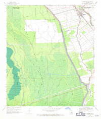
 1959 Osca Bayou1960 Print · USGSThe Atchafalaya Basin in the late fifties was a landscape of remote bayous and emerging oil fields. Genealogists can trace family names at St Peter Cem or explore the rail-linked settlements of Maringouin and Musson.4 unique versions available
 - 1961 Map of Baton Rouge, 1966 Print
 1961 Baton Rouge1966 Print · USGSSoutheastern Louisiana in the early sixties remains a landscape of deep river bends and sprawling coastal lakes. Genealogists and historians can trace the rail-and-river economy through landmarks like Free-Nigger Point, Donaldsonville, and the Illinois Central Railroad.
 - 1962 Map of Baton Rouge
 1962 Baton Rouge1962 Print · USGSSouth Louisiana in the early sixties reveals a landscape of river-bend parishes and emerging interstate corridors. Genealogists and historians can trace family roots through historic river towns like Donaldsonville and Plaquemine, or follow the path of the Illinois Central Railroad through the swamp basins.
 - 1969 Map of Maringouin, 1970 Print
 1969 Maringouin1970 Print · USGSIberville Parish life in the late sixties centers on the bayous and the massive flood control works of the Atchafalaya Basin. Researchers can trace families and land use near Maringouin through landmarks like the St Peter Cem, Little Zion Ch, and the TEXAS AND PACIFIC rail line.2 unique versions available
 - 1984 Map of Baton Rouge
 1984 Baton Rouge1984 Print · USGSBaton Rouge and the surrounding river country are captured in the mid-eighties as the industrial corridor met the deep wetlands of the basin. Researchers can trace the winding Bayou Teche, locate family roots in St Martinville, or study the massive Atchafalaya Basin Floodway.2 unique versions available
 - 1992 Map of Maringouin
 1992 Maringouin1992 Print · USGSThe Atchafalaya Basin in the early nineties reveals a landscape split between the wild Atchafalaya National Wildlife Refuge and the industrial bayou towns. Researchers can trace family roots at New Zion Ch or explore the geography of the Maringouin Oil Field and the old Union Pacific line.
 - 1999 Map of Maringouin, 2001 Print
 1999 Maringouin2001 Print · USGSIberville and Pointe Coupee parishes at the close of the century show a landscape defined by the Atchafalaya Basin Floodway and river commerce. Researchers can trace family sites at Shiloh Ch and West Oak Lane Cem or follow the UNION PACIFIC rail line through Musson.2 unique versions available
 - 2012 Map of Maringouin, 2012 Print
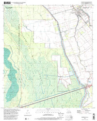
 2012 Maringouin2012 Print · USGSCovers Sparks, including Maringouin, Musson, and other nearby areas
 - 2015 Map of Maringouin, 2015 Print
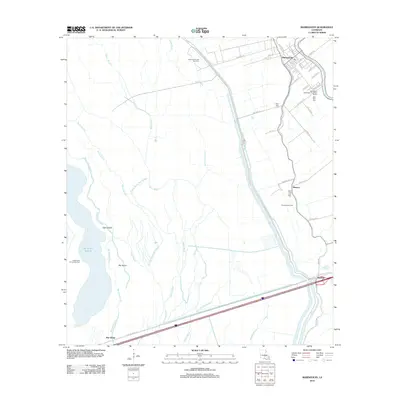
 2015 Maringouin2015 Print · USGSCovers Sparks, including Maringouin, Musson, and other nearby areas
 - 2018 Map of Maringouin, 2018 Print
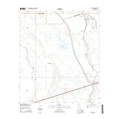
 2018 Maringouin2018 Print · USGSCovers Sparks, including Maringouin, Musson, and other nearby areas
 - 2020 Map of Maringouin, 2020 Print
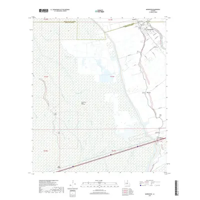
 2020 Maringouin2020 Print · USGSCovers Sparks, including Maringouin, Musson, and other nearby areas
 - 2024 Map of Maringouin, 2024 Print
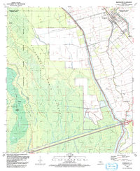
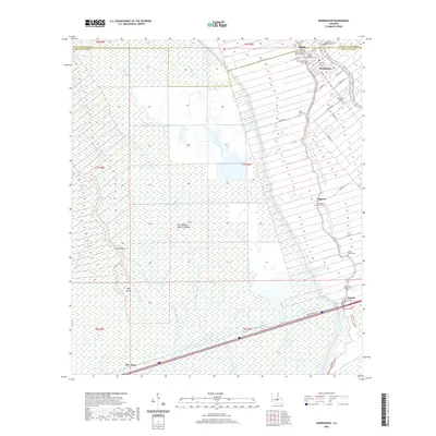
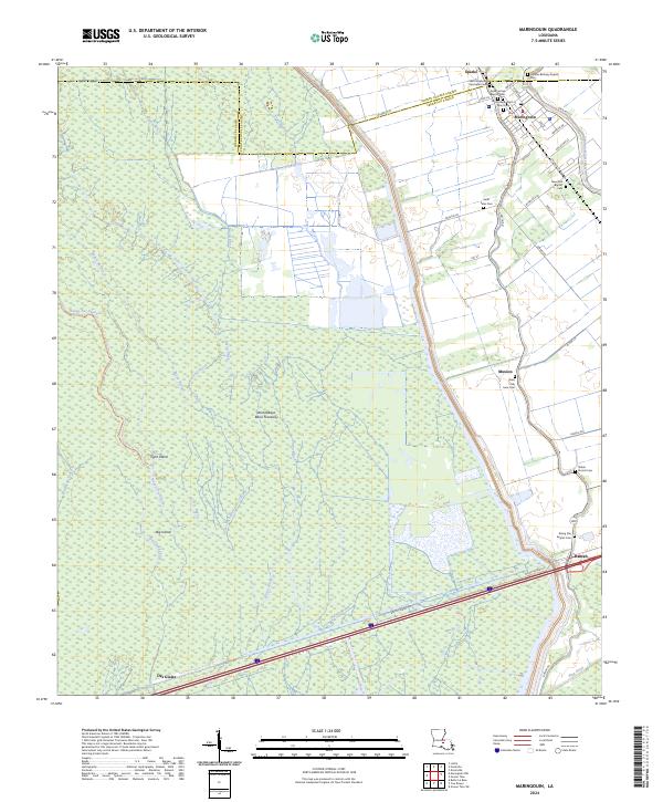 2024 Maringouin2024 Print · USGSIberville and Pointe Coupee Parishes are shown here in modern detail, where the deep swamps meet historic bayou settlements. Genealogists can locate family landmarks like Sweet Home Baptist Cem and Rising Star Baptist Cem along the banks of Bayou Grosse Tete.
End of results
Showing maps 1-17 of 17
Top cities near Sparks
- New Roads historical maps
- Melville historical maps
- Krotz Springs historical maps
- Livonia historical maps
- Fordoche historical maps
- Maringouin historical maps
See more
Frequently asked questions
- What are the different types of historical maps available for Sparks?
- What is the oldest map of Sparks?
- Where can I purchase historical maps of Sparks for my home or office?
- Where can I download high-res historical maps of Sparks?
- Are there historical topographic maps available for Sparks?
- Is there historical aerial imagery available for Sparks?
- Where are historical maps of Sparks sourced from?