Old Maps of Zimmerman, Louisiana for Genealogy
Trace your family roots with 12 historic maps of Zimmerman. These high-res maps reveal old neighborhoods, homesites, landmarks, and streets — helping you uncover where your ancestors lived and how the area evolved over time.
- Explore historic neighborhoods: Identify where your relatives may have lived in the 1800s or 1900s.
- Compare maps over time: Trace the changes in streets, buildings, and landmarks for multi-generational research.
- Perfect for genealogy & ancestry research: Used by family historians and researchers to map out lineage and migration.
These maps are an incredible resource for exploring your personal connection to Zimmerman's past.
Zimmerman, LA maps
(12)- 1941 Map of Boyce, 1945 Print
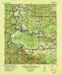 1941 Boyce1945 Print · USGSRapides Parish was a landscape of river plantations and pine forests in the early 1940s. Genealogists and historians can locate numerous rural landmarks like Hotwells, Fairmount Plantation, and the Israelite Ch Sch & Cem along the Red River.2 unique versions available
 - 1949 Map of Boyce NW
 1949 Boyce NW1949 Print · USGSThe Red River valley in the late 1940s reveals a landscape of oxbow lakes and essential rail junctions near the parish borders. Genealogists can locate family landmarks such as Zion Harp Ch, St Matthis Sch, and the small community of Zimmerman.
 - 1953 Map of Alexandria, 1963 Print
 1953 Alexandria1963 Print · USGSCentral Louisiana during the early fifties is mapped here at the intersection of the piney woods and the Red River valley. Genealogists and historians can trace the rail-and-river network connecting towns like Alexandria, Natchitoches, and the grounds of Camp Beauregard.3 unique versions available
 - 1955 Map of Alexandria
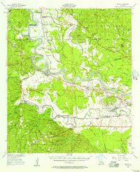
 1955 Alexandria1955 Print · USGSCentral Louisiana in the mid-fifties is a landscape of river-port cities, sprawling timberlands, and massive military reservations. Genealogists and historians can trace the rail networks of the Texas & Pacific RR and locate sites like Camp Polk Military Reservation and Natchitoches.
 - 1956 Map of Boyce, 1957 Print
 1956 Boyce1957 Print · USGSLouisiana's Red River valley in the mid-fifties reveals a landscape transitioning from traditional rail-and-river commerce to a burgeoning military presence. Trace family roots through dozens of rural sites like Hotwells, the Second Evening Star Ch, and Lacour Cem.3 unique versions available
 - 1971 Map of Boyce, 1973 Print
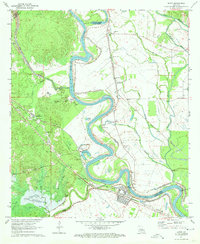 1971 Boyce1973 Print · USGSThe Red River valley in Rapides Parish comes alive in the early seventies, showing the vital rail and river networks of Boyce and Kateland. Researchers can trace family roots at Boyce Cem or St Aloysius Cem and locate rural landmarks like Magnolia Ch and Raven Camp Ch.3 unique versions available
 - 1986 Map of Alexandria
 1986 Alexandria1986 Print · USGSCentral Louisiana in the mid-eighties shows a landscape of strategic military installations and deep river-valley agriculture. Researchers can trace the footprints of England Air Force Base, Camp Beauregard, and the extensive Kisatchie National Forest.2 unique versions available
 - 2012 Map of Boyce, 2012 Print
 2012 Boyce2012 Print · USGSCovers Zimmerman, including Boyce, Rodemacher, and other nearby areas
 - 2015 Map of Boyce, 2015 Print
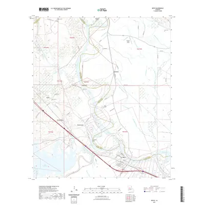
 2015 Boyce2015 Print · USGSCovers Zimmerman, including Boyce, Rodemacher, and other nearby areas
 - 2018 Map of Boyce, 2018 Print
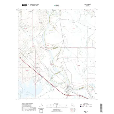 2018 Boyce2018 Print · USGSCovers Zimmerman, including Boyce, Rodemacher, and other nearby areas
 - 2021 Map of Boyce, 2021 Print
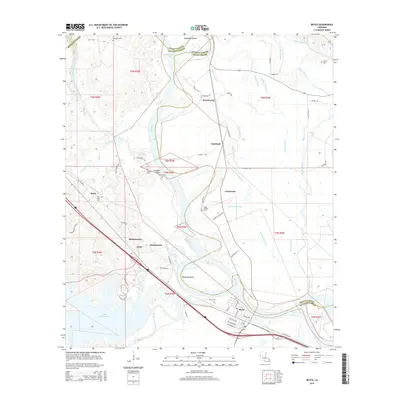
 2021 Boyce2021 Print · USGSCovers Zimmerman, including Boyce, Rodemacher, and other nearby areas
 - 2024 Map of Boyce, 2024 Print
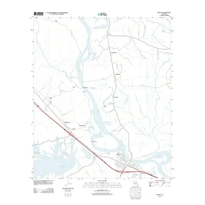
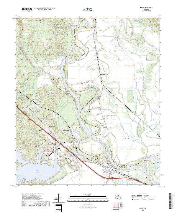 2024 Boyce2024 Print · USGSThe Red River corridor near Boyce comes alive in this survey, showcasing the complex waterworks and old parish settlements of central Louisiana. Researchers can trace family history through numerous burial grounds like Valentine Cem and Boyce Cem or locate the site of Sharp Baptist Church.
End of results
Showing maps 1-12 of 12
Top cities near Zimmerman
Frequently asked questions
- What are the different types of historical maps available for Zimmerman?
- What is the oldest map of Zimmerman?
- Where can I purchase historical maps of Zimmerman for my home or office?
- Where can I download high-res historical maps of Zimmerman?
- Are there historical topographic maps available for Zimmerman?
- Is there historical aerial imagery available for Zimmerman?
- Where are historical maps of Zimmerman sourced from?