Old Maps of Richland Parish, Louisiana for Academic Research
Study the evolution of Richland Parish with 149 high-resolution historic maps. Whether you're teaching, researching, or modeling changes in land use, these maps provide essential visual documentation of urban, environmental, and geographic change.
- Analyze long-term change: Track patterns in development, transportation, and natural features.
- Ideal for environmental or urban studies: Support academic projects with primary historical map data.
- Use in the classroom or lab: Educators and researchers rely on these maps to bring historical context to life.
These maps are a powerful tool for teaching, research, and visualizing how Richland Parish has changed over the decades.
Richland Parish, LA maps
(149)- 1935 Map of Collinston
 1935 Collinston1935 Print · USGSMorehouse and Ouachita Parishes are seen here in the mid-1930s during a period of heavy industrialization fueled by the natural gas boom. Researchers can trace the sprawling footprints of the Southern Carbon Co and find rural landmarks like Jerusalem Ch and the Indian Mounds.
 - 1935 Map of Alto, 1936 Print
 1935 Alto1936 Print · USGSRichland Parish in the mid-1930s shows a landscape of river-bottom agriculture and an early industrial energy boom. Researchers can trace the legacy of local river travel at Douciere Ferry and locate commercial sites like Rhymes Store or the Century Carbon Company.2 unique versions available
 - 1935 Map of Baskinton, 1936 Print
 1935 Baskinton1936 Print · USGSNortheast Louisiana in the mid-1930s is defined by its drainage basins and river landings between the rail towns of Rayville and Delhi. Genealogists can locate rural landmarks such as Hill Ridge Ch & Sch, Baskinton, and landings like Sunrise Ldg.
 - 1935 Map of Hurricane, 1936 Print
 1935 Hurricane1936 Print · USGSRichland and Morehouse Parishes are depicted in the mid-1930s as a complex network of bayous and river islands. Genealogists can trace rural life through landmarks like Point Jefferson, Antioch Ch, and several local schools including Prospect Sch.
 - 1935 Map of Waverly, 1938 Print
 1935 Waverly1938 Print · USGSThe Louisiana delta in the mid-1930s shows a landscape defined by the winding Tensas River and early industrial expansion. Trace the remnants of a Logging Railroad Abandoned and the growth of trackside settlements like Delhi and Quebec.2 unique versions available
 - 1939 Map of Fort Necessity, 1941 Print
 1939 Fort Necessity1941 Print · USGSThe Louisiana backcountry near the junction of Richland, Caldwell, and Franklin Parishes comes alive in the years leading up to the war. Researchers can trace rural lineages through local landmarks like Rosenwald Sch, the community at Fort Necessity, and active river crossings like Duchene Ferry.
 - 1940 Map of Monroe, 1942 Print
 1940 Monroe1942 Print · USGSThe Ouachita River valley at the onset of the 1940s shows a landscape defined by its waterways and burgeoning river towns. Genealogists and historians can trace family roots through numerous country landmarks like Logtown Ch, Faulks Sch, and the La Training Institute for Boys.2 unique versions available
 - 1940 Map of Columbia, 1945 Print
 1940 Columbia1945 Print · USGSCaldwell Parish at the start of the 1940s shows a landscape defined by the winding Ouachita River and the regional lumber industry. Genealogists and historians can trace families near Old Mt Pleasant, locate Oak Grove Sch, and follow the old Louisiana Central Lumber Company rail lines.
 - 1955 Map of Jackson
 1955 Jackson1955 Print · USGSThe Lower Mississippi Valley at the middle of the century reveals a landscape of deep river meanders and growing rail hubs. Genealogists and historians can trace the mid-century footprints of Vicksburg National Military Park, old river landings at Port Gibson, and the rail corridors of the Illinois Central Railroad.3 unique versions available
 - 1955 Map of Shreveport
 1955 Shreveport1955 Print · USGSNorthern Louisiana in the mid-fifties is captured here as a landscape of military bases, vast oil fields, and burgeoning college towns. Genealogists and historians can trace the rail-and-river economy through the Monroe Gas Field, Grambling College, and Barksdale Air Force Base.3 unique versions available
 - 1956 Map of Shreveport
 1956 Shreveport1956 Print · USGSNorthern Louisiana during the mid-fifties presents a complex landscape of booming oil fields and strategic military installations. Genealogists and historians can trace the infrastructure of the Monroe Gas Field and family-named locales from Cotton Valley to Jonesboro.
 - 1957 Map of Columbia, 1958 Print
 1957 Columbia1958 Print · USGSCaldwell Parish in the late fifties is defined by the winding Ouachita River and the bustling corridor of the Missouri Pacific railroad. Genealogists and local historians can trace legacy sites like Union Central High Sch, Banks Springs, and Welcome Home Cem.3 unique versions available
 - 1957 Map of Mangham, 1958 Print
 1957 Mangham1958 Print · USGSRichland and Franklin Parishes in the late fifties reveal a landscape of river-bottom agriculture and small rail towns. Genealogists can trace family roots through numerous local landmarks like Rhymes High Sch, St Luke Cem, and Mt Zion Ch.3 unique versions available
 - 1957 Map of Monroe South, 1958 Print
 1957 Monroe South1958 Print · USGSOuachita Parish at the peak of the 1950s reveals a bustling riverfront economy and expanding neighborhoods. Genealogists and local historians can trace the foundations of West Monroe and rural landmarks like Old St James Ch and Ballard Cem.5 unique versions available
 - 1957 Map of Monroe South, 1958 Print
 1957 Monroe South1958 Print · USGSThe southern Ouachita Parish riverlands are captured here in the late fifties, showcasing a landscape of deep river bends and rural crossroads. Genealogists and researchers can locate ancestral sites like the Furlough Cemetery, Bawcomville, and the Union School along the Ouachita River banks.3 unique versions available
 - 1957 Map of Collinston, 1958 Print
 1957 Collinston1958 Print · USGSMorehouse and Richland Parishes are shown in the late fifties, featuring the transition from agricultural bayous to active gas fields. Genealogists can locate family landmarks like Cedar Grove Sch, William Chapel, and the ancient Indian Mounds near Oak Ridge.3 unique versions available
 - 1958 Map of Baskinton
 1958 Baskinton1958 Print · USGSRichland and Franklin Parishes in the late fifties show a landscape transitioning between traditional bayou life and the post-war energy boom. Researchers can locate vanished rural landmarks like Hunters Chapel, the Delhi Refining Co, and old river stops like Indian Ldg.2 unique versions available
 - 1958 Map of Hurricane
 1958 Hurricane1958 Print · USGSNortheast Louisiana parishes are shown here in the late fifties, where the river and rail lines dictated the pace of rural life. Researchers can trace family roots through numerous country sites like Wimberley Cem, Trails End Ch, and MOUND LDG.
 - 1958 Map of Fort Necessity, 1959 Print
 1958 Fort Necessity1959 Print · USGSThe Louisiana bottomlands of Franklin Parish are captured here in the late fifties, defined by the winding Boeuf River and dense bayou networks. Researchers can locate vanished landmarks and family cemeteries like Long Lake Cem, the Ft Necessity Sch, and Liddieville.3 unique versions available
 - 1959 Map of Mitchiner, 1962 Print
 1959 Mitchiner1962 Print · USGSNortheastern Louisiana at the end of the fifties reveals a landscape of ancient earthworks and rising energy production. Genealogists can trace family roots through Bethany Cem & Ch, Adams Sch, and the historical significance of Poverty Pt.2 unique versions available
 - 1961 Map of Jackson
 1961 Jackson1961 Print · USGSThe Lower Mississippi Delta and the state capital area are captured here during the post-war era of infrastructure expansion. Researchers can trace the complex river oxbows and rail lines connecting Vicksburg, Yazoo City, and the Illinois Central Railroad network.
 - 1961 Map of Waverly, 1963 Print
 1961 Waverly1963 Print · USGSIn the early 1960s, these Northeast Louisiana parishes were defined by their winding bayous and the reach of the timber industry. Genealogists can trace family roots through several rural churches like Midway Church or Zion Pilgrim No 2 Church and the centrally located Waverly Cem.2 unique versions available
 - 1962 Map of Jackson
 1962 Jackson1962 Print · USGSThe Mississippi Delta and the state capital region are mapped here in the early sixties, showing a landscape defined by the great river and the growing city of JACKSON. Genealogists can trace family roots through numerous landmarks like Cedar Hill Cem, rural stops on the Illinois Central RR, and historic sites like Champion Hill.2 unique versions available
 - 1982 Map of Rayville, 1983 Print
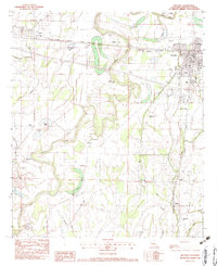 1982 Rayville1983 Print · USGSRichland Parish in the early eighties centers on the rail junction at Rayville, where the Illinois Central Gulf meets the Bayou Boeuf bottomlands. Genealogists and historians can trace numerous rural landmarks like St Paul Ch, Masonic Cem, and the old settlement at Girard.
 - 1982 Map of Gilleyville, 1983 Print
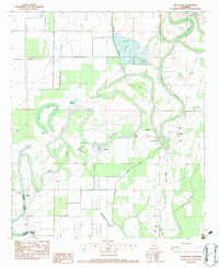 1982 Gilleyville1983 Print · USGSRichland and Caldwell Parishes in the early 1980s are defined by the winding Boeuf River and its rural bayou communities. Genealogists and local historians can locate several family cemeteries and churches, such as Adile Cem, Thomason Cem, and Victory Ch.
Showing maps 1-25 of 149
Top cities of Richland Parish
Frequently asked questions
- What are the different types of historical maps available for Richland Parish?
- What is the oldest map of Richland Parish?
- Where can I purchase historical maps of Richland Parish for my home or office?
- Where can I download high-res historical maps of Richland Parish?
- Are there historical topographic maps available for Richland Parish?
- Is there historical aerial imagery available for Richland Parish?
- Where are historical maps of Richland Parish sourced from?