1970s Maps of Saint Martin Parish, Louisiana
Explore 12 historic maps of Saint Martin Parish from the 1970s. These maps offer a rare glimpse into what life looked like during the 1970s — showing old roads, neighborhoods, homes, and landmarks that have changed or disappeared over time.
Whether you're researching your family's past, planning a metal detecting trip, or studying how Saint Martin Parish's landscape evolved across the 1970s, these high-resolution maps are a powerful tool for exploring the history of this region.
- Focus on a specific era: All maps on this page are from the 1970s, giving you a focused view of this time period.
- See what’s changed: Compare century-old streets, trails, and buildings to today's modern landscape using overlays and satellite layers.
- Research with precision: Use these maps for genealogy, historical research, land use analysis, or educational projects.
- View, download, or print: Maps are fully viewable online in high resolution, and can be downloaded or printed for your own records.
Start exploring Saint Martin Parish's history through authentic maps from the 1970s. This is your window into the past.
Saint Martin Parish, LA maps
(12)- 1970 Map of Centerville NW, 1971 Print
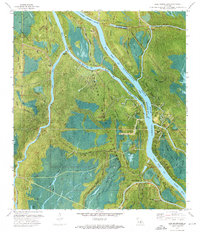
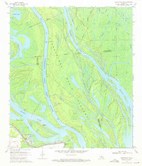 1970 Centerville NW1971 Print · USGSThe Atchafalaya swamplands and the community of Charenton are shown here in the early 1970s as the basin's floodway system was actively managed. Researchers can locate the Myette Point Ch, trace the massive LEVEE system, and find specific Drill Holes scattered near Grand Lake.3 unique versions available
 - 1970 Map of Cecilia, 1972 Print
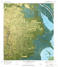
 1970 Cecilia1972 Print · USGSSt. Martin Parish in the early seventies shows a landscape where the Atchafalaya swamplands meet the historic Bayou Teche settlements. Genealogists and historians can locate family landmarks like Our Lady of Mercy Cem or trace the early days of Crawfish Farms and Bordelon Airpark.
 - 1970 Map of St. Martinville, 1972 Print
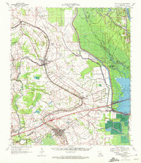
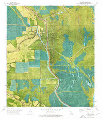
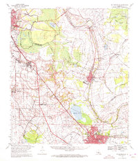 1970 St. Martinville1972 Print · USGSThe heart of Acadiana comes to life in the early 1970s as industrial growth meets the historic Bayou Teche. Genealogists and local historians can trace family-named sites and landmarks like Holy Name Institute, the Keystone Lock and Dam, and the old community at Duchamp.2 unique versions available
 - 1970 Map of Portage, 1972 Print
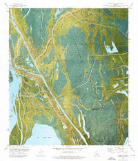
 1970 Portage1972 Print · USGSThe Atchafalaya bottomlands near the St. Landry and St. Martin parish line are captured here in the early 1970s. Researchers can trace the hydraulic engineering of the era through the Levee system, the Krotz Springs Oil and Gas Field, and the settlement at Portage.2 unique versions available
 - 1970 Map of Arnaudville, 1972 Print
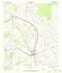
 1970 Arnaudville1972 Print · USGSThe heart of Acadiana is captured here in the early seventies as Cajun communities grew along the winding Bayou Teche. Genealogists and historians can trace family roots through sites like Ridge Zion Cem, Leonville Sch, and the Missouri Pacific Railroad corridor.2 unique versions available
 - 1970 Map of Arnaudville, 1972 Print
 1970 Arnaudville1972 Print · USGSThe Acadiana bayou country comes alive in the early seventies, centered on the junction of the Bayou Teche and Bayou Fusilier. Researchers can trace old family land patterns near Arnaudville and locate rural landmarks like Ring Zion Cemetery and Sacred Heart Chapel.2 unique versions available
 - 1970 Map of Lake Chicot, 1972 Print
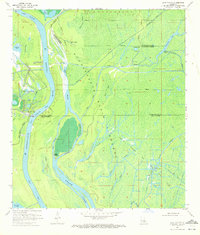 1970 Lake Chicot1972 Print · USGSThe Atchafalaya swamp in the early seventies shows a landscape defined by its shifting waterways and the mid-century energy boom. Trace the intricate network of Keelboat Pass, Deadman Bayou, and the Oil and Gas Field to understand the local economy and geography.2 unique versions available
 - 1970 Map of Breaux Bridge, 1972 Print
 1970 Breaux Bridge1972 Print · USGSBreaux Bridge and the surrounding Cajun heartland are shown here in the early seventies, where water and industry shape the landscape. Genealogists and historians can trace family sites from Anse La Butte to Bushville or locate Strauss Cem and the Anse La Butte Oil and Gas Field.3 unique versions available
 - 1973 Map of Lake Mongoulois, 1976 Print
 1973 Lake Mongoulois1976 Print · USGSThe Atchafalaya swamp in the early seventies reveals a landscape defined by water management and resource extraction. Genealogists and historians can trace the small settlement of Doris and an old Cem amidst a network of oil wells and the waters of Lake Mongoulois.
 - 1973 Map of Loreauville, 1976 Print
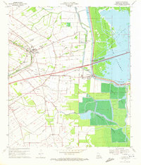
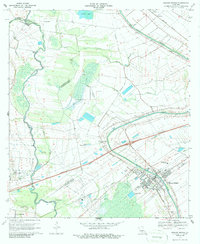
 1973 Loreauville1976 Print · USGSIberia Parish at the start of the 1970s shows a landscape of sugar cane and rice fields bordering the deep basin. Genealogists can locate family landmarks like Belle Place or Mt Zion Ch and trace the old Missouri Pacific rail corridor.
 - 1973 Map of Catahoula, 1976 Print
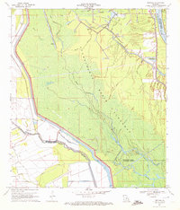
 1973 Catahoula1976 Print · USGSSt. Martin Parish in the early 1970s reveals a landscape defined by the Atchafalaya Basin Floodway and its protective levees. Genealogists and historians can trace old settlements like Catahoula and Coteau Holmes or locate the Our Lady of the Lake Cem.2 unique versions available
 - 1973 Map of Jackass Bay, 1976 Print
 1973 Jackass Bay1976 Print · USGSThe Atchafalaya Basin in the early 1970s reveals a sprawling labyrinth of waterways and industrial activity at the St. Martin and Iberia Parish line. Genealogists and historians can trace the remote Grand Bayou Mission and the early infrastructure of the Lake Chicot Oil and Gas Field.3 unique versions available
End of results
Showing maps 1-12 of 12
Top cities of Saint Martin Parish
Frequently asked questions
- What are the different types of historical maps available for Saint Martin Parish?
- What is the oldest map of Saint Martin Parish?
- Where can I purchase historical maps of Saint Martin Parish for my home or office?
- Where can I download high-res historical maps of Saint Martin Parish?
- Are there historical topographic maps available for Saint Martin Parish?
- Is there historical aerial imagery available for Saint Martin Parish?
- Where are historical maps of Saint Martin Parish sourced from?