1980s Maps of Kaplan, Louisiana
Explore 3 historic maps of Kaplan from the 1980s. These maps offer a rare glimpse into what life looked like during the 1980s — showing old roads, neighborhoods, homes, and landmarks that have changed or disappeared over time.
Whether you're researching your family's past, planning a metal detecting trip, or studying how Kaplan's landscape evolved across the 1980s, these high-resolution maps are a powerful tool for exploring the history of this region.
- Focus on a specific era: All maps on this page are from the 1980s, giving you a focused view of this time period.
- See what’s changed: Compare century-old streets, trails, and buildings to today's modern landscape using overlays and satellite layers.
- Research with precision: Use these maps for genealogy, historical research, land use analysis, or educational projects.
- View, download, or print: Maps are fully viewable online in high resolution, and can be downloaded or printed for your own records.
Start exploring Kaplan's history through authentic maps from the 1980s. This is your window into the past.
Kaplan, LA maps
(3)- 1983 Map of White Lake
 1983 White Lake1983 Print · USGSCoastal Louisiana at the start of the 1980s reveals a world of remote chenier settlements and vast marshlands. Genealogists and historians can trace family locations along Grand Chenier Ridge or explore the hubs of Abbeville and Intracoastal City.2 unique versions available
 - 1983 Map of Kaplan North
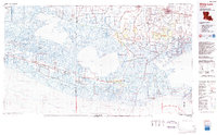
 1983 Kaplan North1983 Print · USGSVermilion Parish in the early eighties shows a landscape of prairie agriculture and water management north of the town center. Genealogists and local historians can locate family landmarks like Abshire Cem, the Meaux Landing Strip, and the winding Bayou Queue De Tortue.
 - 1985 Map of Crowley, 1986 Print
 1985 Crowley1986 Print · USGSCoastal prairie and bayou country are captured in the mid-eighties as the rice-and-rail economy defined South Louisiana life. Genealogists and researchers can trace family lands and rural hubs from Crowley to Jennings, following the paths of the Southern Pacific Railroad and the winding Mermentau River.2 unique versions available
End of results
Showing maps 1-3 of 3
Top cities near Kaplan
- Lafayette historical maps
- Crowley historical maps
- Abbeville historical maps
- Rayne historical maps
- Scott historical maps
- Duson historical maps
See more
Frequently asked questions
- What are the different types of historical maps available for Kaplan?
- What is the oldest map of Kaplan?
- Where can I purchase historical maps of Kaplan for my home or office?
- Where can I download high-res historical maps of Kaplan?
- Are there historical topographic maps available for Kaplan?
- Is there historical aerial imagery available for Kaplan?
- Where are historical maps of Kaplan sourced from?