1950s Maps of Simpson, Louisiana
Explore 10 historic maps of Simpson from the 1950s. These maps offer a rare glimpse into what life looked like during the 1950s — showing old roads, neighborhoods, homes, and landmarks that have changed or disappeared over time.
Whether you're researching your family's past, planning a metal detecting trip, or studying how Simpson's landscape evolved across the 1950s, these high-resolution maps are a powerful tool for exploring the history of this region.
- Focus on a specific era: All maps on this page are from the 1950s, giving you a focused view of this time period.
- See what’s changed: Compare century-old streets, trails, and buildings to today's modern landscape using overlays and satellite layers.
- Research with precision: Use these maps for genealogy, historical research, land use analysis, or educational projects.
- View, download, or print: Maps are fully viewable online in high resolution, and can be downloaded or printed for your own records.
Start exploring Simpson's history through authentic maps from the 1950s. This is your window into the past.
Simpson, LA maps
(10)- 1953 Map of Alexandria, 1963 Print
 1953 Alexandria1963 Print · USGSCentral Louisiana during the early fifties is mapped here at the intersection of the piney woods and the Red River valley. Genealogists and historians can trace the rail-and-river network connecting towns like Alexandria, Natchitoches, and the grounds of Camp Beauregard.3 unique versions available
 - 1954 Map of Slagle, 1958 Print
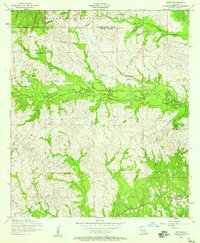
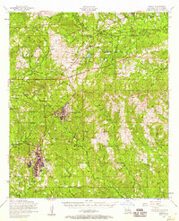 1954 Slagle1958 Print · USGSVernon Parish at the height of the mid-century military era shows the expansive development of North Fort Polk alongside deep-rooted rural communities. Genealogists and local historians can trace family locations through numerous sites like Smart Chapel Cem, Self Cem, and Mt Bethel Church.2 unique versions available
 - 1954 Map of Leander, 1958 Print
 1954 Leander1958 Print · USGSIn the mid-1950s, this portion of Louisiana shows the evolving landscape of Fort Polk and the timber-rich Kisatchie National Forest. Researchers can trace old logging routes like the dismantled railroad and locate sites like the Floctaw School and Hicks Crossing.2 unique versions available
 - 1954 Map of Kisatchie, 1958 Print
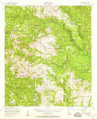
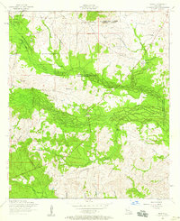
 1954 Kisatchie1958 Print · USGSNatchitoches and Vernon Parishes come alive in this mid-century survey of timberlands and military training grounds. Genealogists can trace family names at the Billy Dowden Cem and West Cem, or locate lost homes near Kurthwood and the dismantled railroad.3 unique versions available
 - 1954 Map of Burton Creek, 1958 Print
 1954 Burton Creek1958 Print · USGSVernon Parish in the mid-fifties shows a landscape transitioning between rural life and military expansion. Genealogists and local historians can trace family ties at Mt Pleasant Cemetery or Glass Window Cemetery, while locating the dismantled railroad and the community at Hicks.
 - 1954 Map of Hutton, 1958 Print
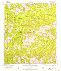
 1954 Hutton1958 Print · USGSLouisiana's central piney woods come into focus during the mid-fifties, showing the rural communities of Natchitoches and Vernon parishes. You can trace the path of a dismantled railroad and locate family sites like Robinson Cemetery or Ballview Cemetery.3 unique versions available
 - 1954 Map of Temple, 1959 Print
 1954 Temple1959 Print · USGSCentral Louisiana parish borders meet in the mid-1950s within the wooded reaches of the Kisatchie National Forest. Genealogists can locate family landmarks like Comrade Cemetery, Burnstown, and the winding path of a dismantled railroad.2 unique versions available
 - 1954 Map of Lacamp, 1959 Print
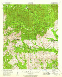
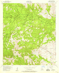 1954 Lacamp1959 Print · USGSThe timber lands and military grounds of Vernon Parish are captured here in the mid-1950s during a period of transition. Genealogists and historians can trace former rail lines and remote communities at Hicks, Pine Island Cemetery, and the Fort Polk Military Reservation.
 - 1954 Map of Chopin, 1959 Print
 1954 Chopin1959 Print · USGSCentral Louisiana in the mid-fifties shows a landscape defined by timber and the Cane River valley. Genealogists and historians can trace numerous remote cemeteries and churches, such as Gorum Cem, Holy Family Church, and the logging community at Zimmerman Camp.2 unique versions available
 - 1955 Map of Alexandria
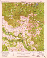
 1955 Alexandria1955 Print · USGSCentral Louisiana in the mid-fifties is a landscape of river-port cities, sprawling timberlands, and massive military reservations. Genealogists and historians can trace the rail networks of the Texas & Pacific RR and locate sites like Camp Polk Military Reservation and Natchitoches.
End of results
Showing maps 1-10 of 10
Frequently asked questions
- What are the different types of historical maps available for Simpson?
- What is the oldest map of Simpson?
- Where can I purchase historical maps of Simpson for my home or office?
- Where can I download high-res historical maps of Simpson?
- Are there historical topographic maps available for Simpson?
- Is there historical aerial imagery available for Simpson?
- Where are historical maps of Simpson sourced from?