Old Maps of Springhill, Louisiana for Academic Research
Study the evolution of Springhill with 25 high-resolution historic maps. Whether you're teaching, researching, or modeling changes in land use, these maps provide essential visual documentation of urban, environmental, and geographic change.
- Analyze long-term change: Track patterns in development, transportation, and natural features.
- Ideal for environmental or urban studies: Support academic projects with primary historical map data.
- Use in the classroom or lab: Educators and researchers rely on these maps to bring historical context to life.
These maps are a powerful tool for teaching, research, and visualizing how Springhill has changed over the decades.
Springhill, LA maps
(25)- 1922 Map of Sarepta, 1954 Print
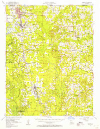
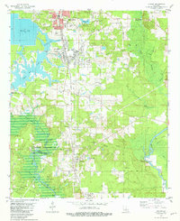
 1922 Sarepta1954 Print · USGSUpper Webster Parish in the early 1920s is a landscape of creek-bottom communities and timber-belt settlements. Genealogists can trace family footprints across dozens of rural landmarks, from the Manuel Garcia Grant to Sykes Ferry and Old Shongaloo Church.
 - 1924 Map of Sarepta
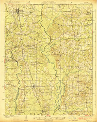 1924 Sarepta1924 Print · USGSNorthern Louisiana during the early twenties is a landscape of rail-linked towns and bayou crossings. Genealogists and local historians can trace family roots through numerous rural landmarks like Beulahs Mt Church, Wise Store, and Old Shongaloo School.
 - 1953 Map of El Dorado, 1967 Print
 1953 El Dorado1967 Print · USGSSouth Arkansas in the mid-1960s was a landscape of industrial growth and river-fed commerce. Researchers can trace the extensive Oil and Gas Fields around Magnolia, the expansive U S Naval Ammunition Depot, and the busy rail lines of the Missouri Pacific.3 unique versions available
 - 1955 Map of Shreveport
 1955 Shreveport1955 Print · USGSNorthern Louisiana in the mid-fifties is captured here as a landscape of military bases, vast oil fields, and burgeoning college towns. Genealogists and historians can trace the rail-and-river economy through the Monroe Gas Field, Grambling College, and Barksdale Air Force Base.3 unique versions available
 - 1956 Map of Shreveport
 1956 Shreveport1956 Print · USGSNorthern Louisiana during the mid-fifties presents a complex landscape of booming oil fields and strategic military installations. Genealogists and historians can trace the infrastructure of the Monroe Gas Field and family-named locales from Cotton Valley to Jonesboro.
 - 1956 Map of Sarepta, 1957 Print
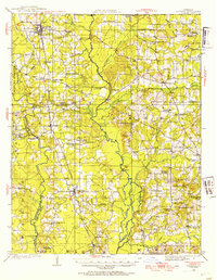
 1956 Sarepta1957 Print · USGSWebster Parish and the Arkansas borderlands during the 1950s oil boom show a landscape defined by derricks and bayous. Genealogists can trace family names at St Peter Cem, find the Rosenwald Sch, or locate rural crossroads like Old Shongaloo.2 unique versions available
 - 1957 Map of El Dorado
 1957 El Dorado1957 Print · USGSSouth Arkansas in the mid-1950s was a critical hub of military logistics and rail-river commerce. Genealogists and historians can trace family land across the Arkansas Louisiana border and locate sites like the U.S. Naval Ammunition Depot or the rail junctions at Magnolia and Camden.
 - 1958 Map of El Dorado
 1958 El Dorado1958 Print · USGSSouthern Arkansas and the Louisiana borderlands are shown during a period of heavy rail traffic and defense industry activity. Researchers can trace the legacy of the U. S. Naval Ammunition Depot or locate family roots in Smackover, Huttig, and Nashville.3 unique versions available
 - 1960 Map of El Dorado
 1960 El Dorado1960 Print · USGSSouth Central Arkansas in the late fifties was a hub of energy production and defense industry. Researchers can trace the extensive Oil and Gas Fields around El Dorado or locate family landmarks like Old Park Cem and New Hope Church.
 - 1960 Map of Taylor, 1961 Print
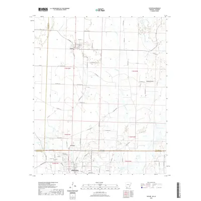
 1960 Taylor1961 Print · USGSThe Arkansas-Louisiana state line comes alive in the early sixties, showing the industrial heart of the Springhill Oil Field and Taylor. Trace the family-named landmarks of the day, from the Kansas City Southern rail line to Salem Grace Ch and Browning Sch.2 unique versions available
 - 1981 Map of Cullen
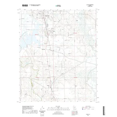
 1981 Cullen1981 Print · USGSNorthwestern Louisiana in the early eighties shows a landscape of industrial development and managed wetlands. Genealogists and historians can trace family sites at Slack Memorial Cem or Taylor Cem, alongside the operations of the South Sarepta Oil and Gas Field.2 unique versions available
 - 1984 Map of Shreveport
 1984 Shreveport1984 Print · USGSNorthern Louisiana at the peak of the 1980s reveals a landscape of massive water management projects and Cold War military hubs. Trace the rail lines of the Kansas City Southern Ry past Barksdale Air Force Base and the high ground of Driskill Mountain.2 unique versions available
 - 1986 Map of Magnolia
 1986 Magnolia1986 Print · USGSThe Arkansas-Louisiana borderlands in the mid-1980s are defined by the river systems and the reach of the petroleum industry. Genealogists and historians can trace the St Louis Southwestern Railroad through Stamps or locate rural sites like Cleveland Cem and Brightstar.2 unique versions available
 - 1986 Map of Shreveport North
 1986 Shreveport North1986 Print · USGSNorthern Louisiana in the mid-eighties shows a landscape of expansive river bottoms and growing suburban centers. Genealogists and historians can trace the development of Shreveport, the infrastructure of Barksdale Air Force Base, and rural life in Rocky Mount.2 unique versions available
 - 1989 Map of El Dorado, 1990 Print
 1989 El Dorado1990 Print · USGSThe Arkansas-Louisiana borderlands in the late eighties show a landscape of heavy industry and wildlife conservation centered on the Ouachita River. Researchers can trace the legacy of timber and transport via the Missouri Pacific RR, Poison Springs State Forest, and the vast Felsenthal Pool.
 - 2011 Map of Taylor, 2011 Print
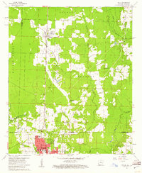
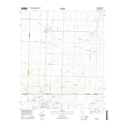
 2011 Taylor2011 Print · USGSCovers Springhill, including Taylor, Walnut Grove, and other nearby areas
 - 2012 Map of Cullen, 2012 Print
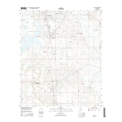
 2012 Cullen2012 Print · USGSCovers Springhill, including Cullen, Sarepta, and other nearby areas
 - 2014 Map of Taylor, 2014 Print
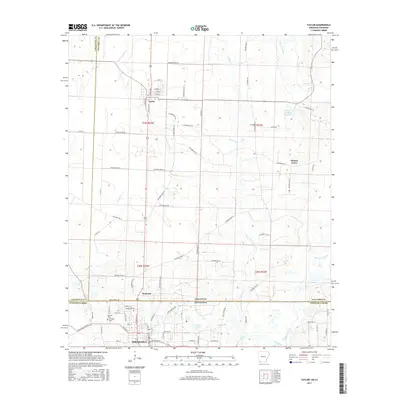
 2014 Taylor2014 Print · USGSCovers Springhill, including Taylor, Walnut Grove, and other nearby areas
 - 2015 Map of Cullen, 2015 Print
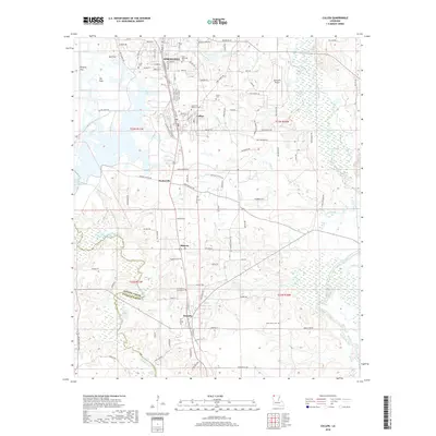
 2015 Cullen2015 Print · USGSCovers Springhill, including Cullen, Sarepta, and other nearby areas
 - 2017 Map of Taylor, 2017 Print
 2017 Taylor2017 Print · USGSCovers Springhill, including Taylor, Walnut Grove, and other nearby areas
 - 2018 Map of Cullen, 2018 Print
 2018 Cullen2018 Print · USGSCovers Springhill, including Cullen, Sarepta, and other nearby areas
 - 2020 Map of Taylor, 2020 Print
 2020 Taylor2020 Print · USGSCovers Springhill, including Taylor, Walnut Grove, and other nearby areas
 - 2020 Map of Cullen, 2020 Print
 2020 Cullen2020 Print · USGSCovers Springhill, including Cullen, Sarepta, and other nearby areas
 - 2024 Map of Taylor, 2024 Print
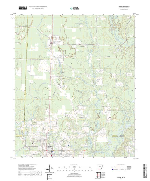 2024 Taylor2024 Print · USGSThe Arkansas-Louisiana borderlands come into focus in this contemporary survey of the corridor between Taylor and Springhill. Researchers can trace family sites at Taylor Memorial Cem and Saint Paul Cem, or follow the Kansas City Southern rail line.
 - 2024 Map of Cullen, 2024 Print
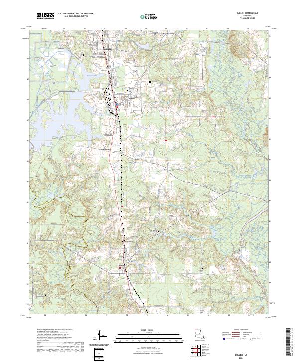 2024 Cullen2024 Print · USGSNorth Louisiana's timberlands and small-town centers are captured here in the contemporary era, spanning the border of Webster and Bossier Parishes. Genealogists can trace family heritage through numerous burial sites like Old Sarepta Church Cem, Hopewell Hendricks Cem, and Slack Memorial Cem.
End of results
Showing maps 1-25 of 25
Top cities near Springhill
- Cullen historical maps
- Cotton Valley historical maps
- Sarepta historical maps
- Taylor historical maps
- Bradley historical maps
- Shongaloo historical maps
Top neighborhoods of Springhill
- Pine Hill Subdivision historical maps
- Robin Hood Subdivision historical maps
- White Way Subdivision historical maps
- Lakewood Estates historical maps
- East Side Subdivision historical maps
- Woodlawn historical maps
See more
Frequently asked questions
- What are the different types of historical maps available for Springhill?
- What is the oldest map of Springhill?
- Where can I purchase historical maps of Springhill for my home or office?
- Where can I download high-res historical maps of Springhill?
- Are there historical topographic maps available for Springhill?
- Is there historical aerial imagery available for Springhill?
- Where are historical maps of Springhill sourced from?