Old Maps of West Baton Rouge Parish, Louisiana for Hiking & Exploration
Hike through history with 86 historic maps of West Baton Rouge Parish. Explore old trails, ghost towns, and forgotten backroads — perfect for outdoor adventurers and local explorers.
- Rediscover forgotten places: Map out old mining camps, roads, and footpaths that no longer exist on modern maps.
- Layer with modern tools: Combine with LiDAR or satellite views to plan hikes through historical terrain.
- Made for exploration: Popular among hikers, overlanders, and local history lovers.
Use these maps to find adventure and explore the hidden past of West Baton Rouge Parish.
West Baton Rouge Parish, LA maps
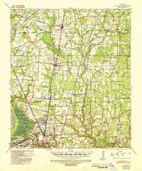
(86)- 1906 Map of Bayou Sara
 1906 Bayou Sara1906 Print · USGSThe Feliciana parishes and the Mississippi River bottomlands come to life in this early twentieth-century survey. Genealogists can trace family footprints through river-town settlements like St Francisville or find early rail stops such as Gayden Sta (Gurley P.O.) and Slaughter.3 unique versions available
 - 1908 Map of Baton Rouge, 1921 Print
 1908 Baton Rouge1921 Print · USGSBaton Rouge and the surrounding river parishes are captured here at the dawn of the twentieth century, as the railroad network began to rival the river. Genealogists can locate family landmarks like Harelsons Store, Morning Star Church, and the community of Benton's.2 unique versions available
 - 1939 Map of Zachary, 1941 Print
 1939 Zachary1941 Print · USGSEast Baton Rouge and East Feliciana parishes are documented here in the late 1930s, showing the vital rail-and-river economy before modern suburbanization. Genealogists can trace early landmarks like Leland College, Goodhope Ch, and the many cemeteries along White Bayou.2 unique versions available
 - 1939 Map of Baton Rouge, 1947 Print
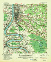 1939 Baton Rouge1947 Print · USGSBaton Rouge and the Mississippi River transition from a plantation-based economy to a burgeoning rail hub just before World War II. Genealogists and historians can trace the foundations of local communities through landmarks like Poplar Grove Plantation, Rose Hill Ch Sch & Cem, and the riverfront at Port Allen.4 unique versions available
 - 1940 Map of Grosse Tete, 1950 Print
 1940 Grosse Tete1950 Print · USGSThe Louisiana river parishes are shown just before the mid-century, defined by a complex network of bayous and sprawling plantation estates. Genealogists and historians can trace family-named sites like Shady Grove Plantation, United Reformers Ch & Sch, and the Texas and Pacific RR corridor.
 - 1953 Map of Baton Rouge West, 1954 Print
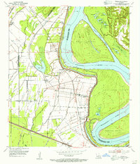
 1953 Baton Rouge West1954 Print · USGSBaton Rouge and its riverfront were entering a period of significant post-war expansion in the early fifties. Genealogists can trace family roots through numerous parish landmarks like Poplar Grove Plantation, Cinclare, and the St John Cem.
 - 1953 Map of Plaquemine, 1954 Print
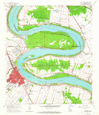
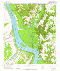
 1953 Plaquemine1954 Print · USGSThe river bends and plantation lands of Iberville Parish are shown here in the mid-1950s, highlighting the transition between water and rail transport. Researchers can trace historic family lands like St Louis Plantation or locate the Plaquemine Lock and Conrad Cem.
 - 1953 Map of Lobdell, 1954 Print
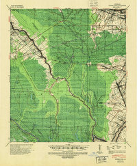
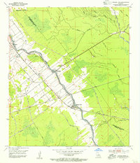
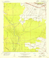 1953 Lobdell1954 Print · USGSWest Baton Rouge Parish comes to life in the early fifties, showing a landscape defined by sugar rail corridors and bayou drainage. Researchers can trace family history at Christ Ch Cem or locate the old settlements of Lobdell and Allendale.5 unique versions available
 - 1953 Map of Addis, 1954 Print
 1953 Addis1954 Print · USGSLouisiana's sugar and oil country comes to life in this mid-century survey of the West Baton Rouge and Iberville parish line. Researchers can trace the heritage of local estates like Star Plantation or locate the Little Zion Ch and the historic river landing at Indian Village.5 unique versions available
 - 1954 Map of Port Hudson, 1955 Print
 1954 Port Hudson1955 Print · USGSMid-century life along the Mississippi is captured here at the intersection of five Louisiana parishes. Genealogists and local researchers can trace family landmarks like Hermitage P.O., Beech Grove Ch No 2 Cem, and the historic Port Hudson riverfront.
 - 1954 Map of Walls, 1955 Print
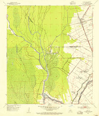
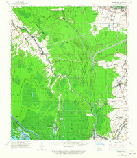
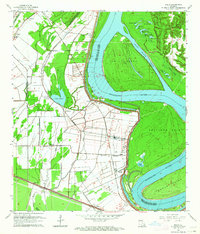
 1954 Walls1955 Print · USGSThe Mississippi River's shifting course in the mid-1950s defines this West Baton Rouge landscape of landings and plantations. Researchers can locate family roots at Walls, trace the Texas and Pacific rail line, or find the Indian Mounds near Bueche.
 - 1954 Map of Scotlandville, 1955 Print
 1954 Scotlandville1955 Print · USGSNorth of Baton Rouge in the mid-fifties, the Mississippi River bluffs supported a mix of academic institutions and river-dependent industry. Genealogists and historians can trace the campuses of Southern University and Leland College, as well as Free Negro Point and Nickwack Cem.
 - 1954 Map of Erwinville, 1955 Print
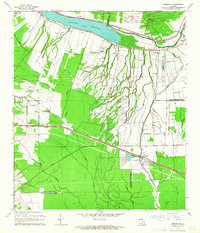
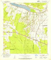 1954 Erwinville1955 Print · USGSLouisiana bayou country in the mid-1950s is mapped here in detail along the False River oxbow and the parish boundary. Genealogists and historians can trace local landmarks like St Peters Church Cemetery, Torbert Post Office, and the Missouri Pacific rail line.
 - 1954 Map of Grosse Tete, 1955 Print
 1954 Grosse Tete1955 Print · USGSThe Bayou Grosse Tete corridor in the 1950s shows a landscape of narrow levee settlements and active rail transport. Genealogists and historians can trace family locations near Rosedale, Slacks, and Grosse Tete, or locate landmarks like St Joseph Cem and Rose Hill Ch.4 unique versions available
 - 1954 Map of Baton Rouge, 1974 Print
 1954 Baton Rouge1974 Print · USGSSoutheast Louisiana in the mid-fifties is captured here during a period of transition for its river and rail economies. Researchers can trace the path of the Mississippi River and find landmarks like the Bonnet Carre Spillway and Bayou Plaquemine.2 unique versions available
 - 1956 Map of Baton Rouge
 1956 Baton Rouge1956 Print · USGSSouth Louisiana at the height of the mid-century oil boom shows a landscape of river oxbows and rising industry. Researchers can trace family roots through river towns like Scotlandville or locate early industrial sites and Oil wells near Lake Maurepas.
 - 1961 Map of Baton Rouge, 1966 Print
 1961 Baton Rouge1966 Print · USGSSoutheastern Louisiana in the early sixties remains a landscape of deep river bends and sprawling coastal lakes. Genealogists and historians can trace the rail-and-river economy through landmarks like Free-Nigger Point, Donaldsonville, and the Illinois Central Railroad.
 - 1962 Map of Baton Rouge
 1962 Baton Rouge1962 Print · USGSSouth Louisiana in the early sixties reveals a landscape of river-bend parishes and emerging interstate corridors. Genealogists and historians can trace family roots through historic river towns like Donaldsonville and Plaquemine, or follow the path of the Illinois Central Railroad through the swamp basins.
 - 1962 Map of Erwinville, 1964 Print
 1962 Erwinville1964 Print · USGSThe West Baton Rouge and Pointe Coupee parish line comes alive in the early 1960s, showing a landscape defined by the False River and railroad-driven commerce. Genealogists can trace family footprints through sites like St Peters Ch, St Ambrose Cem, and the old post office at Erwinville P O.2 unique versions available
 - 1962 Map of Grosse Tete, 1965 Print
 1962 Grosse Tete1965 Print · USGSThe river parishes of Louisiana come into focus during the early sixties, showing a landscape defined by industrial oil fields and historic riverfront estates. Genealogists can trace family footprints through sites like Indian Village, Levy Sch, and Grace Memorial Park Cem.2 unique versions available
 - 1963 Map of Plaquemine, 1964 Print
 1963 Plaquemine1964 Print · USGSIberville Parish and the Mississippi River loops are captured here in the early sixties as the sugar and rail economies remained central to the landscape. Genealogists can trace family roots through named estates like St Louis Plantation and settlements such as Morrisonville and Seymourville.5 unique versions available
 - 1963 Map of Walls, 1964 Print
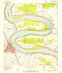
 1963 Walls1964 Print · USGSWest Baton Rouge Parish in the early 1960s shows a landscape defined by the Mississippi River and its massive levee. Genealogists and local historians can trace family roots through settlements like Smithfield, Chamberlin, and Bueche, as well as numerous rural churches including Zion Traveler Ch.5 unique versions available
 - 1963 Map of Scotlandville, 1964 Print
 1963 Scotlandville1964 Print · USGSThe northern reaches of Baton Rouge during the early sixties show a landscape balancing institutional growth with the industrial riverfront. Researchers can trace the footprints of Southern University, Leland College, and local landmarks like Free Negro Point.5 unique versions available
 - 1963 Map of Baton Rouge West, 1964 Print
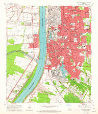 1963 Baton Rouge West1964 Print · USGSBaton Rouge and the river parishes are captured in the early sixties as industrial expansion meets established plantation history. Trace the development of LSU, the busy Port Allen waterfront, and historic sites like Poplar Grove Plantation.5 unique versions available
 - 1963 Map of Port Hudson, 1964 Print
 1963 Port Hudson1964 Print · USGSThe Mississippi River bends through the Louisiana parishes during the early sixties, revealing a landscape of historic river crossings and rail lines. Genealogists can locate family landmarks like Port Hudson National Cemetery, Hermitage, and Mt Pilgrim Ch Cem.5 unique versions available
Showing maps 1-25 of 86
Top cities of West Baton Rouge Parish
Frequently asked questions
- What are the different types of historical maps available for West Baton Rouge Parish?
- What is the oldest map of West Baton Rouge Parish?
- Where can I purchase historical maps of West Baton Rouge Parish for my home or office?
- Where can I download high-res historical maps of West Baton Rouge Parish?
- Are there historical topographic maps available for West Baton Rouge Parish?
- Is there historical aerial imagery available for West Baton Rouge Parish?
- Where are historical maps of West Baton Rouge Parish sourced from?