Old Maps of Kilbourne, Louisiana for Genealogy
Trace your family roots with 25 historic maps of Kilbourne. These high-res maps reveal old neighborhoods, homesites, landmarks, and streets — helping you uncover where your ancestors lived and how the area evolved over time.
- Explore historic neighborhoods: Identify where your relatives may have lived in the 1800s or 1900s.
- Compare maps over time: Trace the changes in streets, buildings, and landmarks for multi-generational research.
- Perfect for genealogy & ancestry research: Used by family historians and researchers to map out lineage and migration.
These maps are an incredible resource for exploring your personal connection to Kilbourne's past.
Kilbourne, LA maps
(25)- 1909 Map of Ashton Bridge, 1961 Print
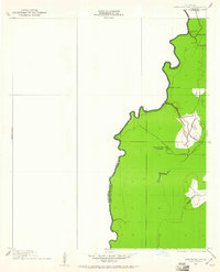 1909 Ashton Bridge1961 Print · USGSThe Louisiana delta country at the turn of the century is documented here along the winding Bayou Macon. Researchers can trace early industry and transport through Cook and McLean's Sawmill, a Tram Road, and the original Ashton Bridge.
 - 1912 Map of Ashton Bridge
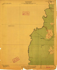 1912 Ashton Bridge1912 Print · USGSNortheast Louisiana timber and transit are captured here in the years before the Great War. Researchers can trace the industrial footprint of Cook and McLean's Sawmill and the early Tram Road crossing Bayou Macon.3 unique versions available
 - 1935 Map of Oak Grove, 1938 Print
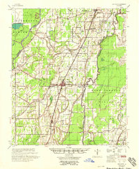
 1935 Oak Grove1938 Print · USGSNortheastern Louisiana in the mid-1930s is mapped here at the height of its rail and timber era. Researchers can trace the El Bruce Co Logging Tramway, find the Hill Sch, and locate family sites near Oak Grove and Forest.
 - 1936 Map of Eudora, 1943 Print
 1936 Eudora1943 Print · USGSSoutheast Arkansas and northeast Louisiana are captured here in the mid-1930s, showing a landscape shaped by water management and rail transport. Researchers can trace the early energy infrastructure of the Standard Oil Pipe Line or locate rural landmarks like Holly Ridge Ch and Empire.
 - 1953 Map of Greenwood, 1966 Print
 1953 Greenwood1966 Print · USGSThe Mississippi Delta in the mid-fifties is captured here as a thriving network of river towns, railroads, and oxbow lakes. Researchers can trace the legacy of the Illinois Central Railroad and locate landmarks like the State Penal Farm and Greenville Air Force Base.5 unique versions available
 - 1955 Map of Jackson
 1955 Jackson1955 Print · USGSThe Lower Mississippi Valley at the middle of the century reveals a landscape of deep river meanders and growing rail hubs. Genealogists and historians can trace the mid-century footprints of Vicksburg National Military Park, old river landings at Port Gibson, and the rail corridors of the Illinois Central Railroad.3 unique versions available
 - 1956 Map of Greenwood
 1956 Greenwood1956 Print · USGSThe Mississippi Delta in the mid-fifties is captured here during a period of significant military and agricultural activity. Researchers can trace the rail lines of the Illinois Central RR, find the Greenville Air Force Base, or locate the State Penal Farm.
 - 1957 Map of Eudora
 1957 Eudora1957 Print · USGSSoutheast Arkansas and Northeast Louisiana are captured here in the late 1950s, showing a delta landscape defined by winding bayous and rural community life. Researchers can trace family roots through numerous local landmarks like Masons Cem, Ross Van Ness Sch, and Holly Sch.2 unique versions available
 - 1958 Map of Oak Grove
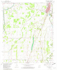
 1958 Oak Grove1958 Print · USGSNortheast Louisiana in the late fifties is captured here as a landscape of bayous and railroad towns. Researchers can trace family history through numerous rural churches like Sardis Ch and Locust Grove Ch, or locate the historic Lanes Ferry crossing.
 - 1961 Map of Jackson
 1961 Jackson1961 Print · USGSThe Lower Mississippi Delta and the state capital area are captured here during the post-war era of infrastructure expansion. Researchers can trace the complex river oxbows and rail lines connecting Vicksburg, Yazoo City, and the Illinois Central Railroad network.
 - 1962 Map of Jackson
 1962 Jackson1962 Print · USGSThe Mississippi Delta and the state capital region are mapped here in the early sixties, showing a landscape defined by the great river and the growing city of JACKSON. Genealogists can trace family roots through numerous landmarks like Cedar Hill Cem, rural stops on the Illinois Central RR, and historic sites like Champion Hill.2 unique versions available
 - 1981 Map of Eudora South, 1982 Print
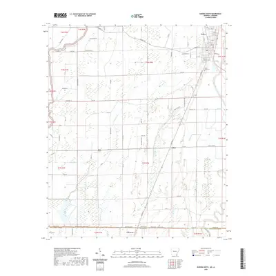
 1981 Eudora South1982 Print · USGSThe Arkansas-Louisiana state line is captured here in the early eighties, showcasing a landscape of Delta farming and small-town life. Researchers can locate numerous country churches and cemeteries like Mt Carmel Cem & Ch, Omega Ch, and Masons Cem.
 - 1982 Map of Bastrop, 1983 Print
 1982 Bastrop1983 Print · USGSNortheastern Louisiana and the Mississippi River Delta are captured here in the early eighties as a landscape of bayous and river towns. Genealogists and historians can trace small communities like Mer Rouge and Oak Grove or the ancient terrain of Poverty Point State Park.
 - 1986 Map of Crossett
 1986 Crossett1986 Print · USGSSoutheast Arkansas and the Mississippi Delta meet in the mid-1980s, revealing a landscape of rail-linked towns and river bottomlands. Researchers can trace the Missouri Pacific line through Hamburg and Parkdale or locate Millers Chapel and Winterville Mounds State Park.2 unique versions available
 - 1988 Map of Kilbourne
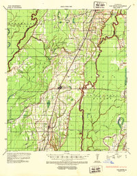
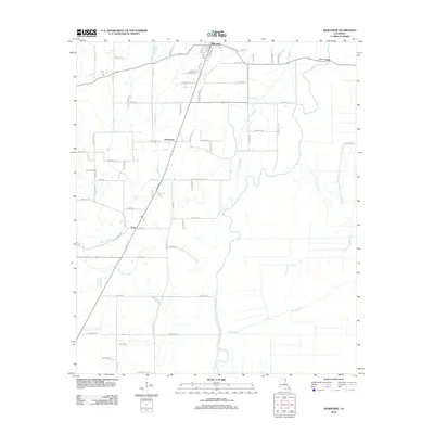
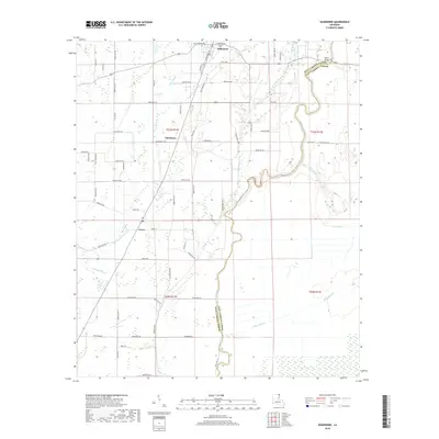
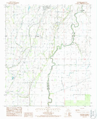 1988 Kilbourne1988 Print · USGSWest Carroll Parish in the late twentieth century is shown here as a landscape of bayous and agricultural development. Genealogists and historians can trace the Old Railroad Grade through Chickasaw and find landmarks like Ashton Bridge and the Kilbourne post office.
 - 2011 Map of Eudora South, 2011 Print
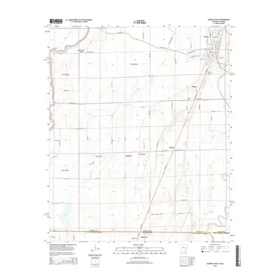
 2011 Eudora South2011 Print · USGSCovers Kilbourne, including Eudora, Ross Van Ness, and other nearby areas
 - 2012 Map of Kilbourne, 2012 Print
 2012 Kilbourne2012 Print · USGSCovers Kilbourne, including Terry, Chickasaw, and other nearby areas
 - 2014 Map of Eudora South, 2014 Print
 2014 Eudora South2014 Print · USGSCovers Kilbourne, including Eudora, Ross Van Ness, and other nearby areas
 - 2015 Map of Kilbourne, 2015 Print
 2015 Kilbourne2015 Print · USGSCovers Kilbourne, including Terry, Chickasaw, and other nearby areas
 - 2017 Map of Eudora South, 2017 Print
 2017 Eudora South2017 Print · USGSCovers Kilbourne, including Eudora, Ross Van Ness, and other nearby areas
 - 2018 Map of Kilbourne, 2018 Print
 2018 Kilbourne2018 Print · USGSCovers Kilbourne, including Terry, Chickasaw, and other nearby areas
 - 2020 Map of Eudora South, 2020 Print
 2020 Eudora South2020 Print · USGSCovers Kilbourne, including Eudora, Ross Van Ness, and other nearby areas
 - 2020 Map of Kilbourne, 2020 Print
 2020 Kilbourne2020 Print · USGSCovers Kilbourne, including Terry, Chickasaw, and other nearby areas
 - 2024 Map of Eudora South, 2024 Print
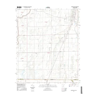
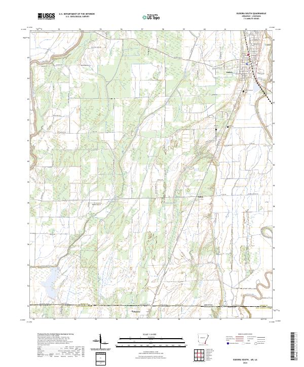 2024 Eudora South2024 Print · USGSThe Arkansas-Louisiana borderlands come into focus in this recent survey of the Chicot County region. Researchers can trace local lineage at Mount Carmel Cem or follow the winding courses of Bayou Macon and Boeuf River through the Delta landscape.
 - 2024 Map of Kilbourne, 2024 Print
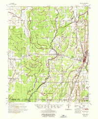
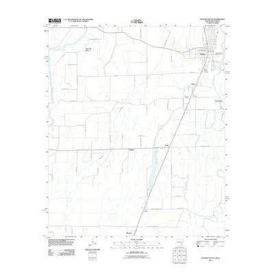
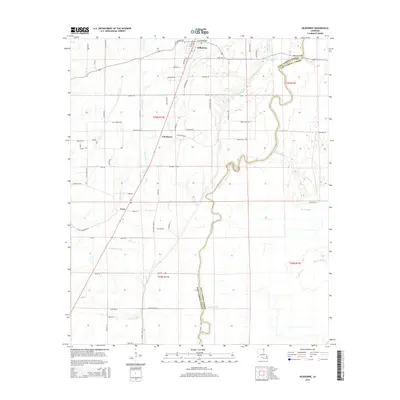
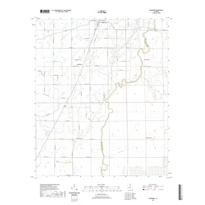
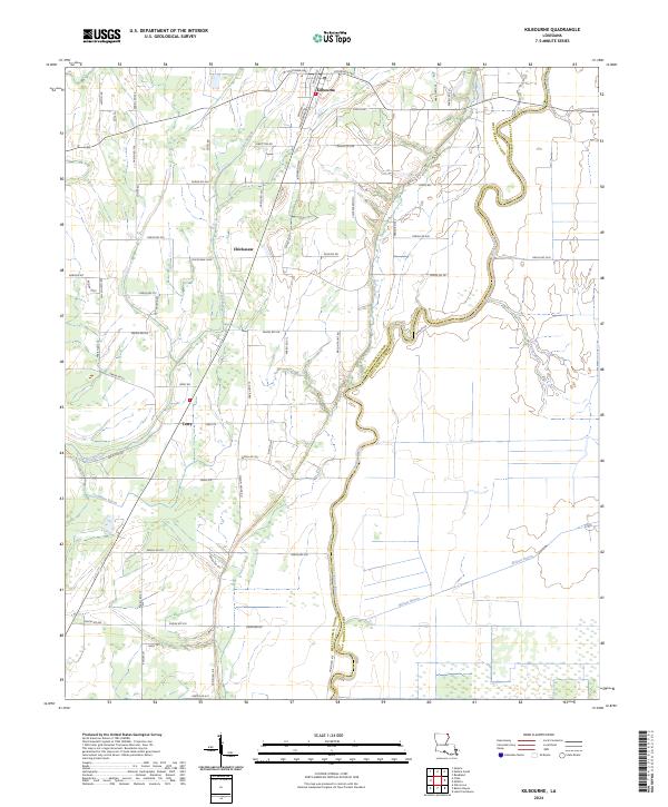 2024 Kilbourne2024 Print · USGSThis Louisiana Delta landscape in the mid-2020s shows the enduring rural character of West Carroll Parish. Genealogists and local historians can trace family locations along Bayou Macon and near the settlements of Kilbourne, Chickasaw, and Terry.
End of results
Showing maps 1-25 of 25
Top cities near Kilbourne
- Lake Providence historical maps
- Eudora historical maps
- Oak Grove historical maps
- Parkdale historical maps
- Forest historical maps
Frequently asked questions
- What are the different types of historical maps available for Kilbourne?
- What is the oldest map of Kilbourne?
- Where can I purchase historical maps of Kilbourne for my home or office?
- Where can I download high-res historical maps of Kilbourne?
- Are there historical topographic maps available for Kilbourne?
- Is there historical aerial imagery available for Kilbourne?
- Where are historical maps of Kilbourne sourced from?