
1912 Map of Ashton Bridge
USGS Topo · Published 1912About this map
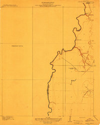
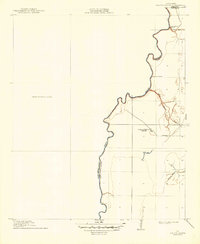
Bayou Macon winds through the alluvial landscape of the Mississippi Delta region, serving as the definitive border between West Carroll Parish and East Carroll Parish. This 1909 survey, published as a preliminary edition, documents a specific industrial moment when timber extraction drove the local economy. A dedicated Tram Road extends through the bottomlands to Cook and McLean's Sawmill, illustrating the ephemeral infrastructure required to move lumber before permanent roads were established. The presence of the namesake Ashton Bridge at the northern boundary and an Abandoned Bridge further south reflects the evolving crossing points over the bayou. Braided waterways like Three Bayou and Wilson Bayou intersect the eastern flats, providing a clear record of the drainage patterns and land divisions in this corner of Northeast Louisiana shortly after the turn of the century.
Find a feature on this map
12 named features on this map. Tap any name to fly to it.
Don’t see what you’re looking for? This feature index may not catch every label — zoom into the map to look around manually.
Map Details
Editions of this 1912 Ashton Bridge Map
3 editions found
Other maps of this area

1909 · Baxter Bayou
USGS Topo · 1:24,000

1909 · Lake Providence
USGS Topo · 1:24,000

1909 · Millikin
USGS Topo · 1:24,000

1909 · Ashton Bridge
USGS Topo · 1:24,000

1911 · Lake Providence
USGS Topo · 1:31,680

1911 · Baxter Bayou
USGS Topo · 1:24,000

1914 · Baxter Bayou
USGS Topo · 1:31,680

1935 · Oak Grove
USGS Topo · 1:62,500

1936 · Eudora
USGS Topo · 1:62,500

1939 · Readland
USGS Topo · 1:62,500