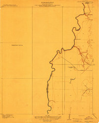
1912 Map of Ashton Bridge
USGS Topo · Published 1912About this map
Bayou Macon defines the border between West Carroll and East Carroll parishes in this 1909 survey, snaking through a landscape shaped by the early timber industry. The river's winding path is the central focus, punctuated by Ashton Bridge and a notable Abandoned Bridge further downstream. The local economy is anchored by Cook and McLean's Sawmill, which is connected to a network of drainage and transport routes including a Tram Road. The map provides specific detail on the drainage patterns of the bottomland, capturing the courses of Three Bayou and Wilson Bayou. This preliminary edition, published by the Fifth Louisiana Levee District and the U.S. Geological Survey, reflects the transition of the Louisiana-Arkansas borderlands into an industrial timber and agricultural region prior to significant modern levee developments.
Find a feature on this map
10 named features on this map. Tap any name to fly to it.
Don’t see what you’re looking for? This feature index may not catch every label — zoom into the map to look around manually.
Map Details
Editions of this 1912 Ashton Bridge Map
3 editions found
Other maps of this area

1909 · Baxter Bayou
USGS Topo · 1:24,000

1909 · Lake Providence
USGS Topo · 1:24,000

1909 · Millikin
USGS Topo · 1:24,000

1909 · Ashton Bridge
USGS Topo · 1:24,000

1911 · Lake Providence
USGS Topo · 1:31,680

1911 · Baxter Bayou
USGS Topo · 1:24,000

1912 · Ashton Bridge
USGS Topo · 1:31,680

1914 · Baxter Bayou
USGS Topo · 1:31,680

1935 · Oak Grove
USGS Topo · 1:62,500

1936 · Eudora
USGS Topo · 1:62,500