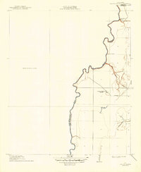
1912 Map of Ashton Bridge
USGS Topo · Published 1949About this map
Bayou Macon defines the border between West Carroll Parish and East Carroll Parish as it meanders through this section of Northeast Louisiana during the early twentieth century. This survey, conducted in cooperation with the Fifth Louisiana Levee District, captures the localized industry and infrastructure of the era, most notably the Cook and McLeans Sawmill and its associated Tramroad. The landscape is dominated by the river's winding path, punctuated by the Ashton Bridge near the Arkansas and Louisiana state line. To the west, a significant portion of the quadrangle is noted as an Unsurveyed Area, contrasting with the more detailed drainage patterns of Three Bayou and Wilson Bayou to the east. The presence of an Abandoned Bridge further south along the bayou provides evidence of changing transportation routes in this low-lying riverine environment.
Find a feature on this map
11 named features on this map. Tap any name to fly to it.
Don’t see what you’re looking for? This feature index may not catch every label — zoom into the map to look around manually.
Map Details
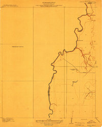
Editions of this 1912 Ashton Bridge Map
3 editions found
Other maps of this area

1909 · Baxter Bayou
USGS Topo · 1:24,000

1909 · Lake Providence
USGS Topo · 1:24,000

1909 · Millikin
USGS Topo · 1:24,000

1909 · Ashton Bridge
USGS Topo · 1:24,000

1911 · Lake Providence
USGS Topo · 1:31,680

1911 · Baxter Bayou
USGS Topo · 1:24,000

1912 · Ashton Bridge
USGS Topo · 1:31,680

1914 · Baxter Bayou
USGS Topo · 1:31,680

1935 · Oak Grove
USGS Topo · 1:62,500

1936 · Eudora
USGS Topo · 1:62,500