1970s Maps of Cyr Plantation, Maine
Explore 4 historic maps of Cyr Plantation from the 1970s. These maps offer a rare glimpse into what life looked like during the 1970s — showing old roads, neighborhoods, homes, and landmarks that have changed or disappeared over time.
Whether you're researching your family's past, planning a metal detecting trip, or studying how Cyr Plantation's landscape evolved across the 1970s, these high-resolution maps are a powerful tool for exploring the history of this region.
- Focus on a specific era: All maps on this page are from the 1970s, giving you a focused view of this time period.
- See what’s changed: Compare century-old streets, trails, and buildings to today's modern landscape using overlays and satellite layers.
- Research with precision: Use these maps for genealogy, historical research, land use analysis, or educational projects.
- View, download, or print: Maps are fully viewable online in high resolution, and can be downloaded or printed for your own records.
Start exploring Cyr Plantation's history through authentic maps from the 1970s. This is your window into the past.
Cyr Plantation, ME maps
(4)- 1975 Map of Van Buren SW, 1981 Print
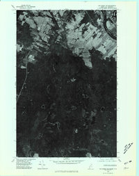 1975 Van Buren SW1981 Print · USGSThe international border at the northern edge of Maine met the mid-seventies with a mix of sprawling timberlands and tidy farm plots. Genealogists and historians can trace the rugged boundary of New Brunswick and Maine near Big Black Brook Lake and Doyle Ridge.
 - 1975 Map of Stockholm NE, 1981 Print
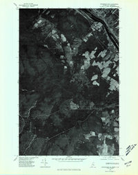 1975 Stockholm NE1981 Print · USGSNorthern Maine meets the Canadian border in the mid-seventies, capturing the riverside settlement of Parent and the surrounding timberlands. Genealogists and historians can trace the international boundary along the Canada United States line near Violette Stream.
 - 1975 Map of Van Buren NW, 1981 Print
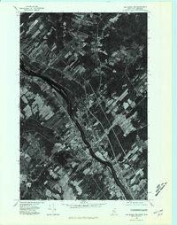 1975 Van Buren NW1981 Print · USGSThe international border at Van Buren and St Leonard is captured in the mid-1970s, showing the unique river-lot land patterns of the valley. Genealogists can trace the rural layouts of the Saint John River and the settlement at Keegan.
 - 1975 Map of Stockholm SE, 1981 Print
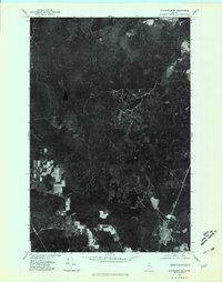 1975 Stockholm SE1981 Print · USGSNorthern Maine's timberlands are captured in this mid-1970s aerial survey during a period of active logging and remote settlement. Trace the course of the Little Madawaska River or locate the forest outpost of California among the dense woods.
End of results
Showing maps 1-4 of 4
Top cities near Cyr Plantation
- Caribou historical maps
- Fort Fairfield historical maps
- Madawaska historical maps
- Van Buren historical maps
- Limestone historical maps
- Woodland historical maps
See more
Frequently asked questions
- What are the different types of historical maps available for Cyr Plantation?
- What is the oldest map of Cyr Plantation?
- Where can I purchase historical maps of Cyr Plantation for my home or office?
- Where can I download high-res historical maps of Cyr Plantation?
- Are there historical topographic maps available for Cyr Plantation?
- Is there historical aerial imagery available for Cyr Plantation?
- Where are historical maps of Cyr Plantation sourced from?