1970s Maps of T11 R4 WELS, Maine
Explore 4 historic maps of T11 R4 WELS from the 1970s. These maps offer a rare glimpse into what life looked like during the 1970s — showing old roads, neighborhoods, homes, and landmarks that have changed or disappeared over time.
Whether you're researching your family's past, planning a metal detecting trip, or studying how T11 R4 WELS's landscape evolved across the 1970s, these high-resolution maps are a powerful tool for exploring the history of this region.
- Focus on a specific era: All maps on this page are from the 1970s, giving you a focused view of this time period.
- See what’s changed: Compare century-old streets, trails, and buildings to today's modern landscape using overlays and satellite layers.
- Research with precision: Use these maps for genealogy, historical research, land use analysis, or educational projects.
- View, download, or print: Maps are fully viewable online in high resolution, and can be downloaded or printed for your own records.
Start exploring T11 R4 WELS's history through authentic maps from the 1970s. This is your window into the past.
T11 R4 WELS, ME maps
(4)- 1975 Map of Ashland SE, 1981 Print
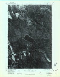 1975 Ashland SE1981 Print · USGSAroostook County was a landscape of dense timber and quiet waters during the mid-seventies, captured here in detailed aerial photography. Trace the historic shoreline of Squa Pan Lake or locate the rural patterns near the Aroostook River and Masardis.
 - 1975 Map of Presque Isle SW, 1981 Print
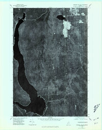 1975 Presque Isle SW1981 Print · USGSNorthern Maine timberlands come into focus in the mid-seventies, showing the intersection of deep-woods industry and the Aroostook wilderness. Trace the logging roads near Walker or locate the shoreline features of Squa Pan Lake and Alder Lake.
 - 1975 Map of Ashland NE, 1981 Print
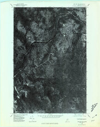 1975 Ashland NE1981 Print · USGSNorthern Maine's timberlands and river valleys are captured in this mid-seventies aerial survey of the region. Researchers can trace the layout of the small settlement at Frenchville and identify the natural drainage patterns of the Aroostook River and Mud Pond.
 - 1975 Map of Presque Isle NW, 1981 Print
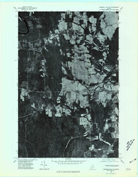 1975 Presque Isle NW1981 Print · USGSAroostook County's mid-century landscape is captured in this 1970s orthophoto showing the transition between northern woodlands and sprawling farmsteads. Trace the rural development of Mapleton and Chapman or locate landmarks like Haystack Mountain.
End of results
Showing maps 1-4 of 4
Top cities near T11 R4 WELS
- Presque Isle historical maps
- Caribou historical maps
- Mapleton historical maps
- Washburn historical maps
- Ashland historical maps
- Chapman historical maps
See more
Top neighborhoods of T11 R4 WELS
Frequently asked questions
- What are the different types of historical maps available for T11 R4 WELS?
- What is the oldest map of T11 R4 WELS?
- Where can I purchase historical maps of T11 R4 WELS for my home or office?
- Where can I download high-res historical maps of T11 R4 WELS?
- Are there historical topographic maps available for T11 R4 WELS?
- Is there historical aerial imagery available for T11 R4 WELS?
- Where are historical maps of T11 R4 WELS sourced from?