1970s Maps of T8 R5 WELS, Maine
Explore 4 historic maps of T8 R5 WELS from the 1970s. These maps offer a rare glimpse into what life looked like during the 1970s — showing old roads, neighborhoods, homes, and landmarks that have changed or disappeared over time.
Whether you're researching your family's past, planning a metal detecting trip, or studying how T8 R5 WELS's landscape evolved across the 1970s, these high-resolution maps are a powerful tool for exploring the history of this region.
- Focus on a specific era: All maps on this page are from the 1970s, giving you a focused view of this time period.
- See what’s changed: Compare century-old streets, trails, and buildings to today's modern landscape using overlays and satellite layers.
- Research with precision: Use these maps for genealogy, historical research, land use analysis, or educational projects.
- View, download, or print: Maps are fully viewable online in high resolution, and can be downloaded or printed for your own records.
Start exploring T8 R5 WELS's history through authentic maps from the 1970s. This is your window into the past.
T8 R5 WELS, ME maps
(4)- 1975 Map of Island Falls NE, 1980 Print
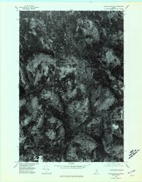 1975 Island Falls NE1980 Print · USGSAroostook County's deep woods and logging routes are revealed in this mid-seventies aerial study of the Northern Maine interior. Researchers can trace the junction at Knowles Corner and find the shoreline of Rockabema Lake near Shoaler Mtn.2 unique versions available
 - 1975 Map of Oxbow SW, 1981 Print
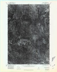
 1975 Oxbow SW1981 Print · USGSPenobscot County’s deep woods are captured in this mid-seventies aerial survey, showing the landscape as it appeared just before the 1980s. Naturalists and historians can trace the intricate wetlands surrounding Umcolcus Lake and the winding course of the East Branch Umcolcus Stream.
 - 1975 Map of Oxbow NE, 1981 Print
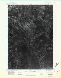 1975 Oxbow NE1981 Print · USGSNorthern Maine timberlands appear in sharp detail during the mid-seventies, showing the intersection of river and rail. Trace the landscape around Masardis and Griswold, following the winding Aroostook River and the secluded Cranberry Pond.
 - 1975 Map of Oxbow NW, 1981 Print
 1975 Oxbow NW1981 Print · USGSNorthern Maine's timberlands are captured in this mid-1970s aerial survey centered on the river valley. Genealogists and local historians can trace the clearings of Oxbow and the confluence of the Aroostook River and Trout Brook.
End of results
Showing maps 1-4 of 4
Top cities near T8 R5 WELS
- Ashland historical maps
- Oakfield historical maps
- Smyrna historical maps
- Dyer Brook historical maps
- Merrill historical maps
- Masardis historical maps
See more
Frequently asked questions
- What are the different types of historical maps available for T8 R5 WELS?
- What is the oldest map of T8 R5 WELS?
- Where can I purchase historical maps of T8 R5 WELS for my home or office?
- Where can I download high-res historical maps of T8 R5 WELS?
- Are there historical topographic maps available for T8 R5 WELS?
- Is there historical aerial imagery available for T8 R5 WELS?
- Where are historical maps of T8 R5 WELS sourced from?