Old Maps of TC R2 WELS, Maine for Hiking & Exploration
Hike through history with 31 historic maps of TC R2 WELS. Explore old trails, ghost towns, and forgotten backroads — perfect for outdoor adventurers and local explorers.
- Rediscover forgotten places: Map out old mining camps, roads, and footpaths that no longer exist on modern maps.
- Layer with modern tools: Combine with LiDAR or satellite views to plan hikes through historical terrain.
- Made for exploration: Popular among hikers, overlanders, and local history lovers.
Use these maps to find adventure and explore the hidden past of TC R2 WELS.
TC R2 WELS, ME maps
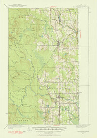
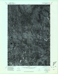
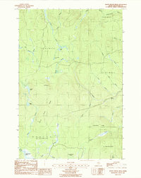
(31)- 1934 Map of Bridgewater
 1934 Bridgewater1934 Print · USGSAroostook County's border with New Brunswick is detailed here during the mid-1930s, highlighting the Bangor and Aroostook rail network. Genealogists can locate family landmarks like Jewells Corner, Snow Settlement, and Robinson Sta.
 - 1935 Map of Howe Brook
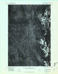
 1935 Howe Brook1935 Print · USGSRemote Aroostook County is shown here in the mid-1930s, when logging camps and the railroad defined the local landscape. Genealogists and researchers can trace the Bangor and Aroostook rail line to find vanished hubs like Little Canada and Weeksboro.
 - 1938 Map of Bridgewater
 1938 Bridgewater1938 Print · USGSEastern Aroostook County is shown here during the mid-1930s, documenting the vital rail and border connections of the era. Researchers can trace the old paths of the Bangor and Ar00stook railroad and locate community landmarks like Snow Settlement and Flagstaff Sch.3 unique versions available
 - 1939 Map of Howe Brook
 1939 Howe Brook1939 Print · USGSAroostook County was a hub for timber and rail in the mid-1930s, defined by its remote township grids and wilderness camps. Genealogists and historians can trace old railroad stops at Weeksboro and Saunders or locate early sporting sites like the Mineola Hunting Club.3 unique versions available
 - 1951 Map of Bridgewater, 1952 Print
 1951 Bridgewater1952 Print · USGSAroostook County's borderlands are captured here at mid-century, showing the vital rail and road networks connecting Maine to New Brunswick. Genealogists can locate old rural landmarks like Flagstaff Sch, Snow Settlement, and the Monticello Sta.3 unique versions available
 - 1953 Map of Bridgewater
 1953 Bridgewater1953 Print · USGSThe Maine-New Brunswick borderlands are captured here in the early 1950s, showing a landscape shaped by the Bangor and Aroostook rail line. Researchers can trace historic school sites like Bratton Sch and family-named corners such as Jewells Corner or Snow Settlement.
 - 1954 Map of Howe Brook, 1955 Print
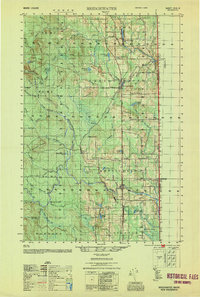
 1954 Howe Brook1955 Print · USGSAroostook County's deep woods are documented in the mid-fifties, showing a landscape of timber-industry rail and seasonal sporting camps. Researchers can locate remote outposts like Old Klondike Camp, the community of Little Canada, and the Bangor and Ar00stook line.2 unique versions available
 - 1954 Map of Presque Isle, 1968 Print
 1954 Presque Isle1968 Print · USGSNorth Woods logging and rail history come alive in this mid-century survey of the Maine-Quebec borderlands. Genealogists and historians can trace the Bangor and Aroostook railroad through timber hubs like Ashland, Smyrna Mills, and Presque Isle.2 unique versions available
 - 1958 Map of Presque Isle
 1958 Presque Isle1958 Print · USGSThe Aroostook timber and potato country is captured here during the late fifties, showing the vital rail-to-river network of Northern Maine. Genealogists and historians can trace the Bangor & Aroostook RR through Mapleton and Ashland, or locate remote sites like Chamberlain Farm and Seven Islands.
 - 1959 Map of Woodstock, 1975 Print
 1959 Woodstock1975 Print · USGSNorthern Maine and New Brunswick meet along the river valleys in the late fifties, showcasing an era of international rail and river commerce. Genealogists can trace family roots through border towns like Woodstock and Houlton, or along the lines of the Bangor & Aroostook railroad.
 - 1960 Map of Presque Isle
 1960 Presque Isle1960 Print · USGSNorthern Maine during the mid-century was a land of timber, rails, and strategic airfields. Genealogists and historians can trace the growth of Presque Isle and Ashland or explore the remote northern reaches of Baxter State Park and Presque Isle AFB.3 unique versions available
 - 1963 Map of Woodstock
 1963 Woodstock1963 Print · USGSThe Maine-New Brunswick borderlands come alive in the early sixties, showing the vital river-and-rail connection between Houlton and Woodstock. Genealogists and historians can trace the paths of the Canadian Pacific RR and locate rural communities like Stickney and Upper Kent.
 - 1965 Map of Howe Brook, 1968 Print
 1965 Howe Brook1968 Print · USGSAroostook County was a landscape of timber and rail in the mid-1960s, dominated by unorganized townships and hunting camps. You can trace the Bangor and Aroostook railroad as it passes through Weeksboro and by lookout towers on Howe Brook Mtn and Number Nine Mtn.2 unique versions available
 - 1975 Map of Howe Brook SE, 1981 Print
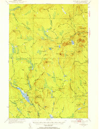
 1975 Howe Brook SE1981 Print · USGSNorthern Maine's timberlands are seen from above in the mid-seventies, showing the intersection of logging trails and waterways. Trace the remote landscape surrounding The Pinnacle and the quiet waters of Carlisle Pond and North Pond.
 - 1975 Map of Bridgewater SW, 1981 Print
 1975 Bridgewater SW1981 Print · USGSAroostook County's deep timberlands and agricultural clearings are captured here in the mid-seventies via aerial orthophotography. Trace the remote settlement at Harvey or study the shoreline and forest margins around Conroy Lake and the South Brook drainage.
 - 1981 Map of Brooklin
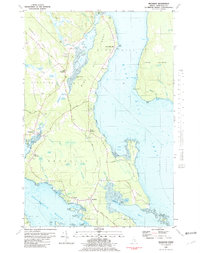 1981 Brooklin1981 Print · USGSCoastal Hancock County is captured here in the early 1980s, showcasing the traditional maritime settlements between Blue Hill Bay and Eggemoggin Reach. Genealogists can trace family names at Pine Grove Cemetery and Freethy Cemetery or explore the docks at Center Harbor.
 - 1984 Map of Harvey
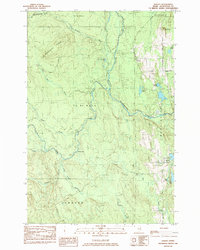 1984 Harvey1984 Print · USGSAroostook County was a network of timberlands and isolated settlements in the early eighties. Genealogists and historians can trace local landmarks like The Lake Road Ch near Conroy Lake or the small community at Harvey.
 - 1985 Map of Oakfield
 1985 Oakfield1985 Print · USGSAroostook County in the 1980s displays a balance between the timber-and-rail industry and the protected wilderness of the North Woods. Genealogists and local historians can trace family-named hubs like Smyrna Mills, Island Falls, and Knowles Corner along the Bangor and Aroostook railroad line.
 - 1986 Map of North Brook Ridge, 1987 Print
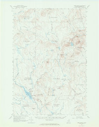
 1986 North Brook Ridge1987 Print · USGSAroostook County's remote timberlands are captured here in the mid-1980s, showing a landscape defined by logging roads and glacial hydrology. Researchers can trace the path of Carlisle Road past The Pinnacle or locate the wetlands of Thousand Acre Swamp.
 - 1993 Map of Houlton
 1993 Houlton1993 Print · USGSThe Maine-New Brunswick borderlands are captured here in the early 1990s, centered on the transit and trade hub of Houlton. Genealogists and historians can trace family-named locales and crossroads like Porter Settlement, Jackson Settlement, and Bridgewater Corner.
 - 1994 Map of Oakfield
 1994 Oakfield1994 Print · USGSAroostook County's North Woods and rural settlements are shown here in the mid-1990s, capturing the region's transition from forest to farmland. Trace the path of the Bangor and Aroostook RR through Smyrna Mills or locate landings on Millinocket Lake.
 - 2011 Map of Harvey, 2011 Print
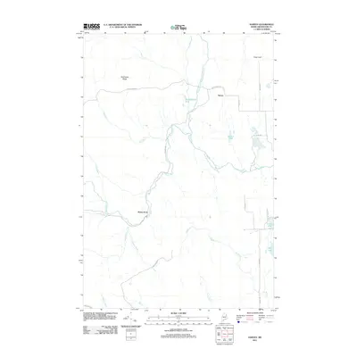 2011 Harvey2011 Print · USGSCovers TC R2 WELS, including Littleton, Monticello, and other nearby areas
 - 2011 Map of North Brook Ridge, 2011 Print
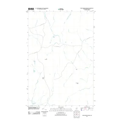 2011 North Brook Ridge2011 Print · USGSCovers TC R2 WELS, including Hammond, TD R2 WELS, and other nearby areas
 - 2014 Map of North Brook Ridge, 2014 Print
 2014 North Brook Ridge2014 Print · USGSCovers TC R2 WELS, including Hammond, TD R2 WELS, and other nearby areas
 - 2014 Map of Harvey, 2014 Print
 2014 Harvey2014 Print · USGSCovers TC R2 WELS, including Littleton, Monticello, and other nearby areas
Showing maps 1-25 of 31
Top cities near TC R2 WELS
- Houlton historical maps
- Mars Hill historical maps
- Hodgdon historical maps
- Littleton historical maps
- Linneus historical maps
- Monticello historical maps
See more
Top neighborhoods of TC R2 WELS
Frequently asked questions
- What are the different types of historical maps available for TC R2 WELS?
- What is the oldest map of TC R2 WELS?
- Where can I purchase historical maps of TC R2 WELS for my home or office?
- Where can I download high-res historical maps of TC R2 WELS?
- Are there historical topographic maps available for TC R2 WELS?
- Is there historical aerial imagery available for TC R2 WELS?
- Where are historical maps of TC R2 WELS sourced from?