1970s Maps of Franklin County, Maine
Explore 49 historic maps of Franklin County from the 1970s. These maps offer a rare glimpse into what life looked like during the 1970s — showing old roads, neighborhoods, homes, and landmarks that have changed or disappeared over time.
Whether you're researching your family's past, planning a metal detecting trip, or studying how Franklin County's landscape evolved across the 1970s, these high-resolution maps are a powerful tool for exploring the history of this region.
- Focus on a specific era: All maps on this page are from the 1970s, giving you a focused view of this time period.
- See what’s changed: Compare century-old streets, trails, and buildings to today's modern landscape using overlays and satellite layers.
- Research with precision: Use these maps for genealogy, historical research, land use analysis, or educational projects.
- View, download, or print: Maps are fully viewable online in high resolution, and can be downloaded or printed for your own records.
Start exploring Franklin County's history through authentic maps from the 1970s. This is your window into the past.
Franklin County, ME maps
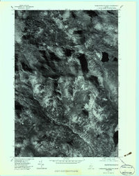
(49)- 1970 Map of Skinner, 1973 Print
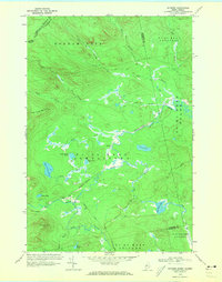 1970 Skinner1973 Print · USGSThe international border and the high timberlands of Franklin County are captured here in the early 1970s. Researchers can trace the Canadian Pacific rail line as it passes the remote outposts of Skinner and Keough along the Moose River.2 unique versions available
 - 1970 Map of Merrill Mountain, 1973 Print
 1970 Merrill Mountain1973 Print · USGSThe international border between Maine and Quebec was surveyed here in the early 1970s, revealing a landscape of timberlands and isolated outposts. Researchers can trace historic township lines like the Merrill Strip and find remote sites such as Moose Mill Camp and Lower Nathan Bog.
 - 1970 Map of Kennebago Lake, 1973 Print
 1970 Kennebago Lake1973 Print · USGSNorthwestern Maine at the start of the 1970s remained a landscape of sporting camps and timber townships. Genealogists and researchers can trace the remote outposts of Grants Camps and Kennebago Lake Camps among the peaks of East Kennebago Mtn.
 - 1970 Map of Tim Mountain, 1973 Print
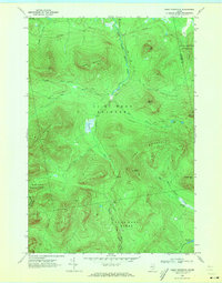
 1970 Tim Mountain1973 Print · USGSThe Franklin County highlands in the early 1970s show a remote landscape of timber townships and sporting camps. Researchers can locate remote outposts like Tim Pond Camp, trace the winding Tim Pond Lookout Road, and explore the high peaks of the Barnard Mountains.
 - 1970 Map of Kibby Mountain, 1973 Print
 1970 Kibby Mountain1973 Print · USGSThe Maine highlands and timberlands of Franklin County are shown here in the early seventies, centered on the heights of Kibby Mountain. Researchers can trace the mid-century logging roads and remote water bodies like Caribou Pond and Spencer Bog.2 unique versions available
 - 1970 Map of Skinner NE, 1973 Print
 1970 Skinner NE1973 Print · USGSThe international boundary between Maine and Quebec is documented in detail here during the early 1970s. Researchers can trace the remote drainage of the West Branch Gulf Stream and locate wilderness landmarks like Sixtynine Mtn and Turner Pond.2 unique versions available
 - 1970 Map of Boundary Pond, 1973 Print
 1970 Boundary Pond1973 Print · USGSThe Maine-Quebec borderlands in the early 1970s appear as a wild network of mountain peaks and isolated camps. Genealogists and historians can trace the remote settlement at Lowelltown or locate seasonal sites like the Dome Mtn Camps near Boundary Pond.
 - 1975 Map of Norridgewock SW, 1980 Print
 1975 Norridgewock SW1980 Print · USGSThe Kennebec County lakeland is seen from above in the mid-seventies, showing the literal footprint of woods and water. Trace the rural landscape between Belgrade Lakes and Rome Corner, including the shores of Long Pond.
 - 1975 Map of Norridgewock NW, 1980 Print
 1975 Norridgewock NW1980 Print · USGSCentral Maine in the mid-seventies is revealed through this detailed orthophoto of the winding Sandy River valley. Genealogists and historians can trace the rural layouts of Starks and Mercer or locate homesteads along Bog Stream.
 - 1976 Map of Sherbrooke
 1976 Sherbrooke1976 Print · USGSThe northern Maine woods and Quebec’s Eastern Townships meet in this mid-century survey of the rugged international borderlands. Genealogists and historians can trace rail-and-river connections through Thetford Mines, follow the Dead River to Flagstaff Lake, or locate small border crossings at Stanhope and Beecher Falls.2 unique versions available
 - 1977 Map of Boundary Pond, 1983 Print
 1977 Boundary Pond1983 Print · USGSThe Maine-Quebec border in the late seventies is shown in photographic detail, emphasizing the timberlands and remote outposts of Franklin County. Trace the forest roads and waterways through Lowelltown and past landmarks like Boundary Pond and Keenes.
 - 1977 Map of Mount Abraham, 1983 Print
 1977 Mount Abraham1983 Print · USGSThe Franklin County highlands are captured in late autumn during the late seventies, showing the rugged timberlands of the western mountains. Trace the footprints of Salem and Barnjum or follow the paths of Rapid Stream and Quick Stream.
 - 1977 Map of Northwest Pond, 1983 Print
 1977 Northwest Pond1983 Print · USGSThe Maine-Quebec borderlands appear in striking detail in the late seventies, showing a landscape defined by timber and water. Researchers can trace the flow of the Kennebago River and locate isolated features like Northwest Pond and Mont Gosford.
 - 1977 Map of Tumbledown Mountain, 1983 Print
 1977 Tumbledown Mountain1983 Print · USGSSomerset County's timberlands are captured in detail during the late 1970s through this orthophoto survey. Researchers can trace the water systems of Baker Stream and Spencer Stream or locate remote landmarks like Rock Pond.
 - 1977 Map of Poplar Mountain, 1983 Print
 1977 Poplar Mountain1983 Print · USGSThe Carrabassett River valley in the late seventies reveals the intersection of timbered wilderness and small rural settlements. Trace the exact structures and clearings at Records, Carrabassett, and Spring Farm through precise aerial imagery.
 - 1977 Map of Chain Of Ponds, 1983 Print
 1977 Chain Of Ponds1983 Print · USGSThe Maine wilderness in the late seventies is captured here through detailed aerial imagery, focusing on the deep waters of the Chain of Ponds. Researchers can trace the isolated Upper Farm and the high-elevation peaks of Snow Mountain and Bag Pond Mountain.
 - 1977 Map of Skinner, 1983 Print
 1977 Skinner1983 Print · USGSThe Maine-Quebec borderlands in the late seventies are captured in this aerial survey of a working timber landscape. Genealogists and researchers can pinpoint the isolated outposts at Skinner and Keough along the winding path of the Moose River.
 - 1977 Map of Little Bigelow Mountain, 1983 Print
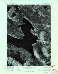 1977 Little Bigelow Mountain1983 Print · USGSThe Somerset County wilderness appears in stark detail in the late seventies, showing the vast reach of Flagstaff Lake. Researchers can trace the original path of the Dead River and locate remote landmarks like Little Bigelow Mountain and West Carry Pond.
 - 1977 Map of Jim Pond, 1983 Print
 1977 Jim Pond1983 Print · USGSFranklin County's remote wilderness is captured in the late seventies through this detailed aerial orthophotograph. Researchers can trace the winding course of the Dead River and study the terrain surrounding Kibby Range and Jim Pond.
 - 1977 Map of Kennebago Lake, 1983 Print
 1977 Kennebago Lake1983 Print · USGSThe Maine wilderness of the late seventies is captured in this orthophoto, showing the unpopulated mountain landscapes near Loon Lake. Researchers can trace the drainages of Big Sag Brook and the high ridges of Spotted Mountain.
 - 1977 Map of Phillips, 1983 Print
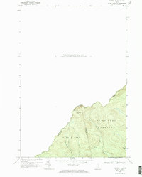
 1977 Phillips1983 Print · USGSFranklin County in the late 1970s is shown here as a landscape of river valleys and mountain peaks centered on the Phillips area. Researchers can trace the winding course of the Sandy River and locate rural landmarks like Avon Corner and Mount Blue Pond.
 - 1977 Map of Kennebago, 1983 Print
 1977 Kennebago1983 Print · USGSOxford County's timberlands and river systems are shown with photographic precision in the late seventies. Researchers can trace the winding Kennebago River and the shoreline of Cupsuptic Lake as they appeared during this era of forest management.
 - 1977 Map of Louise Mountain, 1983 Print
 1977 Louise Mountain1983 Print · USGSThe Maine-Quebec borderlands appear in striking photographic detail during the late seventies, documenting the remote timberlands and waterways. Researchers can trace the layout of Saint-Augustin-De-Woburn and the shores of Lac Aux Araignées.
 - 1977 Map of Merrill Mountain, 1983 Print
 1977 Merrill Mountain1983 Print · USGSThe Maine-Quebec border region is shown in high detail through 1970s aerial imagery, revealing the untamed wilderness of Franklin County. Trace the winding Riviere Aux Araignees and the high peaks of Merrill Mountain and Vane Mountain.
 - 1977 Map of Black Mountain, 1983 Print
 1977 Black Mountain1983 Print · USGSFranklin County's high timberlands are captured in detail during the late seventies, showing the area's transition into the winter season. Genealogists and outdoorsmen can trace the drainage of North Branch Alder Stream and identify sites near Tim Pond.
Showing maps 1-25 of 49
Top cities of Franklin County
- Farmington historical maps
- Jay historical maps
- Wilton historical maps
- New Sharon historical maps
- Chesterville historical maps
- Rangeley historical maps
See more
Frequently asked questions
- What are the different types of historical maps available for Franklin County?
- What is the oldest map of Franklin County?
- Where can I purchase historical maps of Franklin County for my home or office?
- Where can I download high-res historical maps of Franklin County?
- Are there historical topographic maps available for Franklin County?
- Is there historical aerial imagery available for Franklin County?
- Where are historical maps of Franklin County sourced from?