Old Maps of Dog Corners, Osborn for Genealogy
Trace your family roots with 15 historic maps of Dog Corners. These high-res maps reveal old neighborhoods, homesites, landmarks, and streets — helping you uncover where your ancestors lived and how the area evolved over time.
- Explore historic neighborhoods: Identify where your relatives may have lived in the 1800s or 1900s.
- Compare maps over time: Trace the changes in streets, buildings, and landmarks for multi-generational research.
- Perfect for genealogy & ancestry research: Used by family historians and researchers to map out lineage and migration.
These maps are an incredible resource for exploring your personal connection to Dog Corners's past.
Dog Corners, Osborn maps
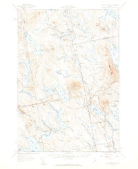
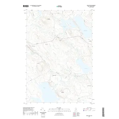
(15)- 1929 Map of Lead Mountain
 1929 Lead Mountain1929 Print · USGSThe Maine backcountry near the Hancock and Washington County line is shown here in the late twenties, dominated by timberlands and glacial lakes. Genealogists and historians can locate remote outposts like Jacobs Camp, the Howe Farm, and the trails surrounding Lead Mountain.
 - 1932 Map of Lead Mountain
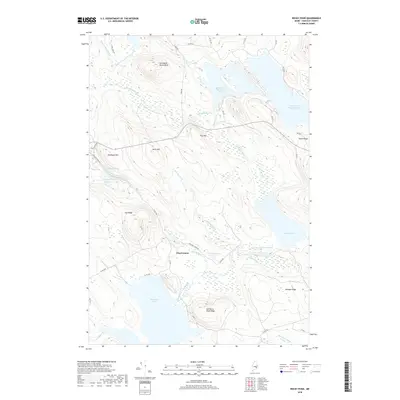
 1932 Lead Mountain1932 Print · USGSThe Maine timberlands and the historic Air Line Road are captured here in the early thirties, showcasing a landscape of isolated logging camps and remote lakes. Researchers can locate family-named sites like Howe Farm Camp, the settlements of Deblois and Beddington, and the Fire Tower atop Lead Mountain.5 unique versions available
 - 1948 Map of Bangor
 1948 Bangor1948 Print · USGSThe Maine coast and its industrial river valleys are captured here shortly after the war, showing the vital shipping and rail hubs of the late 1940s. Genealogists and historians can trace the tracks of the Maine Central RR connecting Bangor, Augusta, and Old Town.
 - 1956 Map of Bangor, 1966 Print
 1956 Bangor1966 Print · USGSMid-century Maine comes alive in this survey of the rugged coast and river valleys during the 1950s. Genealogists and historians can trace the vital rail corridors of the Maine Central RR connecting timber towns like Old Town to the coast at Bar Harbor.3 unique versions available
 - 1957 Map of Lead Mountain, 1959 Print
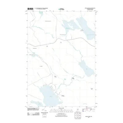
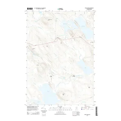
 1957 Lead Mountain1959 Print · USGSThe wild lake country of Down East Maine is shown here in the late fifties, featuring the scattered outposts and high ridges of Washington and Hancock Counties. Genealogists and researchers can trace local landmarks like Beddington, Dog Corners, and the prominent Lookout Tower atop Lead Mtn.3 unique versions available
 - 1960 Map of Bangor
 1960 Bangor1960 Print · USGSCentral Maine in the sixties reveals a landscape of river-powered industry and sprawling coastal island chains. Researchers can trace the rail corridors of the Maine Central or locate mid-century aviation landmarks like Dow Air Force Base.
 - 1961 Map of Bangor
 1961 Bangor1961 Print · USGSMid-century Maine comes alive through its busy river ports and rocky archipelagoes during a period of steady maritime and rail commerce. Researchers can trace the path of the Maine Central railroad and locate coastal landmarks from Acadia National Park to Vinalhaven Island.
 - 1985 Map of Bangor
 1985 Bangor1985 Print · USGSMid-Maine during the mid-eighties centers on the industrial pulse of the Penobscot River and its critical rail connections. Genealogists and historians can trace the development of river towns from Old Town to Ellsworth and locate regional landmarks like Fort Knox State Park.
 - 1987 Map of Rocky Pond, 1988 Print
 1987 Rocky Pond1988 Print · USGSHancock County's interior ponds and river branches are captured here in the late eighties, showing a landscape shaped by water and timber. Researchers can trace landforms and landmarks like Dog Corners, the Sevenmile Brook Bluff, and the landings along the Union River.
 - 1994 Map of Bangor
 1994 Bangor1994 Print · USGSThe Penobscot River valley and the coastal highlands of eastern Maine are captured here in the mid-1990s. Researchers can trace the industrial rail corridors of the Maine Central Railroad or explore the landscape around Old Town, Bucksport, and Graham Lake.
 - 2011 Map of Rocky Pond, 2011 Print
 2011 Rocky Pond2011 Print · USGSCovers Dog Corners, including Aurora, Osborn, and other nearby areas
 - 2014 Map of Rocky Pond, 2014 Print
 2014 Rocky Pond2014 Print · USGSCovers Dog Corners, including Aurora, Osborn, and other nearby areas
 - 2018 Map of Rocky Pond, 2018 Print
 2018 Rocky Pond2018 Print · USGSCovers Dog Corners, including Aurora, Osborn, and other nearby areas
 - 2021 Map of Rocky Pond, 2021 Print
 2021 Rocky Pond2021 Print · USGSCovers Dog Corners, including Aurora, Osborn, and other nearby areas
 - 2024 Map of Rocky Pond, 2024 Print
 2024 Rocky Pond2024 Print · USGSHancock County in the modern era continues to be shaped by its waterways and ridges. Researchers can trace the junction at Dog Corners or explore the drainage of the East Branch Union River near Spectacle Pond and Rocky Pond.
End of results
Showing maps 1-15 of 15
Frequently asked questions
- What are the different types of historical maps available for Dog Corners?
- What is the oldest map of Dog Corners?
- Where can I purchase historical maps of Dog Corners for my home or office?
- Where can I download high-res historical maps of Dog Corners?
- Are there historical topographic maps available for Dog Corners?
- Is there historical aerial imagery available for Dog Corners?
- Where are historical maps of Dog Corners sourced from?