Old Maps of Winthrop, Maine for Hiking & Exploration
Hike through history with 31 historic maps of Winthrop. Explore old trails, ghost towns, and forgotten backroads — perfect for outdoor adventurers and local explorers.
- Rediscover forgotten places: Map out old mining camps, roads, and footpaths that no longer exist on modern maps.
- Layer with modern tools: Combine with LiDAR or satellite views to plan hikes through historical terrain.
- Made for exploration: Popular among hikers, overlanders, and local history lovers.
Use these maps to find adventure and explore the hidden past of Winthrop.
Winthrop, ME maps
(31)- 1892 Map of Augusta
 1892 Augusta1892 Print · USGSAugusta and the Kennebec River valley are captured here in the 1890s, during a peak era of rail transport and riverfront industry. Genealogists and historians can trace old homesteads and depots along the Maine Central Railroad from Winthrop to Belgrade.8 unique versions available
 - 1910 Map of Livermore, 1959 Print
 1910 Livermore1959 Print · USGSMaine's river valleys and lake districts are captured here in the early twentieth century, showing a network of rail-reliant mill towns and rural crossroads. Genealogists can locate family landmarks like Howes Corner and Brettuns Mills, or trace local schools like Saunders School.
 - 1912 Map of Livermore
 1912 Livermore1912 Print · USGSMaine's lake district comes to life in this pre-war survey of the Androscoggin River valley. Genealogists and historians can trace old homesteads and landmarks like Brettuns Mills Livermore P O, Strickland Ferry, and Monmouth Academy.5 unique versions available
 - 1941 Map of Livermore
 1941 Livermore1941 Print · USGSAndroscoggin County at the start of the 1940s is a landscape defined by the river and rail economy between Livermore Falls and Wayne. Genealogists can trace family footprints across numerous rural districts, locating Brettuns Mills and the many schoolhouses like Young Sch and Pike Sch.
 - 1941 Map of Augusta, 1956 Print
 1941 Augusta1956 Print · USGSThe Kennebec River valley and its surrounding lake country are documented here just before the mid-century, showing the capital's growth alongside quiet rural townships. Genealogists can locate family-named sites like Stevens Cem, several small schoolhouses including Cony Sch, and the rail stops at Readfield Depot.
 - 1943 Map of Augusta
 1943 Augusta1943 Print · USGSAugusta and the surrounding Kennebec County lakes are shown in detail during the early 1940s as the rail and river economies converged. Genealogists can locate family plots at Lakeview Cem, trace old school districts like Ballard Sch, and find landmarks like the Fish Hatchery.3 unique versions available
 - 1948 Map of Bangor
 1948 Bangor1948 Print · USGSThe Maine coast and its industrial river valleys are captured here shortly after the war, showing the vital shipping and rail hubs of the late 1940s. Genealogists and historians can trace the tracks of the Maine Central RR connecting Bangor, Augusta, and Old Town.
 - 1950 Map of Lewiston
 1950 Lewiston1950 Print · USGSThe Maine and New Hampshire borderlands come alive in this post-war survey of the White Mountains and Androscoggin valley. Genealogists and historians can trace rail lines like the Maine Central Railroad and find high-altitude landmarks from Mount Washington to Bretton Woods.2 unique versions available
 - 1956 Map of Augusta, 1958 Print
 1956 Augusta1958 Print · USGSMaine’s capital city and the surrounding lake country appear here in the mid-fifties as the region’s recreation and rail economies thrived. Genealogists and local historians can locate many small family cemeteries like Tiffany Cem and Stevens Cem, or trace the old rail stops at Readfield Sta.4 unique versions available
 - 1956 Map of Bangor, 1966 Print
 1956 Bangor1966 Print · USGSMid-century Maine comes alive in this survey of the rugged coast and river valleys during the 1950s. Genealogists and historians can trace the vital rail corridors of the Maine Central RR connecting timber towns like Old Town to the coast at Bar Harbor.3 unique versions available
 - 1956 Map of Lewiston, 1975 Print
 1956 Lewiston1975 Print · USGSThe Northern New England interior is documented here in the mid-fifties, from the industrial Androscoggin River to the high peaks of the White Mountains. Trace the Grand Trunk Railway through mountain passes or locate family landmarks near Sabbathday Lake and Bretton Woods.
 - 1960 Map of Bangor
 1960 Bangor1960 Print · USGSCentral Maine in the sixties reveals a landscape of river-powered industry and sprawling coastal island chains. Researchers can trace the rail corridors of the Maine Central or locate mid-century aviation landmarks like Dow Air Force Base.
 - 1961 Map of Bangor
 1961 Bangor1961 Print · USGSMid-century Maine comes alive through its busy river ports and rocky archipelagoes during a period of steady maritime and rail commerce. Researchers can trace the path of the Maine Central railroad and locate coastal landmarks from Acadia National Park to Vinalhaven Island.
 - 1961 Map of Lewiston
 1961 Lewiston1961 Print · USGSWestern Maine and the White Mountains appear here during the early sixties, showing the industrial river towns and vast timberlands before the modern interstate era. Genealogists and historians can trace the Grand Trunk RR through Berlin or locate landmarks like Old Speck Mountain and Elephant Mountain.
 - 1962 Map of Lewiston
 1962 Lewiston1962 Print · USGSThe industrial river valleys and high peaks of Maine and New Hampshire define the region in the early sixties. Trace the rail-and-river network from Lewiston to the White Mountains, passing through mill towns like Berlin and Rumford.
 - 1966 Map of Wayne, 1968 Print
 1966 Wayne1968 Print · USGSKennebec County’s lake country is captured in the mid-1960s, showing the vital connection between its waterfront villages and the rail corridor. Researchers can trace the layout of Wayne and North Monmouth, or locate local landmarks like Monmouth Academy and the Lookout Tower atop Mt Pisgah.3 unique versions available
 - 1969 Map of Lewiston
 1969 Lewiston1969 Print · USGSThe northern New England highlands come into focus during the mid-fifties, showing the vital rail and river networks connecting industrial centers to the deep woods. Researchers can trace the path of the Grand Trunk RR or locate landmarks like Mt Washington and Rangeley Lake.
 - 1980 Map of Winthrop
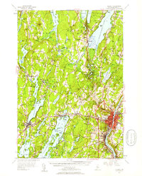
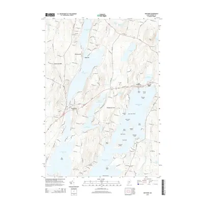
 1980 Winthrop1980 Print · USGSKennebec County's lake district is shown in detail during the late twentieth century, capturing the area's mix of village life and waterfront recreation. Researchers can locate family heritage sites like Lakeview Cem, the Jesse Lee Ch, and the Maine Central rail line.
 - 1984 Map of Augusta
 1984 Augusta1984 Print · USGSMid-coast and central Maine were undergoing steady change in the mid-eighties as traditional river and coastal industries met expanding recreation. You can trace the Maine Central RR through Augusta or explore the rugged shoreline from Rockland Harbor up to Mount Megunticook.
 - 1986 Map of Lewiston
 1986 Lewiston1986 Print · USGSMaine’s industrial river valleys and western mountain foothills are captured here in the mid-eighties as rail and road networks tied the region together. Genealogists and historians can trace the development of mill towns and lakefront settlements from Lisbon to Bethel, following the Androscoggin River and the path of the Maine Central Railroad.2 unique versions available
 - 2000 Map of Winthrop, 2001 Print
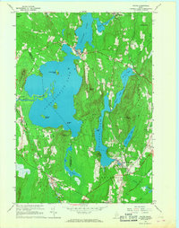
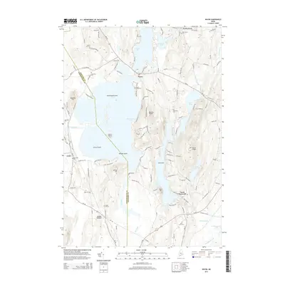
 2000 Winthrop2001 Print · USGSMaine's lake country at the turn of the millennium shows a landscape defined by deep-water ponds and small lakeside villages. Genealogists can locate family burial sites like Whistler Cem and Benson Cem, or trace landmarks at Tallwood and Winthrop Center.
 - 2011 Map of Wayne, 2011 Print
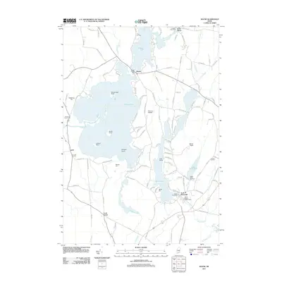 2011 Wayne2011 Print · USGSCovers Winthrop, including Monmouth, Livermore Falls, and other nearby areas
 - 2011 Map of Winthrop, 2011 Print
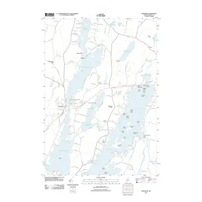 2011 Winthrop2011 Print · USGSCovers Winthrop, including Monmouth, West Gardiner, and other nearby areas
 - 2014 Map of Winthrop, 2014 Print
 2014 Winthrop2014 Print · USGSCovers Winthrop, including Monmouth, West Gardiner, and other nearby areas
 - 2014 Map of Wayne, 2014 Print
 2014 Wayne2014 Print · USGSCovers Winthrop, including Monmouth, Livermore Falls, and other nearby areas
Showing maps 1-25 of 31
Top cities near Winthrop
- Lewiston historical maps
- Auburn historical maps
- Augusta historical maps
- Oakland historical maps
- Gardiner historical maps
- Turner historical maps
See more
Top neighborhoods of Winthrop
- Tallwood historical maps
- Winthrop Center historical maps
- East Winthrop historical maps
- Island Park historical maps
- Sturtevant Hill historical maps
- Maranacook historical maps
Frequently asked questions
- What are the different types of historical maps available for Winthrop?
- What is the oldest map of Winthrop?
- Where can I purchase historical maps of Winthrop for my home or office?
- Where can I download high-res historical maps of Winthrop?
- Are there historical topographic maps available for Winthrop?
- Is there historical aerial imagery available for Winthrop?
- Where are historical maps of Winthrop sourced from?