2000s (21st Century) Maps of Oxford, Maine
Explore 21 historic maps of Oxford from the 2000s (21st Century). These maps offer a rare glimpse into what life looked like during the 2000s — showing old roads, neighborhoods, homes, and landmarks that have changed or disappeared over time.
Whether you're researching your family's past, planning a metal detecting trip, or studying how Oxford's landscape evolved across the 2000s, these high-resolution maps are a powerful tool for exploring the history of this region.
- Focus on a specific era: All maps on this page are from the 2000s, giving you a focused view of this time period.
- See what’s changed: Compare century-old streets, trails, and buildings to today's modern landscape using overlays and satellite layers.
- Research with precision: Use these maps for genealogy, historical research, land use analysis, or educational projects.
- View, download, or print: Maps are fully viewable online in high resolution, and can be downloaded or printed for your own records.
Start exploring Oxford's history through authentic maps from the 2000s. This is your window into the past.
Oxford, ME maps
(21)- 2000 Map of Norway, 2001 Print
 2000 Norway2001 Print · USGSOxford County at the turn of the millennium shows the enduring connection between New England towns and their waterways. Researchers can locate family landmarks like Otisfield Gore Cem, trace the banks of the Crooked River, or find old school sites like Fox Sch.
 - 2011 Map of Casco, 2011 Print
 2011 Casco2011 Print · USGSCovers Oxford, including Naples, Casco, and other nearby areas
 - 2011 Map of Oxford, 2011 Print
 2011 Oxford2011 Print · USGSCovers Oxford, including Paris, Mechanic Falls, and other nearby areas
 - 2011 Map of Mechanic Falls, 2011 Print
 2011 Mechanic Falls2011 Print · USGSCovers Oxford, including Poland, New Gloucester, and other nearby areas
 - 2011 Map of Norway, 2011 Print
 2011 Norway2011 Print · USGSCovers Oxford, including Paris, Norway, and other nearby areas
 - 2014 Map of Norway, 2014 Print
 2014 Norway2014 Print · USGSCovers Oxford, including Paris, Norway, and other nearby areas
 - 2014 Map of Casco, 2014 Print
 2014 Casco2014 Print · USGSCovers Oxford, including Naples, Casco, and other nearby areas
 - 2014 Map of Oxford, 2014 Print
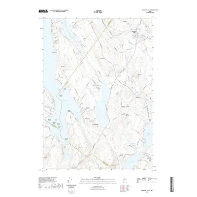
 2014 Oxford2014 Print · USGSCovers Oxford, including Paris, Mechanic Falls, and other nearby areas
 - 2014 Map of Mechanic Falls, 2014 Print
 2014 Mechanic Falls2014 Print · USGSCovers Oxford, including Poland, New Gloucester, and other nearby areas
 - 2018 Map of Norway, 2018 Print
 2018 Norway2018 Print · USGSCovers Oxford, including Paris, Norway, and other nearby areas
 - 2018 Map of Casco, 2018 Print
 2018 Casco2018 Print · USGSCovers Oxford, including Naples, Casco, and other nearby areas
 - 2018 Map of Oxford, 2018 Print
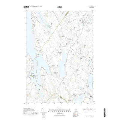
 2018 Oxford2018 Print · USGSCovers Oxford, including Paris, Mechanic Falls, and other nearby areas
 - 2018 Map of Mechanic Falls, 2018 Print
 2018 Mechanic Falls2018 Print · USGSCovers Oxford, including Poland, New Gloucester, and other nearby areas
 - 2021 Map of Oxford, 2021 Print
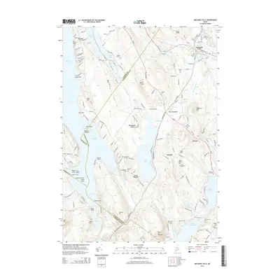
 2021 Oxford2021 Print · USGSCovers Oxford, including Paris, Mechanic Falls, and other nearby areas
 - 2021 Map of Norway, 2021 Print
 2021 Norway2021 Print · USGSCovers Oxford, including Paris, Norway, and other nearby areas
 - 2021 Map of Casco, 2021 Print
 2021 Casco2021 Print · USGSCovers Oxford, including Naples, Casco, and other nearby areas
 - 2021 Map of Mechanic Falls, 2021 Print
 2021 Mechanic Falls2021 Print · USGSCovers Oxford, including Poland, New Gloucester, and other nearby areas
 - 2024 Map of Oxford, 2024 Print
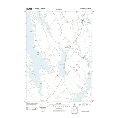
 2024 Oxford2024 Print · USGSThe foothills of western Maine are captured in this recent survey, showcasing a landscape of river-valley settlements and upland farms. Historians can trace local family lineages through sites like Caldwell Cem or Shepards Field Cem and locate historic hubs at Oxford Station and Hebron.
 - 2024 Map of Norway, 2024 Print
 2024 Norway2024 Print · USGSThe eastern corridor of the Oxford hills comes into focus in this recent survey of South Paris and Norway. Researchers can trace local lineage through numerous sites including Norway Pine Grove Cem, Merrill Memorial Cem, and Riverside Cem.
 - 2024 Map of Casco, 2024 Print
 2024 Casco2024 Print · USGSCumberland and Oxford counties meet in this detailed modern record of the Casco region and its interconnected lakes. Genealogists can trace family heritage through a high density of burial sites including Oakdale Cem, Wight Cem, and the historic Scribners Mill area.
 - 2024 Map of Mechanic Falls, 2024 Print
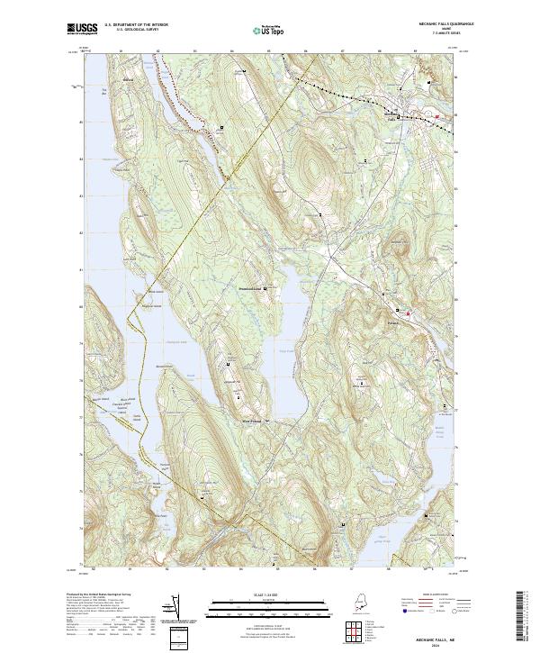 2024 Mechanic Falls2024 Print · USGSAndroscoggin and Oxford counties meet in this lakeside landscape where family heritage and modern geography intersect. Genealogists can trace family footprints across numerous sites like the Amos Estes Family Cem, Old Megquier Hill Cem, and Henry Tenny Cem.
End of results
Showing maps 1-21 of 21
Top cities near Oxford
- Auburn historical maps
- Gray historical maps
- Turner historical maps
- Poland historical maps
- New Gloucester historical maps
- Bridgton historical maps
See more
Top neighborhoods of Oxford
- Pratt Corner historical maps
- Oxford Station historical maps
- Paine Corner historical maps
- Caldwell Corner historical maps
- Welchville historical maps
Frequently asked questions
- What are the different types of historical maps available for Oxford?
- What is the oldest map of Oxford?
- Where can I purchase historical maps of Oxford for my home or office?
- Where can I download high-res historical maps of Oxford?
- Are there historical topographic maps available for Oxford?
- Is there historical aerial imagery available for Oxford?
- Where are historical maps of Oxford sourced from?