Old Maps of Lincoln, Maine for Metal Detecting
Plan your next treasure hunt with 51 historic maps of Lincoln. Find old homesites, ghost towns, trails, and gathering spots that may be lost to time — perfect for identifying promising metal detecting locations.
- Locate forgotten sites: Uncover places like long-lost settlements, abandoned rail lines, or gathering spots.
- Plan better hunts: Use map overlays combined with LiDAR or satellite views to narrow in on historically rich areas.
- Made for detectorists: Thousands of hobbyists use these maps to discover relics, coins, and hidden history.
Use these historic maps to boost your research and find new opportunities beneath the surface of Lincoln.
Lincoln, ME maps
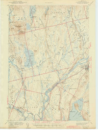
(51)- 1920 Map of Winn
 1920 Winn1920 Print · USGSPenobscot County in the years following the Great War was a landscape shaped by competing railroads and the power of the river. Genealogists and local historians can trace the early layouts of Winn, Lincoln, and Lee, or locate family landmarks near Mattanawcook Pond and Libby Corner.5 unique versions available
 - 1942 Map of Lincoln
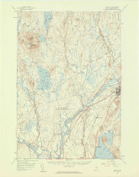
 1942 Lincoln1942 Print · USGSPenobscot River life and the timber-driven rail economy are captured here during the early years of the war. Genealogists and historians can locate old landmarks like Merrifield Sch, the Ridge Cem, and the river island communities of the Penobscot Indian Reservation.3 unique versions available
 - 1954 Map of Millinocket, 1968 Print
 1954 Millinocket1968 Print · USGSMaine's North Woods and the Penobscot Valley are captured here during the mid-century era of logging and rail dominance. You can trace the path of the Bangor and Aroostook Railroad through timber towns like Millinocket, Mattawamkeag, and Silver Ridge.3 unique versions available
 - 1957 Map of Lincoln, 1959 Print
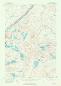
 1957 Lincoln1959 Print · USGSPenobscot River towns and the Maine woods are captured here in the late fifties, showing the vital rail-and-river corridor. Genealogists and historians can trace rail lines like the Maine Central, locate the Fairfield Sch, and find the remote Mattamiscontis Club Camp.3 unique versions available
 - 1958 Map of Millinocket
 1958 Millinocket1958 Print · USGSMaine's North Woods and the Penobscot river valley are captured here in the mid-1950s, showing a landscape of timber, rail, and wild waters. Researchers can trace the legacy of the Canadian Pacific railroad and find historic settlements like Millinocket, Sherman Station, and Mattawamkeag.
 - 1960 Map of Millinocket
 1960 Millinocket1960 Print · USGSThe Maine North Woods and Penobscot River valley are captured at mid-century during the height of the paper milling era. Researchers can trace the Appalachian Trail near Mount Katardin or locate family roots in towns like Dover-Foxcroft and Milo.3 unique versions available
 - 1960 Map of Winn, 1963 Print
 1960 Winn1963 Print · USGSMid-century Penobscot County comes alive along the river and rail corridors of the 1960s. Genealogists and researchers can trace family landmarks like North Chester Cem, the Burr Sch, and the riverside tracks of the Maine Central railroad.3 unique versions available
 - 1975 Map of Winn SW, 1980 Print
 1975 Winn SW1980 Print · USGSPenobscot County is seen through high-resolution aerial photography in the mid-1970s, capturing the dense forest and water networks of the Maine interior. Researchers can examine the detailed shorelines and surrounding timberland of Eskutassis Pond.
 - 1975 Map of Winn NE, 1980 Print
 1975 Winn NE1980 Print · USGSThe dense forests of Penobscot County are captured in this mid-seventies aerial survey of Northern Maine. Researchers can trace the winding course of the Mattawamkeag River and examine the layout of the settlement at WINN.
 - 1975 Map of Winn SE, 1980 Print
 1975 Winn SE1980 Print · USGSPenobscot County is captured in detailed aerial imagery during the mid-seventies, revealing the raw texture of the Maine woods. Researchers can trace the timber tracks and natural shorelines surrounding Moose Mountain.
 - 1975 Map of Lincoln SE, 1980 Print
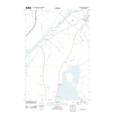
 1975 Lincoln SE1980 Print · USGSCentral Maine in the mid-seventies is captured here via aerial photography along the Penobscot River corridor. Genealogists and local historians can trace the mid-century footprints of Lincoln, South Lincoln, and the shores of Cold Stream Pond.
 - 1975 Map of Lincoln NE, 1980 Print
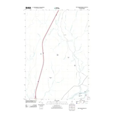
 1975 Lincoln NE1980 Print · USGSPenobscot County timberlands and river corridors are captured in this mid-seventies aerial survey of the Maine woods. Researchers can trace forest management patterns and waterways including the Penobscot River, Pea Ridge, and the Medunkeunk River.
 - 1975 Map of Winn NW, 1980 Print
 1975 Winn NW1980 Print · USGSPenobscot County land and timber patterns are revealed in this mid-seventies orthophoto survey of the Maine woods. Local historians and land researchers can trace the specific boundaries of Woodville and the shoreline of Caribou Pond during this era of forest management.
 - 1985 Map of Lincoln, 1994 Print
 1985 Lincoln1994 Print · USGSPenobscot County in the mid-eighties remains a landscape of river-based commerce and sprawling timberlands connected by rail. You can trace the historic paths of the Maine Central RR and Canadian Pacific RR or locate rural sites like Enfield Station and the Winn Cem.
 - 1986 Map of Lincoln
 1986 Lincoln1986 Print · USGSMid-century Maine settlement and industry converge along the Penobscot and Piscataquis rivers during the 1980s. Researchers can trace the rail networks of the Maine Central and Bangor and Aroostook through towns like Howland and Milo.
 - 1988 Map of Lee
 1988 Lee1988 Print · USGSPenobscot County is captured in the late eighties as a landscape of interconnected lakes and high ridges centered on the town of Lee. Genealogists and local researchers can locate Woodlawn Cem, Mt Jefferson Jr High Sch, and the shores of Silver Lake.
 - 1988 Map of Lincoln Center
 1988 Lincoln Center1988 Print · USGSPenobscot River life in the late eighties is centered on the townships of Lincoln and Chester, where the waterway dictates local boundaries and travel. Researchers can trace family history at the Lincoln Center Cem or locate the Mattanawcook Academy near the shores of Long Pond.
 - 1988 Map of Lincoln West
 1988 Lincoln West1988 Print · USGSThe Penobscot River valley and the shores of Cold Stream Pond are shown in high detail during the late eighties. Researchers can trace the Maine Central rail line through Enfield Station or locate local landmarks like the Lincoln Municipal Airport and Morgan Beach.
 - 1988 Map of Lincoln East
 1988 Lincoln East1988 Print · USGSPenobscot County in the late 1980s reveals a landscape of interconnected glacial lakes and rural township boundaries. Researchers can trace local history through the Transalpine Cem and Long Ridge Cem or locate old settlements like Libby Corner.
 - 1988 Map of Nine Meadow Ridge
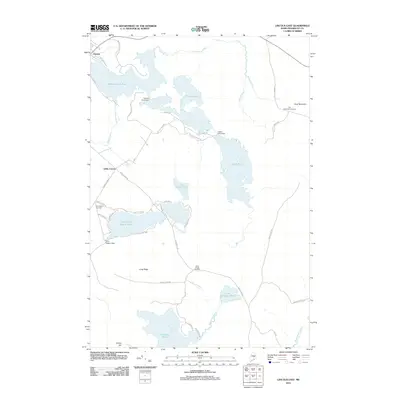
 1988 Nine Meadow Ridge1988 Print · USGSThe riverfront and timberlands of Penobscot County are documented here in the late eighties, showing the region's unique glacial topography and river settlements. Researchers can trace the Penobscot River through Lincoln Center or find remote landmarks like The Horseback and the Woodard (Site).
 - 1988 Map of East Winn
 1988 East Winn1988 Print · USGSPenobscot County in the late eighties centers on the river junctions and timberlands of the Maine interior. Researchers can trace rural settlement patterns through East Winn, the East Winn Cem, and family-named landmarks like Rollins Mtn.
 - 2011 Map of Lincoln Center, 2011 Print
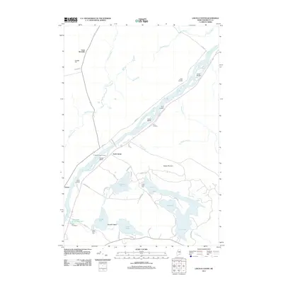 2011 Lincoln Center2011 Print · USGSCovers Lincoln, including Chester, Winn, and other nearby areas
 - 2011 Map of Lincoln West, 2011 Print
 2011 Lincoln West2011 Print · USGSCovers Lincoln, including Enfield, Chester, and other nearby areas
 - 2011 Map of Nine Meadow Ridge, 2011 Print
 2011 Nine Meadow Ridge2011 Print · USGSCovers Lincoln, including Chester, Woodville, and other nearby areas
 - 2011 Map of Lincoln East, 2011 Print
 2011 Lincoln East2011 Print · USGSCovers Lincoln, including Burlington, Lowell, and other nearby areas
Showing maps 1-25 of 51
Top cities near Lincoln
- Enfield historical maps
- Greenbush historical maps
- Medway historical maps
- Howland historical maps
- Lee historical maps
- Mattawamkeag historical maps
See more
Top neighborhoods of Lincoln
- South Lincoln historical maps
- North Lincoln historical maps
- Libby Corner historical maps
- Lincoln Center historical maps
Frequently asked questions
- What are the different types of historical maps available for Lincoln?
- What is the oldest map of Lincoln?
- Where can I purchase historical maps of Lincoln for my home or office?
- Where can I download high-res historical maps of Lincoln?
- Are there historical topographic maps available for Lincoln?
- Is there historical aerial imagery available for Lincoln?
- Where are historical maps of Lincoln sourced from?