Old Maps of T2 R9 NWP, Maine for Metal Detecting
Plan your next treasure hunt with 37 historic maps of T2 R9 NWP. Find old homesites, ghost towns, trails, and gathering spots that may be lost to time — perfect for identifying promising metal detecting locations.
- Locate forgotten sites: Uncover places like long-lost settlements, abandoned rail lines, or gathering spots.
- Plan better hunts: Use map overlays combined with LiDAR or satellite views to narrow in on historically rich areas.
- Made for detectorists: Thousands of hobbyists use these maps to discover relics, coins, and hidden history.
Use these historic maps to boost your research and find new opportunities beneath the surface of T2 R9 NWP.
T2 R9 NWP, ME maps
(37)- 1942 Map of Lincoln
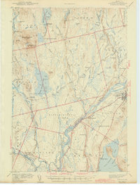 1942 Lincoln1942 Print · USGSPenobscot River life and the timber-driven rail economy are captured here during the early years of the war. Genealogists and historians can locate old landmarks like Merrifield Sch, the Ridge Cem, and the river island communities of the Penobscot Indian Reservation.3 unique versions available
 - 1951 Map of Millinocket, 1953 Print
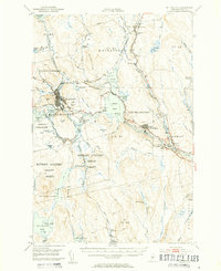 1951 Millinocket1953 Print · USGSThe river-driven industrial landscape of northern Maine comes into focus in the early fifties, where the Penobscot forks meet at Medway. Genealogists and historians can trace the Bangor and Aroostook rail line and locate Bethel Ch or the Lynch Cem.4 unique versions available
 - 1954 Map of Millinocket, 1968 Print
 1954 Millinocket1968 Print · USGSMaine's North Woods and the Penobscot Valley are captured here during the mid-century era of logging and rail dominance. You can trace the path of the Bangor and Aroostook Railroad through timber towns like Millinocket, Mattawamkeag, and Silver Ridge.3 unique versions available
 - 1957 Map of Lincoln, 1959 Print
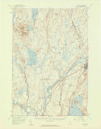 1957 Lincoln1959 Print · USGSPenobscot River towns and the Maine woods are captured here in the late fifties, showing the vital rail-and-river corridor. Genealogists and historians can trace rail lines like the Maine Central, locate the Fairfield Sch, and find the remote Mattamiscontis Club Camp.3 unique versions available
 - 1958 Map of Millinocket
 1958 Millinocket1958 Print · USGSMaine's North Woods and the Penobscot river valley are captured here in the mid-1950s, showing a landscape of timber, rail, and wild waters. Researchers can trace the legacy of the Canadian Pacific railroad and find historic settlements like Millinocket, Sherman Station, and Mattawamkeag.
 - 1960 Map of Millinocket
 1960 Millinocket1960 Print · USGSThe Maine North Woods and Penobscot River valley are captured at mid-century during the height of the paper milling era. Researchers can trace the Appalachian Trail near Mount Katardin or locate family roots in towns like Dover-Foxcroft and Milo.3 unique versions available
 - 1975 Map of Millinocket SW, 1979 Print
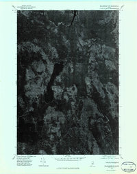 1975 Millinocket SW1979 Print · USGSPenobscot County timberlands and remote waters are captured in this mid-1970s aerial survey. Sportsmen and researchers can trace the detailed shorelines and forest tracks surrounding Nollesemic Lake and the West Branch Penobscot River.2 unique versions available
 - 1975 Map of Lincoln NW, 1980 Print
 1975 Lincoln NW1980 Print · USGSPenobscot County’s deep woods and glacial lakes are captured in this mid-seventies aerial survey of the Maine wilderness. Researchers can trace the timber-hauling networks around Mattamiscontis Mountain or study the shorelines of Mattamiscontis Lake and South Branch Lake.
 - 1975 Map of Millinocket SE, 1980 Print
 1975 Millinocket SE1980 Print · USGSPenobscot County in the mid-seventies reveals the industrial riverfronts of East Millinocket and Medway set against the Maine woods. Trace the path of the West Branch Penobscot River or locate the remote Medunkeunk Lake.
 - 1975 Map of Lincoln NE, 1980 Print
 1975 Lincoln NE1980 Print · USGSPenobscot County timberlands and river corridors are captured in this mid-seventies aerial survey of the Maine woods. Researchers can trace forest management patterns and waterways including the Penobscot River, Pea Ridge, and the Medunkeunk River.
 - 1985 Map of Millinocket, 1986 Print
 1985 Millinocket1986 Print · USGSThe North Maine Woods were a landscape of industrial timber and wilderness recreation in the mid-eighties. Genealogists and researchers can trace local settlements and rail stops like Sherman Mills, Wytopitlock, and the Old Long A Siding near the Penobscot River.2 unique versions available
 - 1985 Map of Lincoln, 1994 Print
 1985 Lincoln1994 Print · USGSPenobscot County in the mid-eighties remains a landscape of river-based commerce and sprawling timberlands connected by rail. You can trace the historic paths of the Maine Central RR and Canadian Pacific RR or locate rural sites like Enfield Station and the Winn Cem.
 - 1986 Map of Lincoln
 1986 Lincoln1986 Print · USGSMid-century Maine settlement and industry converge along the Penobscot and Piscataquis rivers during the 1980s. Researchers can trace the rail networks of the Maine Central and Bangor and Aroostook through towns like Howland and Milo.
 - 1988 Map of Mattamiscontis Mtn
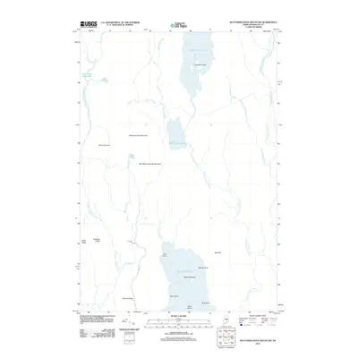
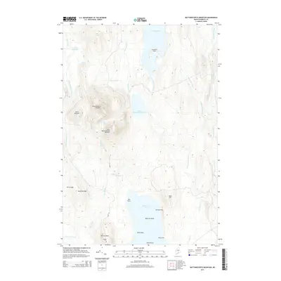
 1988 Mattamiscontis Mtn1988 Print · USGSPenobscot County's interior woods and waters are captured here in the late eighties, documenting the wilderness character of the Seboeis Plt region. Trace family-named landmarks like Johnny Ayers Brook or the site of the Mattamiscontis Club Camp.
 - 1988 Map of Nollesemic Lake
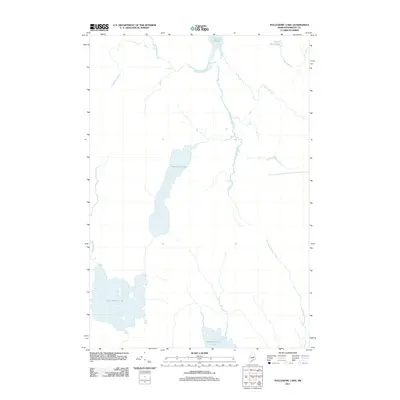
 1988 Nollesemic Lake1988 Print · USGSPenobscot County’s deep woods and interlocking waterways are captured here during the late eighties. Researchers can trace the wild hydrology of Nollesemic Lake and East Branch Lake, alongside the remote Hopkins Academy Grant boundary.
 - 1988 Map of Nine Meadow Ridge
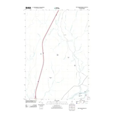
 1988 Nine Meadow Ridge1988 Print · USGSThe riverfront and timberlands of Penobscot County are documented here in the late eighties, showing the region's unique glacial topography and river settlements. Researchers can trace the Penobscot River through Lincoln Center or find remote landmarks like The Horseback and the Woodard (Site).
 - 1988 Map of Medunkeunk Lake
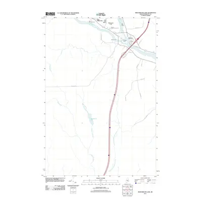
 1988 Medunkeunk Lake1988 Print · USGSThe northern Penobscot woods in the late eighties show a landscape defined by the West Branch Penobscot River and its industrial towns. Genealogists and historians can locate a Cem in Medway, trace Medunkeunk Stream to the lake, and find working Gravel Pits.
 - 2011 Map of Nollesemic Lake, 2011 Print
 2011 Nollesemic Lake2011 Print · USGSCovers T2 R9 NWP, including Millinocket, T3 Indian Purchase Township, and other nearby areas
 - 2011 Map of Nine Meadow Ridge, 2011 Print
 2011 Nine Meadow Ridge2011 Print · USGSCovers T2 R9 NWP, including Lincoln, Chester, and other nearby areas
 - 2011 Map of Medunkeunk Lake, 2011 Print
 2011 Medunkeunk Lake2011 Print · USGSCovers T2 R9 NWP, including East Millinocket, Medway, and other nearby areas
 - 2011 Map of Mattamiscontis Mountain, 2011 Print
 2011 Mattamiscontis Mountain2011 Print · USGSCovers T2 R9 NWP, including Seboeis Plantation, Cedar Lake Township, and other nearby areas
 - 2014 Map of Nine Meadow Ridge, 2014 Print
 2014 Nine Meadow Ridge2014 Print · USGSCovers T2 R9 NWP, including Lincoln, Chester, and other nearby areas
 - 2014 Map of Mattamiscontis Mountain, 2014 Print
 2014 Mattamiscontis Mountain2014 Print · USGSCovers T2 R9 NWP, including Seboeis Plantation, Cedar Lake Township, and other nearby areas
 - 2014 Map of Medunkeunk Lake, 2014 Print
 2014 Medunkeunk Lake2014 Print · USGSCovers T2 R9 NWP, including East Millinocket, Medway, and other nearby areas
 - 2014 Map of Nollesemic Lake, 2014 Print
 2014 Nollesemic Lake2014 Print · USGSCovers T2 R9 NWP, including Millinocket, T3 Indian Purchase Township, and other nearby areas
Showing maps 1-25 of 37
Top cities near T2 R9 NWP
- Lincoln historical maps
- Millinocket historical maps
- East Millinocket historical maps
- Enfield historical maps
- Medway historical maps
- Howland historical maps
See more
Frequently asked questions
- What are the different types of historical maps available for T2 R9 NWP?
- What is the oldest map of T2 R9 NWP?
- Where can I purchase historical maps of T2 R9 NWP for my home or office?
- Where can I download high-res historical maps of T2 R9 NWP?
- Are there historical topographic maps available for T2 R9 NWP?
- Is there historical aerial imagery available for T2 R9 NWP?
- Where are historical maps of T2 R9 NWP sourced from?