1980s Maps of Bowdoin College Grant West Township, Maine
Explore 7 historic maps of Bowdoin College Grant West Township from the 1980s. These maps offer a rare glimpse into what life looked like during the 1980s — showing old roads, neighborhoods, homes, and landmarks that have changed or disappeared over time.
Whether you're researching your family's past, planning a metal detecting trip, or studying how Bowdoin College Grant West Township's landscape evolved across the 1980s, these high-resolution maps are a powerful tool for exploring the history of this region.
- Focus on a specific era: All maps on this page are from the 1980s, giving you a focused view of this time period.
- See what’s changed: Compare century-old streets, trails, and buildings to today's modern landscape using overlays and satellite layers.
- Research with precision: Use these maps for genealogy, historical research, land use analysis, or educational projects.
- View, download, or print: Maps are fully viewable online in high resolution, and can be downloaded or printed for your own records.
Start exploring Bowdoin College Grant West Township's history through authentic maps from the 1980s. This is your window into the past.
Bowdoin College Grant West Township, ME maps
(7)- 1985 Map of Moosehead Lake, 1986 Print
 1985 Moosehead Lake1986 Print · USGSThe Maine North Woods in the 1980s remain a landscape of vast timberlands, railroads, and the sprawling waters of the state's largest lake. Researchers can trace the Canadian Pacific line through Rockwood or locate historical townships from Seboomook to Kokadjo.
 - 1986 Map of Dover-Foxcroft
 1986 Dover-Foxcroft1986 Print · USGSPiscataquis County at the edge of the great Maine woods is documented here in the mid-1980s, centered on the river-and-rail hubs of the interior. Trace the industrial footprints of Dover South Mills, the rail yards at Brownville Junction, or the historic Katahdin Iron Works.
 - 1988 Map of Number Four Mtn.
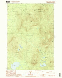 1988 Number Four Mtn.1988 Print · USGSPiscataquis County timberlands and remote highlands are captured here in the late eighties, showing the expansive Bowdoin College Grant West. Trace logging access routes and wilderness hydrology near Upper Wilson Pond, Baker Mtn, and Lily Bay Mtn.2 unique versions available
 - 1988 Map of Barren Mountain West
 1988 Barren Mountain West1988 Print · USGSThe Maine North Woods in the late eighties appear as a working landscape where logging heritage meets recreational trails. You can trace the Appalachian National Scenic Trail as it crosses Barren Mountain and locate isolated timber outposts like St Regis Depot Camp.2 unique versions available
 - 1988 Map of Barren Mountain East
 1988 Barren Mountain East1988 Print · USGSPiscataquis County's interior wilderness is captured here in the late eighties, showing the remote township grants and timberlands. Trace the Appalachian National Scenic Trail past The Hermitage and explore falls like Screw Auger Falls along the river.2 unique versions available
 - 1988 Map of Hay Mountain
 1988 Hay Mountain1988 Print · USGSPiscataquis County timberlands and the deep gorge of Gulf Hagas define this late-twentieth-century landscape. Hikers and historians can trace the Appalachian National Scenic Trail past Big Lyford Pond and over White Cap Mtn.
 - 1989 Map of Lily Bay
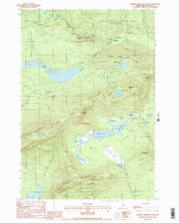
 1989 Lily Bay1989 Print · USGSPiscataquis County's shoreline and wooded uplands are captured in the late eighties as seasonal recreation and timber lands intersect. Researchers can trace the bounds of Lily Bay State Park or locate landmarks like Burnt Jacket Mtn and Sugar Island.
End of results
Showing maps 1-7 of 7
Top cities near Bowdoin College Grant West Township
- Greenville historical maps
- Monson historical maps
- Shirley historical maps
- Bowerbank historical maps
- Willimantic historical maps
- Beaver Cove historical maps
See more
Frequently asked questions
- What are the different types of historical maps available for Bowdoin College Grant West Township?
- What is the oldest map of Bowdoin College Grant West Township?
- Where can I purchase historical maps of Bowdoin College Grant West Township for my home or office?
- Where can I download high-res historical maps of Bowdoin College Grant West Township?
- Are there historical topographic maps available for Bowdoin College Grant West Township?
- Is there historical aerial imagery available for Bowdoin College Grant West Township?
- Where are historical maps of Bowdoin College Grant West Township sourced from?