2020s Maps of T4 R15 WELS, Maine
Explore 8 historic maps of T4 R15 WELS from the 2020s. These maps offer a rare glimpse into what life looked like during the 2020s — showing old roads, neighborhoods, homes, and landmarks that have changed or disappeared over time.
Whether you're researching your family's past, planning a metal detecting trip, or studying how T4 R15 WELS's landscape evolved across the 2020s, these high-resolution maps are a powerful tool for exploring the history of this region.
- Focus on a specific era: All maps on this page are from the 2020s, giving you a focused view of this time period.
- See what’s changed: Compare century-old streets, trails, and buildings to today's modern landscape using overlays and satellite layers.
- Research with precision: Use these maps for genealogy, historical research, land use analysis, or educational projects.
- View, download, or print: Maps are fully viewable online in high resolution, and can be downloaded or printed for your own records.
Start exploring T4 R15 WELS's history through authentic maps from the 2020s. This is your window into the past.
T4 R15 WELS, ME maps
(8)- 2021 Map of Seboomook, 2021 Print
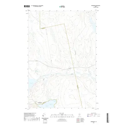 2021 Seboomook2021 Print · USGSCovers T4 R15 WELS, including Northeast Carry Township, Big W Township, and other nearby areas
 - 2021 Map of Penobscot Farm, 2021 Print
 2021 Penobscot Farm2021 Print · USGSCovers T4 R15 WELS, including Northeast Carry Township, T4 R14 WELS, and other nearby areas
 - 2021 Map of Bean Pot Pond, 2021 Print
 2021 Bean Pot Pond2021 Print · USGSCovers T4 R15 WELS, including Saint John Township, Elm Stream Township, and other nearby areas
 - 2021 Map of Ragmuff Stream, 2021 Print
 2021 Ragmuff Stream2021 Print · USGSCovers T4 R15 WELS, including T5 R14 WELS, T6 R14 WELS, and other nearby areas
 - 2024 Map of Penobscot Farm, 2024 Print
 2024 Penobscot Farm2024 Print · USGSPiscataquis County timberlands and remote waterways are captured here in the early twenty-first century. Researchers can trace the logging infrastructure and wild hydrology along the West Branch Penobscot River, Golden Rd, and Little Lobster Lake.
 - 2024 Map of Ragmuff Stream, 2024 Print
 2024 Ragmuff Stream2024 Print · USGSPiscataquis County remains a landscape of remote timberlands and hidden waterways in this modern survey of the Maine woods. Researchers can trace the drainage of Ragmuff Stream and locate local landmarks like Ragmuff Airport and McGooseley Pond.
 - 2024 Map of Bean Pot Pond, 2024 Print
 2024 Bean Pot Pond2024 Print · USGSThe remote timberlands of Piscataquis County are revealed in this modern survey of the Maine North Woods. Researchers can trace historic logging access and water routes through Withey Bog, Bean Pot Pond, and the Boulett Camp Rd corridor.
 - 2024 Map of Seboomook, 2024 Print
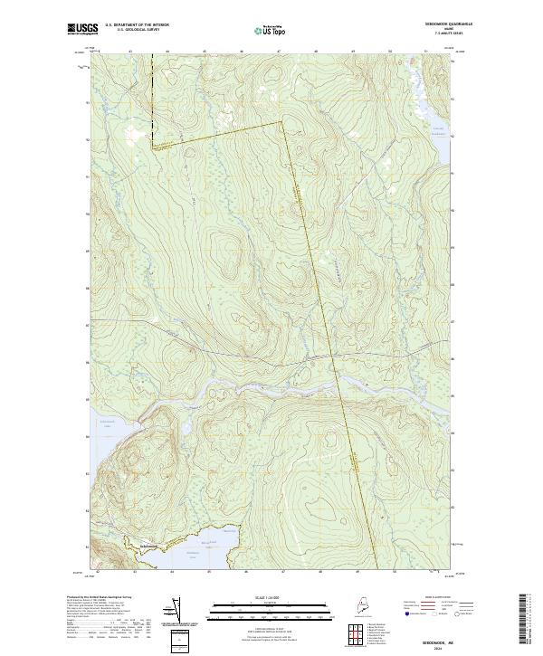 2024 Seboomook2024 Print · USGSThe northern Maine wilderness at the edge of the Somerset and Piscataquis county line is captured in this recent survey. Local historians and sportsmen can trace the intricate waterways of Moosehead Lake and Seboomook Lake, as well as the heavy-duty timber routes like Golden Rd.
End of results
Showing maps 1-8 of 8
Frequently asked questions
- What are the different types of historical maps available for T4 R15 WELS?
- What is the oldest map of T4 R15 WELS?
- Where can I purchase historical maps of T4 R15 WELS for my home or office?
- Where can I download high-res historical maps of T4 R15 WELS?
- Are there historical topographic maps available for T4 R15 WELS?
- Is there historical aerial imagery available for T4 R15 WELS?
- Where are historical maps of T4 R15 WELS sourced from?