Old Maps of T5 R12 WELS, Maine for Genealogy
Trace your family roots with 33 historic maps of T5 R12 WELS. These high-res maps reveal old neighborhoods, homesites, landmarks, and streets — helping you uncover where your ancestors lived and how the area evolved over time.
- Explore historic neighborhoods: Identify where your relatives may have lived in the 1800s or 1900s.
- Compare maps over time: Trace the changes in streets, buildings, and landmarks for multi-generational research.
- Perfect for genealogy & ancestry research: Used by family historians and researchers to map out lineage and migration.
These maps are an incredible resource for exploring your personal connection to T5 R12 WELS's past.
T5 R12 WELS, ME maps
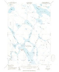
(33)- 1953 Map of Telos Lake, 1955 Print
 1953 Telos Lake1955 Print · USGSThe Maine North Woods in the early fifties reveal a remote wilderness of interconnected waterways and logging history. Genealogists and historians can trace the primitive Tote Road and locate early sporting sites like Camp Phoenix or the Telos Dam.
 - 1954 Map of Chesuncook, 1955 Print
 1954 Chesuncook1955 Print · USGSThe Maine North Woods around the mid-1950s reveal a landscape of interconnected lakes and isolated settlements centered on Chesuncook Lake. Researchers can trace the layout of Chesuncook Village, find the remote Chamberlain Farm, and locate the historic Carry Trail.2 unique versions available
 - 1954 Map of Presque Isle, 1968 Print
 1954 Presque Isle1968 Print · USGSNorth Woods logging and rail history come alive in this mid-century survey of the Maine-Quebec borderlands. Genealogists and historians can trace the Bangor and Aroostook railroad through timber hubs like Ashland, Smyrna Mills, and Presque Isle.2 unique versions available
 - 1957 Map of Telos Lake, 1960 Print
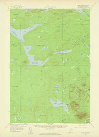 1957 Telos Lake1960 Print · USGSPiscataquis County's North Woods are mapped here in the late fifties, showing the logging infrastructure and wilderness boundaries of the era. Trace the path of the Eagle Lake Tote Road or locate remote sites like Camp Phoenix and Telos Dam.4 unique versions available
 - 1958 Map of Presque Isle
 1958 Presque Isle1958 Print · USGSThe Aroostook timber and potato country is captured here during the late fifties, showing the vital rail-to-river network of Northern Maine. Genealogists and historians can trace the Bangor & Aroostook RR through Mapleton and Ashland, or locate remote sites like Chamberlain Farm and Seven Islands.
 - 1958 Map of Chesuncook, 1961 Print
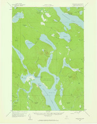 1958 Chesuncook1961 Print · USGSThe Maine North Woods at the end of the fifties remained a wilderness of timber and interconnected waterways. Trace old portages and homesteads such as the Carry Trail, Chamberlain Farm, and the remote Chesuncook Village.4 unique versions available
 - 1960 Map of Presque Isle
 1960 Presque Isle1960 Print · USGSNorthern Maine during the mid-century was a land of timber, rails, and strategic airfields. Genealogists and historians can trace the growth of Presque Isle and Ashland or explore the remote northern reaches of Baxter State Park and Presque Isle AFB.3 unique versions available
 - 1986 Map of Chamberlain Lake
 1986 Chamberlain Lake1986 Print · USGSThe Maine North Woods in the mid-eighties appear here as a land of protected wilderness and logging heritage, centered on the Allagash Wilderness Waterway. Researchers can trace the historic Tramway at Chamberlain Lake and locate old outposts like Churchill Depot.
 - 1988 Map of Telos Brook
 1988 Telos Brook1988 Print · USGSPiscataquis County's interior wilderness is captured in the late eighties as a network of protected waterways and private timber roads. Researchers can trace the drainage of the Allagash Wilderness State Waterway and locate features like the Shale Pit and Telos Lake.
 - 1988 Map of Telos Lake
 1988 Telos Lake1988 Print · USGSNorth-central Maine's interconnected waterways are mapped in detail here during the late 1980s, showcasing the remote timberland townships. Local historians can trace early wilderness infrastructure through sites like the Telos Dam, the Ranger Station, and the Shale Pit.
 - 1988 Map of Mud Pond
 1988 Mud Pond1988 Print · USGSPiscataquis County’s deep woods and connected waterways are documented here in the late eighties as the region transitioned toward wilderness preservation. Researchers can trace the Old Railroad Grade and locate historic sites like Chamberlain Farm and Nugents Point.
 - 1988 Map of Cuxabexis Lake
 1988 Cuxabexis Lake1988 Print · USGSPiscataquis County's deep woods and connected waterways are captured here in the late eighties before modern shifts in land use. Discover the shoreline details of Cuxabexis Lake and Chesuncook Lake, or trace the remote reaches of Umbazooksus Stream.
 - 1994 Map of Chamberlain Lake
 1994 Chamberlain Lake1994 Print · USGSThe North Maine Woods in the early nineties remained a network of logging outposts and protected waterways. You can trace the historic logging infrastructure at Churchill Depot, the portage at Tramway, and remote landings such as Telos Landing.
 - 2011 Map of Telos Brook, 2011 Print
 2011 Telos Brook2011 Print · USGSCovers T5 R12 WELS, including T5 R11 WELS, T4 R11 WELS, and other nearby areas
 - 2011 Map of Telos Lake, 2011 Print
 2011 Telos Lake2011 Print · USGSCovers T5 R12 WELS, including T7 R12 WELS, T5 R11 WELS, and other nearby areas
 - 2011 Map of Mud Pond, 2011 Print
 2011 Mud Pond2011 Print · USGSCovers T5 R12 WELS, including T7 R12 WELS, T7 R13 WELS, and other nearby areas
 - 2011 Map of Cuxabexis Lake, 2011 Print
 2011 Cuxabexis Lake2011 Print · USGSCovers T5 R12 WELS, including Chesuncook Township, T6 R13 WELS, and other nearby areas
 - 2014 Map of Cuxabexis Lake, 2014 Print
 2014 Cuxabexis Lake2014 Print · USGSCovers T5 R12 WELS, including Chesuncook Township, T6 R13 WELS, and other nearby areas
 - 2014 Map of Telos Brook, 2014 Print
 2014 Telos Brook2014 Print · USGSCovers T5 R12 WELS, including T5 R11 WELS, T4 R11 WELS, and other nearby areas
 - 2014 Map of Telos Lake, 2014 Print
 2014 Telos Lake2014 Print · USGSCovers T5 R12 WELS, including T7 R12 WELS, T5 R11 WELS, and other nearby areas
 - 2014 Map of Mud Pond, 2014 Print
 2014 Mud Pond2014 Print · USGSCovers T5 R12 WELS, including T7 R12 WELS, T7 R13 WELS, and other nearby areas
 - 2018 Map of Cuxabexis Lake, 2018 Print
 2018 Cuxabexis Lake2018 Print · USGSCovers T5 R12 WELS, including Chesuncook Township, T6 R13 WELS, and other nearby areas
 - 2018 Map of Telos Lake, 2018 Print
 2018 Telos Lake2018 Print · USGSCovers T5 R12 WELS, including T7 R12 WELS, T5 R11 WELS, and other nearby areas
 - 2018 Map of Telos Brook, 2018 Print
 2018 Telos Brook2018 Print · USGSCovers T5 R12 WELS, including T5 R11 WELS, T4 R11 WELS, and other nearby areas
 - 2018 Map of Mud Pond, 2018 Print
 2018 Mud Pond2018 Print · USGSCovers T5 R12 WELS, including T7 R12 WELS, T7 R13 WELS, and other nearby areas
Showing maps 1-25 of 33
Frequently asked questions
- What are the different types of historical maps available for T5 R12 WELS?
- What is the oldest map of T5 R12 WELS?
- Where can I purchase historical maps of T5 R12 WELS for my home or office?
- Where can I download high-res historical maps of T5 R12 WELS?
- Are there historical topographic maps available for T5 R12 WELS?
- Is there historical aerial imagery available for T5 R12 WELS?
- Where are historical maps of T5 R12 WELS sourced from?