1970s Maps of T8 R9 WELS, Maine
Explore 4 historic maps of T8 R9 WELS from the 1970s. These maps offer a rare glimpse into what life looked like during the 1970s — showing old roads, neighborhoods, homes, and landmarks that have changed or disappeared over time.
Whether you're researching your family's past, planning a metal detecting trip, or studying how T8 R9 WELS's landscape evolved across the 1970s, these high-resolution maps are a powerful tool for exploring the history of this region.
- Focus on a specific era: All maps on this page are from the 1970s, giving you a focused view of this time period.
- See what’s changed: Compare century-old streets, trails, and buildings to today's modern landscape using overlays and satellite layers.
- Research with precision: Use these maps for genealogy, historical research, land use analysis, or educational projects.
- View, download, or print: Maps are fully viewable online in high resolution, and can be downloaded or printed for your own records.
Start exploring T8 R9 WELS's history through authentic maps from the 1970s. This is your window into the past.
T8 R9 WELS, ME maps
(4)- 1975 Map of Millinocket Lake NW, 1981 Print
 1975 Millinocket Lake NW1981 Print · USGSPiscataquis County's deep timberlands are seen in the mid-seventies through this detailed aerial orthophotograph. Researchers can trace the logging roads and natural drainage patterns surrounding Munsungan Lake and the slopes of Willard Mountain.
 - 1975 Map of Millinocket Lake SE, 1981 Print
 1975 Millinocket Lake SE1981 Print · USGSThe Maine North Woods are captured in detailed aerial photography during the mid-1970s, showing a landscape of dense timber and vast waterways. Trace the winding path of the Aroostook River and the expansive shorelines of Millinocket Lake and Millimagassett Lake.
 - 1975 Map of Millinocket Lake SW, 1981 Print
 1975 Millinocket Lake SW1981 Print · USGSThe Maine wilderness of the mid-seventies is captured here in stark aerial detail. Genealogists and historians can trace the remote shoreline of MILLINOCKET LAKE and the high ground of Caribou Ridge across this uninhabited woodland expanse.
 - 1975 Map of Millinocket Lake NE, 1981 Print
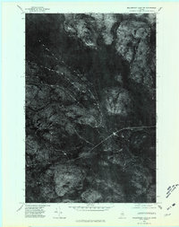 1975 Millinocket Lake NE1981 Print · USGSAroostook County's deep timberlands are captured in the mid-1970s through this aerial orthophotoquad of the Maine wilderness. Researchers can trace the winding course of Mooseleuk Stream and identify early logging tracks near Middle Brook Mountain.
End of results
Showing maps 1-4 of 4
Frequently asked questions
- What are the different types of historical maps available for T8 R9 WELS?
- What is the oldest map of T8 R9 WELS?
- Where can I purchase historical maps of T8 R9 WELS for my home or office?
- Where can I download high-res historical maps of T8 R9 WELS?
- Are there historical topographic maps available for T8 R9 WELS?
- Is there historical aerial imagery available for T8 R9 WELS?
- Where are historical maps of T8 R9 WELS sourced from?