1980s Maps of T8 R9 WELS, Maine
Explore 5 historic maps of T8 R9 WELS from the 1980s. These maps offer a rare glimpse into what life looked like during the 1980s — showing old roads, neighborhoods, homes, and landmarks that have changed or disappeared over time.
Whether you're researching your family's past, planning a metal detecting trip, or studying how T8 R9 WELS's landscape evolved across the 1980s, these high-resolution maps are a powerful tool for exploring the history of this region.
- Focus on a specific era: All maps on this page are from the 1980s, giving you a focused view of this time period.
- See what’s changed: Compare century-old streets, trails, and buildings to today's modern landscape using overlays and satellite layers.
- Research with precision: Use these maps for genealogy, historical research, land use analysis, or educational projects.
- View, download, or print: Maps are fully viewable online in high resolution, and can be downloaded or printed for your own records.
Start exploring T8 R9 WELS's history through authentic maps from the 1980s. This is your window into the past.
T8 R9 WELS, ME maps
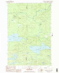
(5)- 1985 Map of Oakfield
 1985 Oakfield1985 Print · USGSAroostook County in the 1980s displays a balance between the timber-and-rail industry and the protected wilderness of the North Woods. Genealogists and local historians can trace family-named hubs like Smyrna Mills, Island Falls, and Knowles Corner along the Bangor and Aroostook railroad line.
 - 1985 Map of Millinocket Lake East, 1986 Print
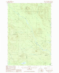
 1985 Millinocket Lake East1986 Print · USGSThe Maine woods near the Penobscot and Piscataquis county lines are shown here in the mid-eighties as a landscape of timber management and remote waterways. Researchers can locate specific sites of activity like the Isthmus Logging Camp, Moosehorn Crossing, and Libby Camp among the many ponds and ridges.2 unique versions available
 - 1985 Map of Mooseleuk Mtn, 1986 Print
 1985 Mooseleuk Mtn1986 Print · USGSPiscataquis County timberlands and remote summits are captured in the mid-eighties before the shift in traditional fire watching. Trace the rugged terrain from Little Munsungan Lake to the Norway Bluff Lookout Tower and its nearby Radio Facility.
 - 1985 Map of Middle Brook Mtn, 1986 Print
 1985 Middle Brook Mtn1986 Print · USGSNorth Maine Woods timberlands and the upper reaches of the Aroostook watershed are captured here in the mid-1980s. Trace the logging infrastructure and waterway camps like Pinkham Camp, Chandler Deadwater, and Brown Pond.
 - 1985 Map of Millinocket Lake West, 1986 Print
 1985 Millinocket Lake West1986 Print · USGSPiscataquis County's remote timberlands and interconnected waterways are captured here in the mid-eighties. Genealogists and outdoorsmen can trace the drainage of Munsungan Stream or locate remote landmarks like Big Caribou Pond and Millinocket Ridge.
End of results
Showing maps 1-5 of 5
Frequently asked questions
- What are the different types of historical maps available for T8 R9 WELS?
- What is the oldest map of T8 R9 WELS?
- Where can I purchase historical maps of T8 R9 WELS for my home or office?
- Where can I download high-res historical maps of T8 R9 WELS?
- Are there historical topographic maps available for T8 R9 WELS?
- Is there historical aerial imagery available for T8 R9 WELS?
- Where are historical maps of T8 R9 WELS sourced from?