1970s Maps of Misery Gore, Maine
Explore 7 historic maps of Misery Gore from the 1970s. These maps offer a rare glimpse into what life looked like during the 1970s — showing old roads, neighborhoods, homes, and landmarks that have changed or disappeared over time.
Whether you're researching your family's past, planning a metal detecting trip, or studying how Misery Gore's landscape evolved across the 1970s, these high-resolution maps are a powerful tool for exploring the history of this region.
- Focus on a specific era: All maps on this page are from the 1970s, giving you a focused view of this time period.
- See what’s changed: Compare century-old streets, trails, and buildings to today's modern landscape using overlays and satellite layers.
- Research with precision: Use these maps for genealogy, historical research, land use analysis, or educational projects.
- View, download, or print: Maps are fully viewable online in high resolution, and can be downloaded or printed for your own records.
Start exploring Misery Gore's history through authentic maps from the 1970s. This is your window into the past.
Misery Gore, ME maps
(7)- 1976 Map of Sherbrooke
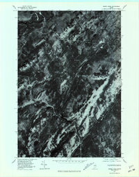
 1976 Sherbrooke1976 Print · USGSThe northern Maine woods and Quebec’s Eastern Townships meet in this mid-century survey of the rugged international borderlands. Genealogists and historians can trace rail-and-river connections through Thetford Mines, follow the Dead River to Flagstaff Lake, or locate small border crossings at Stanhope and Beecher Falls.2 unique versions available
 - 1977 Map of Misery Knob, 1981 Print
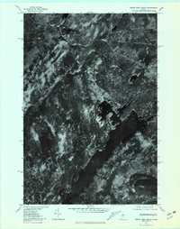
 1977 Misery Knob1981 Print · USGSThe Maine woods in the late seventies are documented in this detailed aerial study of Somerset County. Trace the wild water systems of Moose River, Misery Pond, and the terrain surrounding Misery Knob.
 - 1977 Map of Moosehead, 1981 Print
 1977 Moosehead1981 Print · USGSThe Maine North Woods and the expansive waters of Moosehead Lake appear in sharp detail in this late-seventies aerial survey. Researchers can trace the wild shorelines of Deer Island and the origins of the Kennebec River.
 - 1977 Map of Mount Kineo, 1981 Print
 1977 Mount Kineo1981 Print · USGSThe Maine North Woods and the shores of Moosehead Lake are seen here in the late seventies. Researchers can trace the shoreline of Rockwood and identify topographic landmarks like Mount Kineo and Little Kineo Mountain.
 - 1977 Map of Indian Pond North, 1981 Print
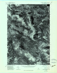
 1977 Indian Pond North1981 Print · USGSSomerset County, Maine, is captured in the late 1970s as a landscape of timber and wild water. Researchers can trace the rail and river history of Tarratine and Somerset Junction or locate the headwaters of the Kennebec River.
 - 1977 Map of Catheart Mountain, 1983 Print
 1977 Catheart Mountain1983 Print · USGSSomerset County in the late seventies is captured here in sharp aerial detail, showing a landscape defined by timber and water. Researchers can trace remote logging access roads and shoreline features near Attean Pond, Jackman Station, and Catheart Mountain.
 - 1979 Map of Long Pond, 1983 Print
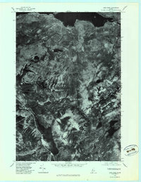 1979 Long Pond1983 Print · USGSThe deep woods of Somerset County are seen from above in the late seventies, documenting the remote lake country of northern Maine. Researchers can trace the wild shorelines of Lake Parlin and Long Pond or locate the small clearing at Mackamp.
End of results
Showing maps 1-7 of 7
Top cities near Misery Gore
Top neighborhoods of Misery Gore
Frequently asked questions
- What are the different types of historical maps available for Misery Gore?
- What is the oldest map of Misery Gore?
- Where can I purchase historical maps of Misery Gore for my home or office?
- Where can I download high-res historical maps of Misery Gore?
- Are there historical topographic maps available for Misery Gore?
- Is there historical aerial imagery available for Misery Gore?
- Where are historical maps of Misery Gore sourced from?